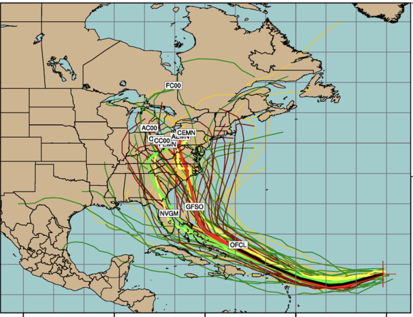
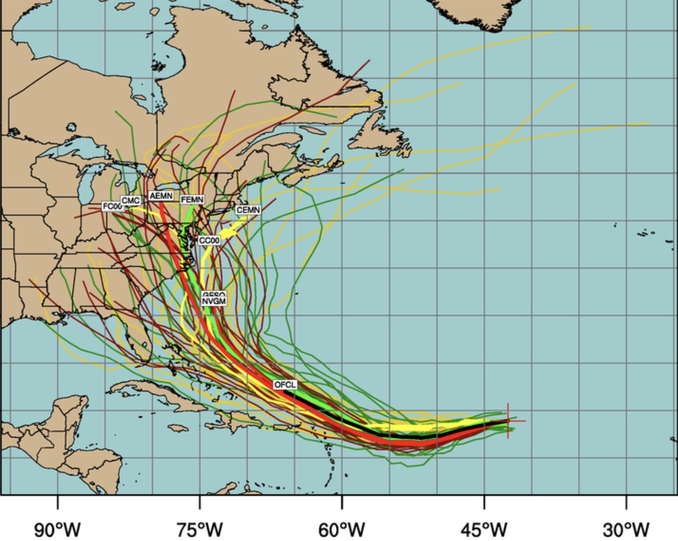
It appears that the models have been incredibly poor predicting the track of hurricane Irma in the long term. Consistency in predicting an east coast hit has luckily faded over the weekend. Each successive model run has had Irma take a more southerly track.
So the concern about affecting Philadelphia and the Jersey Shore has disappeared.
Last night’s models now have Irma making the same general west then north motion, but much further south, south of Florida. What a change! The only consistent part of the predicted track is a sharp right turn, this time affecting much of Florida. Based on the predictions so far, it’s hard to hang one’s hat on anything right now.
Rain should end between 7-9 am on Sunday and clouds will break to sunshine by afternoon. High temp about 74.
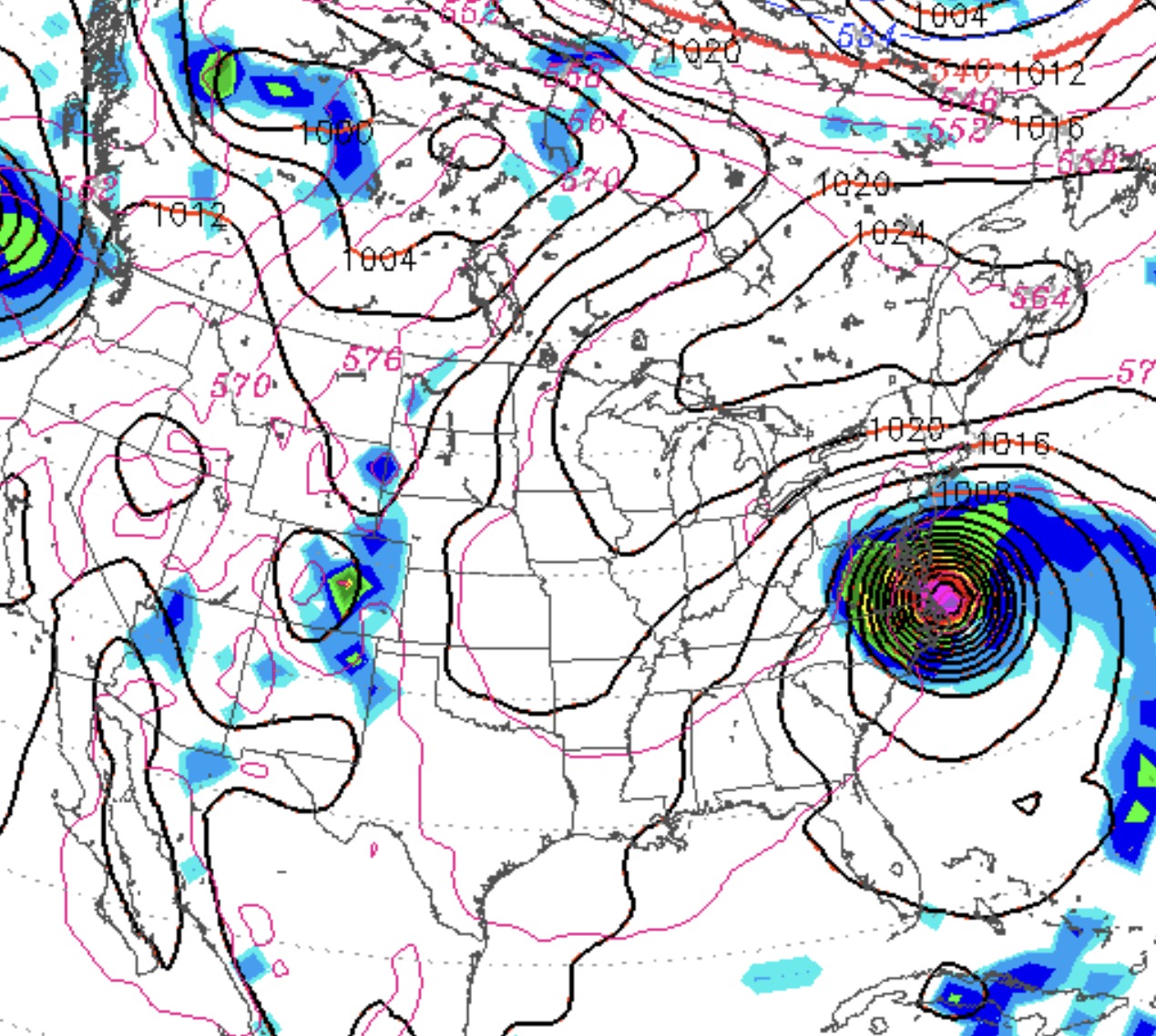
Of continued interest is hurricane Irma. Several models show it moving up the coast and coming inland over the Delmarva area and then over Philadelphia next Sunday evening as a category 3, possibly a category 4 storm . This potential scenario is over a week away, but the situation bears watching. Changes in the predicted track are likely, so stay tuned.
Sunday AM Update: Last night’s models have changed the track to hit North Carolina-Virginia. Expect more changes. Of concern is that this storm does not look like it will go out to sea.
Updated multi-model Forecast :
Updated 9/3/17 Multi-model and Statistical Ensemble forecast Tracks
Previous Model Forecasts.
Previous (9/2/17) GFS forecast for Sunday evening, Sept 10thMulti model Forecasts
Tonight’s latest NAM keeps the showers very light until mid to late afternoon on Saturday. So cloudy with scattered light showers for much of the day. (Heavier showers south of Phladelphia. ) Full forecast here