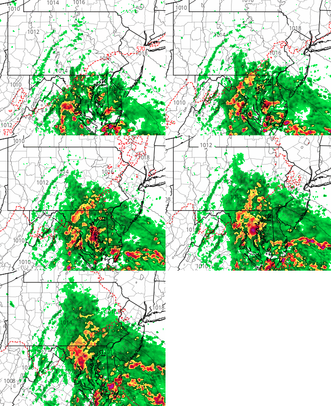
The models are in unusually good agreement about this weekend’s weather forecast.
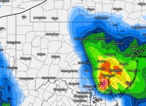
All show coastal low pressure developing off of the Maryland-Virginia coast as a result of a transfer of energy from an upper closed low pressure system in the Ohio Valley. Upper air support combined with a strong low level moisture flow will result in heavy rain Saturday afternooon and especially Saturday night. Total QPF values are in the 2 inch range and local amounts could be higher.

The timing of the onset has clarified- Areas south of Philadelphia will have rain starting in the morning. For Philadelphia and areas north, showers may start as early as 10- 12 PM. By 2-4 PM, all areas in the immediate PHL will have rain. The rain will become quite heavy early evening and localized flooding is possible.

A northeasterly flow ahead of the low will cause temperatures to remain in the 70s on Saturday. There will be gusty winds.
For Sunday, the low pressure system will have lifted north. Skies will break for some hazy sunshine but there will also be considerable cloudiness as well. It will be warm and humid with higher dew points and highs in the mid 80s.
Any sunshine will cause the unstable atmosphere to develop scattered showers and thunderstorms, especially by the late afternoon. Another upper air disturbance moves in late Sunday and enhances the likelihood of showers Sunday evening and night.
