
#Philadelphia #weather #PAwx #PhillyWx
Saturday Update
Posted Saturday 05/24/25 @ 9:37 AM — Last night’s forecast still holds. The sunshine this morning will be mixing with clouds by about noon. There’s a chance of an isolated, fast moving light shower about 3-5 PM. although most areas are expected to remain dry.
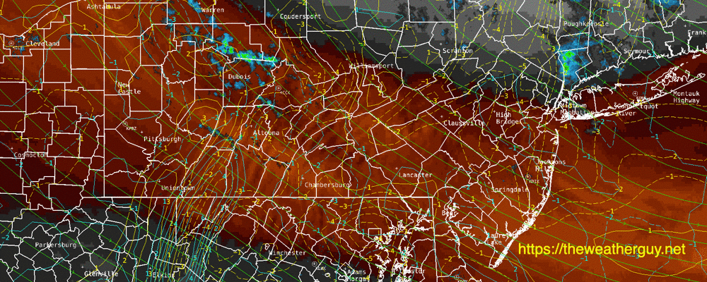
Current Water Vapor with Radar shows the disturbance expected to move through—
Previously Posted Fri @ 6:19 PM — —The main low pressure system that affected our weather over previous days is slowly moving away, but the first upper low and a second upper low will bring cool weather and unsettled skies at times through the first portion of the Memorial Day Weekend. Monday should be mostly sunny.
(An upper low can be thought of as a cold circulation of air aloft.)
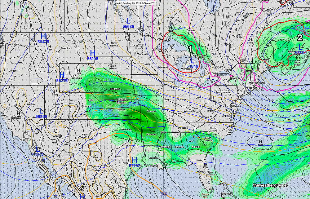
We had widely scattered fast moving showers late this afternoon, and with cold air aloft, that possibility still exists for Saturday afternoon. Sunday, any instability showers should remain far north of the Philadelphia area.
It should be noted that any really warm weather isn’t forecast for our area this weekend or even for the coming week.
Saturday Forecast
Sunny in the morning. Instability cloudiness develops before noon and lasts several hours into the afternoon. A few, isolated showers move through at that time. Most areas will be rain-free. It will be windy during the mid-day hours.
NBM high temperatures: Blue Bell, PA 63º Philadelphia, PA 66º
Uncertainty:average (based on standard deviation): ± 1.9º
Sunday Forecast
Partly sunny, although the experimental RRFS shows considerable cloudiness south of the city and in Southern NJ. Less windy but still breezy.
NBM high temperatures: Blue Bell, PA 68º Philadelphia, PA 70º
Uncertainty: average (based on standard deviation): ± 1.8º
Memorial Day
Sunny. Winds subside further but still breezy. High thin cirrus clouds move in late afternoon.
NBM high temperatures: Blue Bell, PA 68 72º Philadelphia, PA 74º
Uncertainty: low (based on standard deviation): ± 1.4º