
Labor Day Weekend Forecast
#Philadelphia #weather #PAwx
Forecast Update
Posted Sunday 09/01/24 @ 9:35 AM — The forecast continues to have cloudy skies (perhaps with some bright spots at times) and not much rainfall as a front is stalled over our area and small disturbance will move up towards us—
A few weak disturbances will move along the front with some light showers possible Sunday afternoon and again this evening as a secondary cold front is expected to move through late.
Increasing sunshine from northwest to southeast Monday. Cooler with lower humidity.
Unseasonably cool weather this week. Sunny with little chance of rainfall.
So this weekend’s forecast is continuing with the lack of accuracy and low confidence that had been the situation of this past week.
Rain is forecast by the models to reach us about 11 PM and after midnight. It’s also expected to weaken considerably as it approaches, with heavier rain in northern Bucks county. There’s low confidence in this forecast, since the current situation isn’t being accurately modeled.
While the timing is uncertain, I do think there will be weakening of the storms as they approach our area.
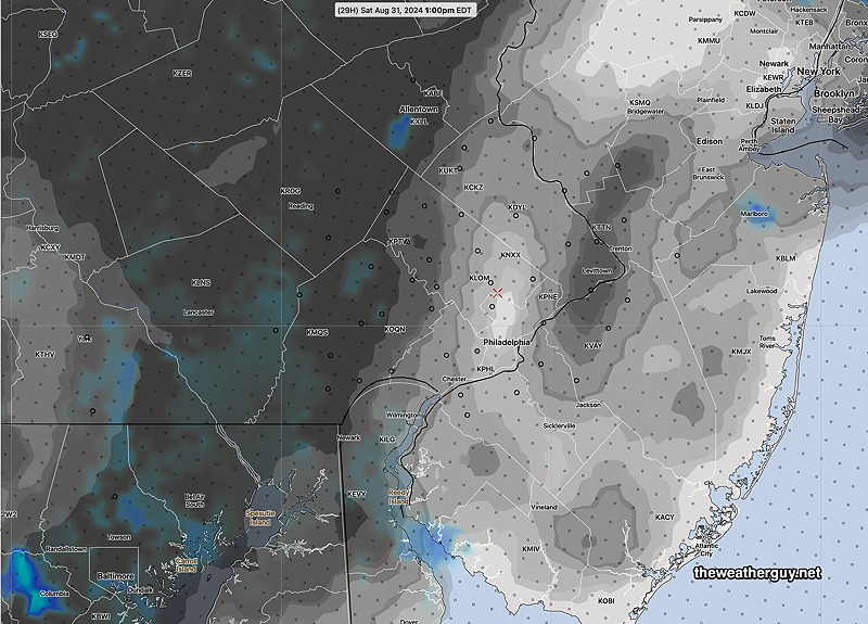
Saturday Forecast Update
Posted Saturday 08/31/24 @ 8:24 AM — Last night’s 06z models show more sunshine for today than previously forecast in many, but not all, areas.
Here’s the latest RRFS cloud cover forecast for noon—
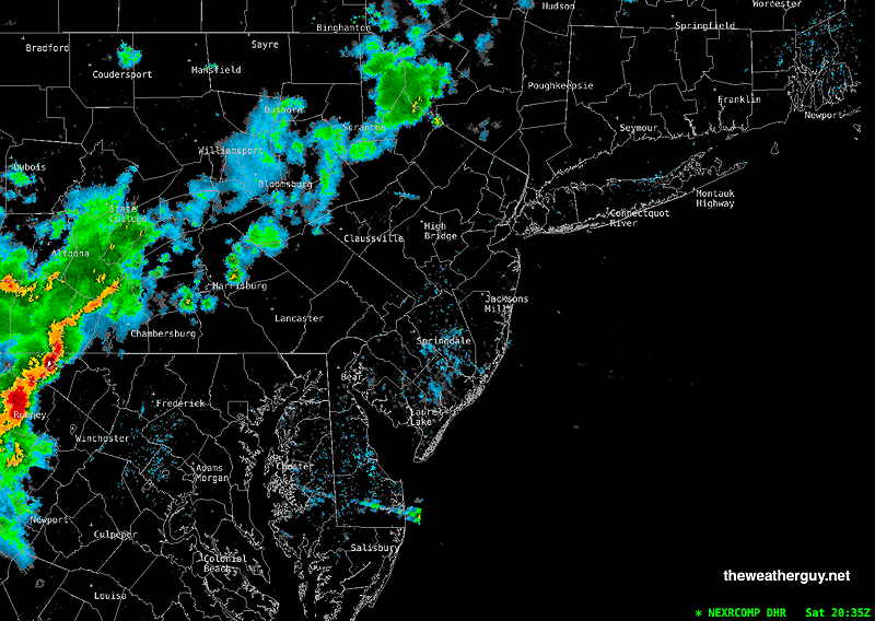
Regarding showers, the showers associated with the approaching cold front move in late from the northwest, about midnight tonight (Saturday).
Heaviest showers appear to skip over the Philadelphia area, keeping many areas in a rainfall deficit.
For Sunday, low clouds break for sunshine through high cloudiness by early afternoon. Cloudy at the shore. Some scattered instability showers develop after 3 PM throughout the area.
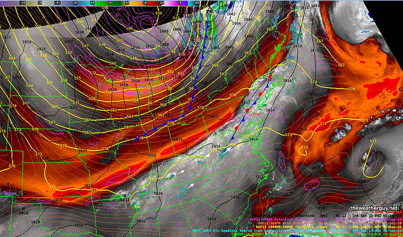
Originally Posted Fri 5:19 PM — A warm front will pass north or our area Friday night into Saturday. An approaching cold front will bring showers and storms Saturday night into Sunday morning. The front will slow on Sunday.
Here’s the current water vapor image showing these features—
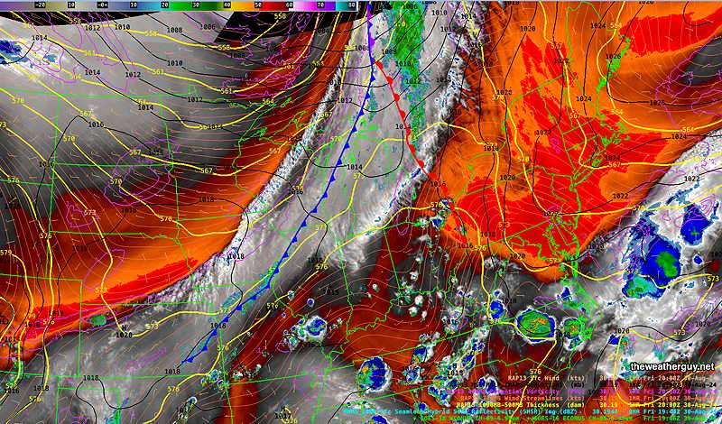
The front will slowly sag south as weak low pressure develops along the front, causing clouds and showers to linger through Sunday.
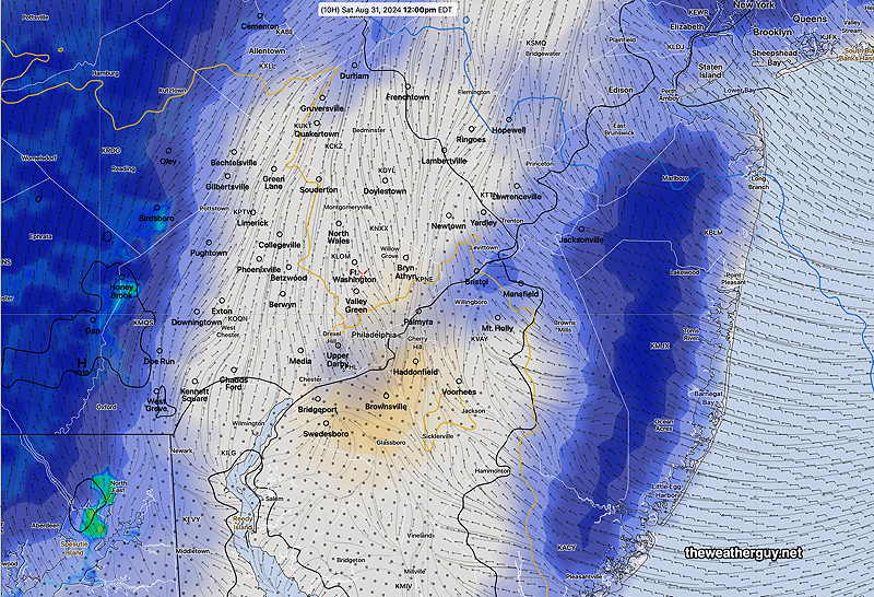
Saturday Forecast
Some areas will see sunshine in the morning, some areas west will have more clouds and some spotty sprinkles. Overall, very changeable skies in many areas. The Jersey shore looks to have a fair amount of sunshiine.
Here’s the RRFS cloud/radar forecast for 2 PM—
Humid with dew points in the low 70s.
NBM high temperatures: Blue Bell, PA 85º Philadelphia, PA 86º
Above Average Uncertainty (based on standard deviation): ± 2.3º
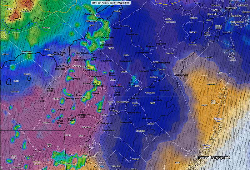
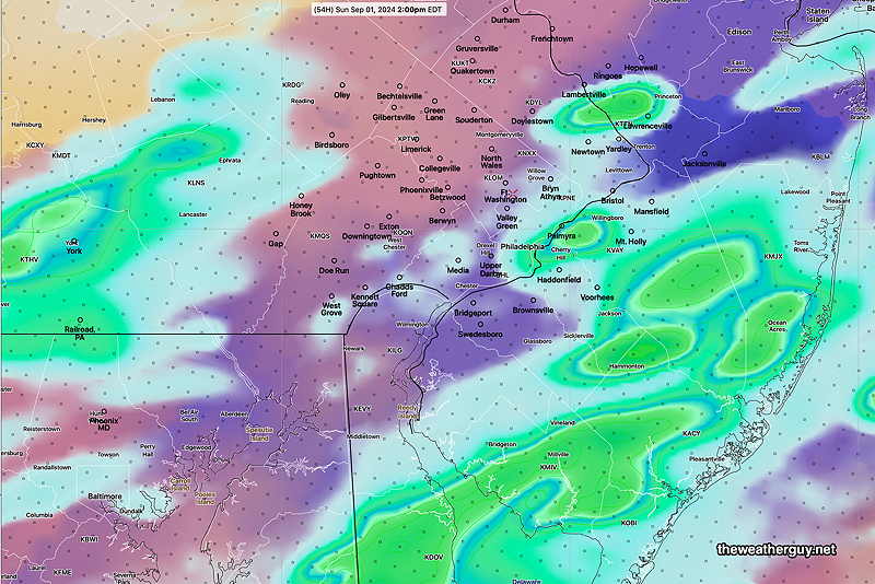
Sunday Forecast
Cloudy with lingering showers in the morning. Brighter skies at the west of the city in the afternoon with clouds and possible showers lingering in NJ and at the shore.
Here’s the latest experimental REFS depicting showers at 2 PM Sunday—
Increasingly breezy. Humid with dew points in the low 70s.
NBM high temperatures: Blue Bell, PA 85º Philadelphia, PA 86º
Average Uncertainty (based on standard deviation): ± 1.8º
Monday Forecast
Sunny and breezy. Low humidity
NBM high temperatures: Blue Bell, PA 77º Philadelphia, PA 79º
Low Uncertainty (based on standard deviation): ± 1.3º