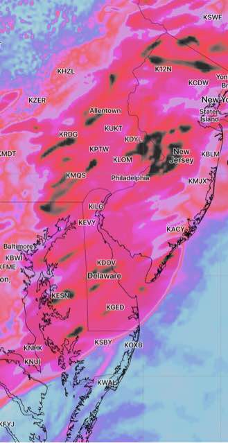
This afternoon’s models have backed off on the extreme weather just a bit. Most of the severe activity will move in between 8-12 midnight. Accumulated precipitation values have come down a bit to 1-2 inches of rain with additional rain on Thursday afternoon and evening.
Shear, Helicity and Vertical Velocity values have reduced a bit from yesterday’s posted graphics with the heaviest activity now predicted to occur in the northern suburbs of Philadelphia, Berks, Lehigh and Bucks counties and into central/ northern NJ and New York City.

That said, these locations are hard [impossible] to pin down precisely in advance. There are differences in the models.
It’s a good thing I don’t usually “do thunderstorm forecasts”. This would have to become a full-time job!
