The showers today will be scattered as in past days, but total rainfall (in some areas) may be greater. Showers start about 2-3 PM and continue through 8-9 PM.
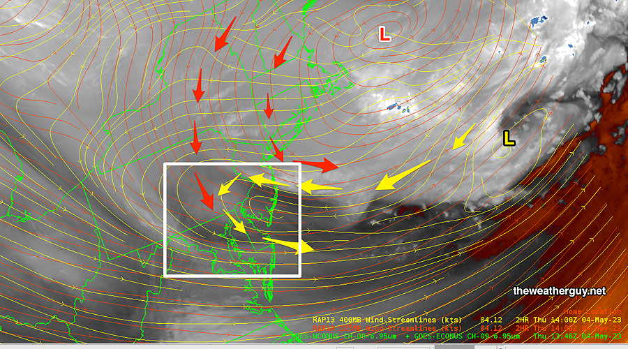
Today’s 12zHIRESW 2.5KM model total rainfall forecast for later Friday (Click on image for a larger view.)
I’ll post the Weekend Weather Forecast this evening. (The weather looks to be much improved from past days, but some uncertainty about showers Sunday. )
Friday Forecast Update
Update Thu 5/04 10:59 PM — Tonight’s models continue with a forecast of sunshine Friday morning followed by clouds and pop-up showers during the afternoon, especially late afternoon and early evening.
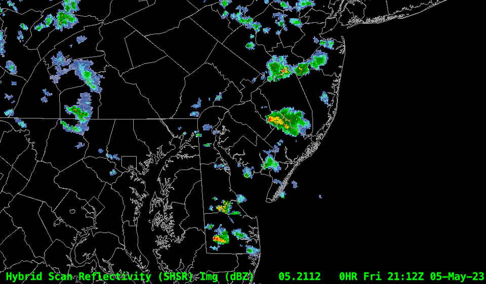
The big change on Friday — the showers may be more substantial than past days and a rumble of thunder can’t be ruled out. As much as this weather will be the result of the influence of the upper low finally departing, a warm front type scenario will also contribute to the mix.
Thursday Forecast Update
Update Thu 05/04 @ 9:38 AM —
The early morning sun we saw might have been the most sun we’ll see today. Already, the cold upper air pool of air is causing instability cloudiness to form. Most models continue with the forecast of light scattered sprinkles and showers developing about 3-5 PM.
In some areas, the sprinkles might be negligible; in others, as much as 0.03″ of rain may fall. High temperature will be just shy of 60º (Blue Bell, PA)
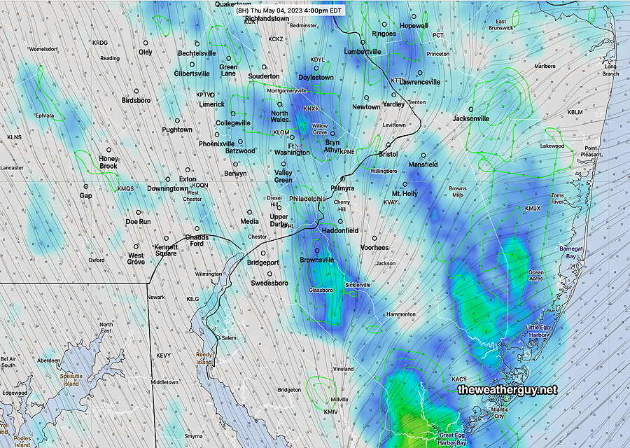
This morning’s 12z NBM simulated radar forecast for 4 PM. ( Green contours are 1 hour accumulated rainfall ) (Click on image for a larger view.)
Incredibily, the NBM shows a similar forecast for Friday, perhaps even more showers!
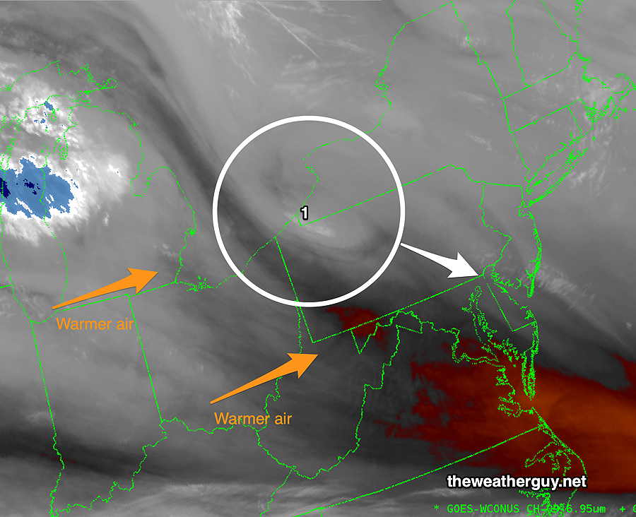
For a greater insight into today, the upper air flow at 250 mb (~34000 ft) around the upper low is colliding with moisture circulating a mid level low at 400 mb (~23,000 ft).
Clouds and sprinkles will be the result. Lack of precision of measurements over the ocean will result in uncertainty regarding the exact placement of the sprinkles today—
Wind flow Thursday morning at 250 mb and 400 mb heights with supimposed water vapor satellite image. (Click on image for a larger view.)
Things do dry out for the weekend.
Previously Posted Wed 7:41 PM —
We have about two more days of an upper cyclonic flow that has given us the clouds, light showers and cool temperatures.
The big upcoming change will be the transition to an upper level ridge. Temperatures will move back towards the low 70s by the weekend—
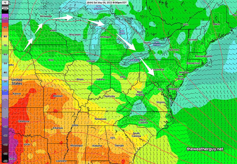
NAEFS Max Temperature forecast for late Saturday. Also visible are the 250 mb (jet stream level) contours showing the ridge that will slowly move towards us. Temperatures near 70 on Saturday and above 70 on Sunday are expected.
Thursday will be similar to today, Wednesday, although there should be noticeably fewer scattered sprinkles and perhaps some more breaks of sun.