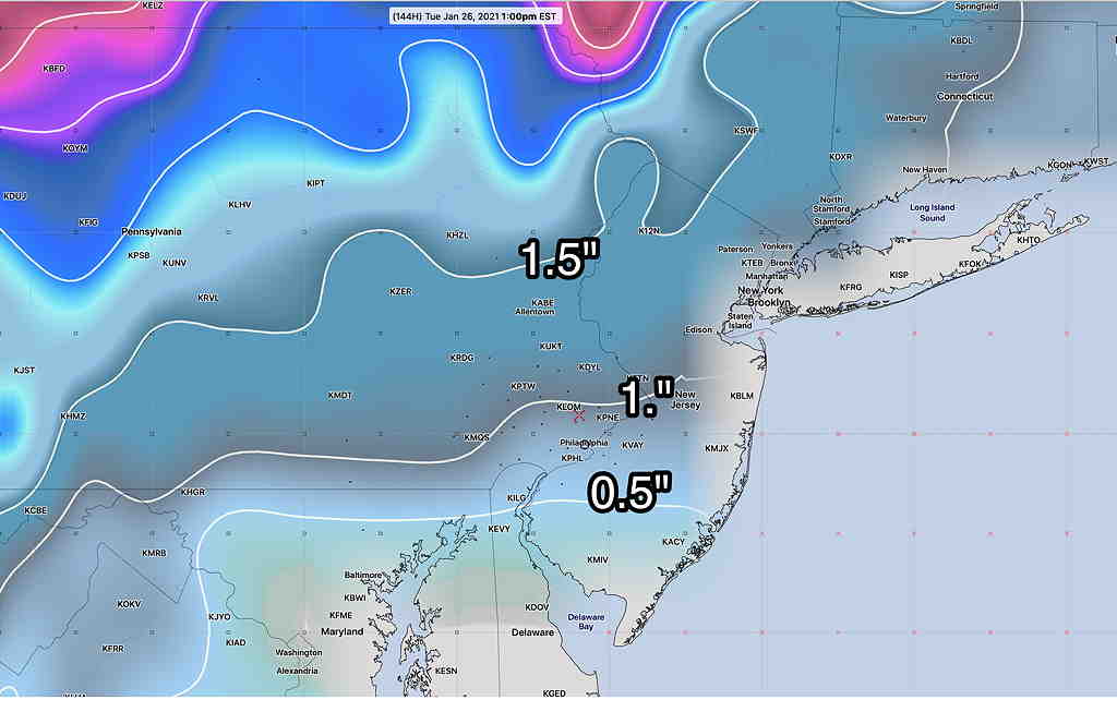
Current operational GFS snow totals by Tuesday afternoon—
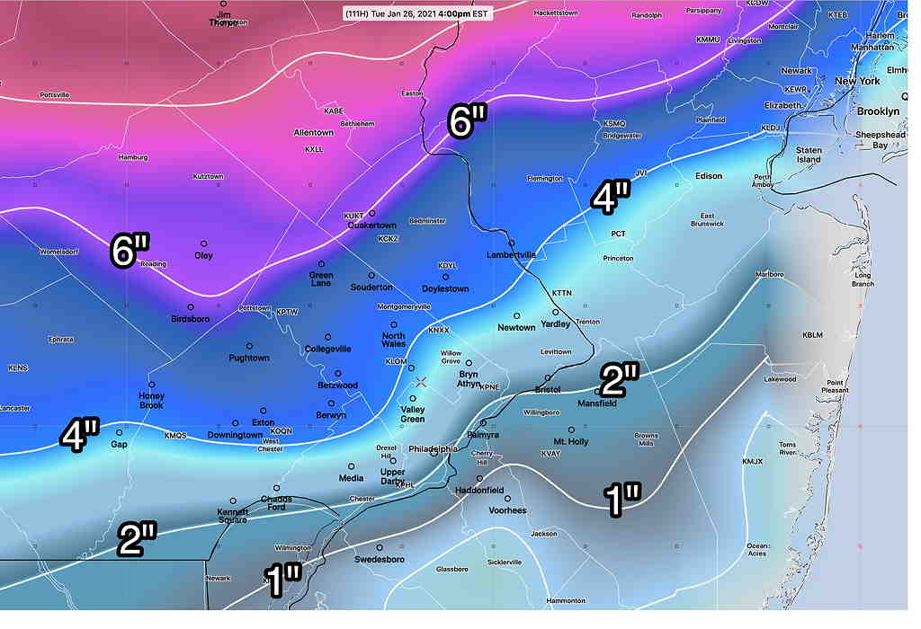
The above GFS snow totals are somewhat similar to the ECMWF (European), Canadian GEM-Gobal and German ICON. Stay tuned.

With it so close, I’m going to stay with only posting major new posts to Twitter, but with an occasional update also posting. (A slight change to the current approach I use.) The updates (such as those on this page) won’t be automatically posted to Twitter.
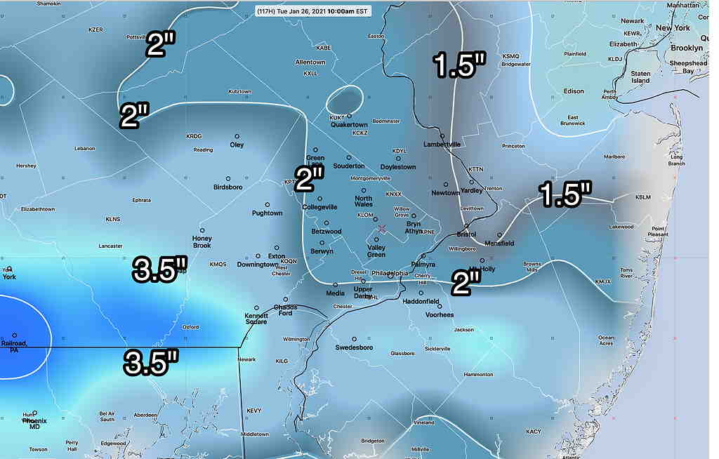
A new wrinkle for getting larger snow accumulation is going to be temperatures, which are trending somewhat warmer at certain levels of the atmosphere, especially near Philadelphia. Many areas will have a sleet/rain mix at times during the event reducing snow totals and making an accurate snow total forecast difficult. Since the storm is coming during the nighttime hours, a period of sleet or freezing rain is a possibility as temperatures near the ground may drop below freezing—
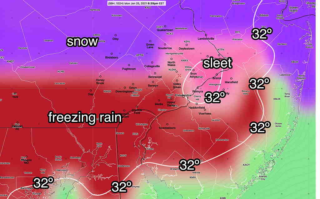
A change back to snow is expected before ending Tuesday morning.
The fine structure of the thermal profile won’t be known until the day before the event. Stay tuned.
From Wednesday …
Today, several people at work asked me, ‘so where’s the snow?’
The statistical ensemble (GEFS) model continues to forecast a minor snow possibility for the overnight period from Monday into Tuesday morning. (see yesterday’s post for the precip forecast graphic; it hasn’t changed much with today’s model runs.)
The sort of thing I like to do is compare the soon-to-be-released GFS model version 16 and the current operational GFS model (version 15.2)’
(The GFS 16 is scheduled to become the operational model the first week in February.)
The soon-to-be-released GFS 16 has significant snowfall for our area, 4-7 inches—
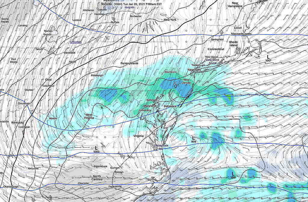
The current operational GFS model has the storm a bust with little development and little snow—
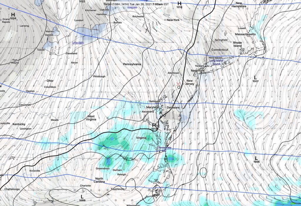
The current Canadian Global and the European models are closer to the the low end with some snow 1-2 inches.
In the time period in question (~138 hours in the future), the statistical GEFS model is probably the one to consider most—
If that’s the case, the soon-to-be-released GFS model v16 has a serious precipitation over-prediction bias.
The fun of this is to see what happens. Stay tuned.
