Poor Model Forecast

It was supposed to be a dry frontal passage this morning, but that hasn’t panned out.   The models show as little as a 4% chance of showers this morning, but the short range models (GFS-LAMP) have increased the chances s bit.  Nonetheless, radar shows that an area of fast-moving showers is passing through.
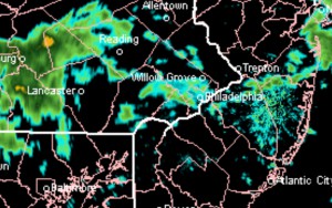
NEXRAD Radar PHL 9:25 AM today

Interestingly, the NAM model was updated and enhanced this past Tuesday, but I see little improvement in the precipitation forecasts since then.

For the balance of the day, broken clouds, showers early morning , then clearing in the mid-afternoon.

Philly Weather Update

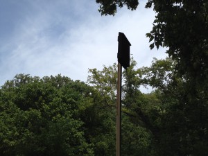
In some areas today, there was a large high cirrus cloud cover, even High level cirrus clouds with bat box in the foregroundan altocumulus congestus layer which kept temperatures down. There were more high level clouds than I had expected.

A weak frontal boundary will move through Sunday morning with cloudy skies early.  The models keep us dry.  Skies clear during the day as a dry northerly flow develops.

So for Sunday, clouds in the early morning with blue skies and billowy fair weather clouds in the afternoon.

Weather… and Other Things 'Up in the Air'