SEVERE WEATHER UPDATE

[su_note note_color=”#d9f2da”]11PM Update. Tonight’s NAM continues to show most of the heavy/severe thunderstorm activity between 7 and midnight Wednesday evening. However, tonight’s  WRF models suggest the possibility of scattered showers and thunderstorms any time during the afternoon as well, with the heaviest in the evening. It will be an active day weather-wise. [/su_note]

For tonight (Tues), the models have no showers moving into Philadelphia, but current radar shows some storms in upper Montgomery county moving eastward.

Looking at the latest Rapid Update Model, there are enough parameters that would support the showers moving into the immediate PHL area.  I guess we’ll see whether they fall apart as predicted or hang together.  Nothing major expected.

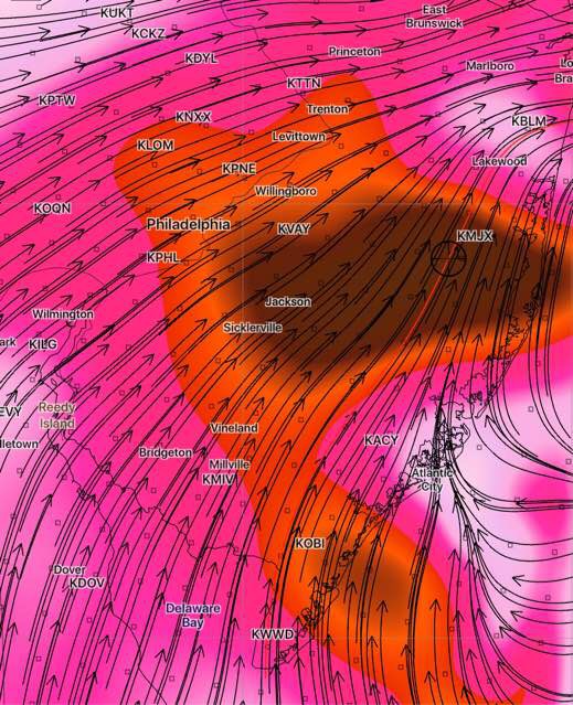
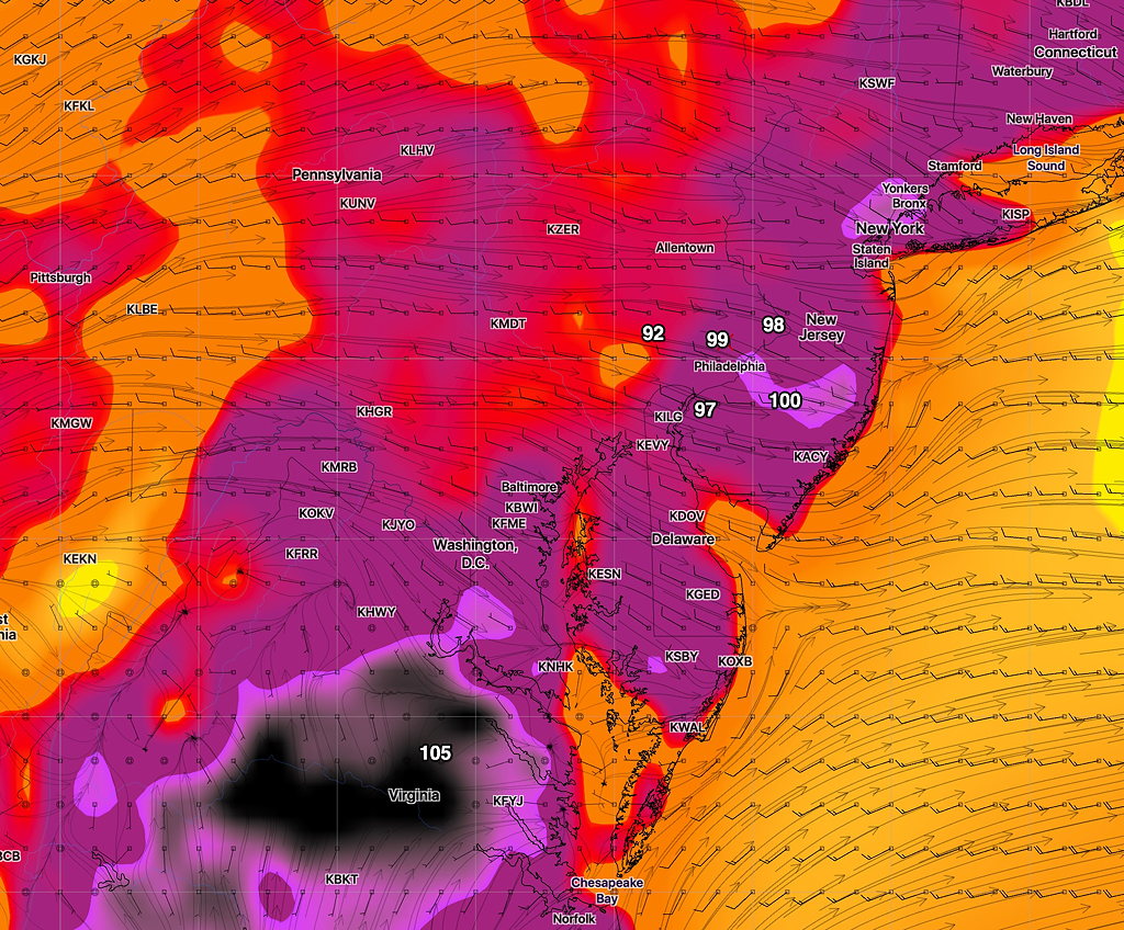
As for tomorrow, Wednesday, the remains of Barry will be moving through our area late afternoon and evening.  Some of the severe parameters are fairly impressive and the models have been predicting that the Philadelphia area will be a bullseye for the heavy activity.

Some models have storms breaking out in the northwest suburbs as early as 4-6 PM.   Most of the severe weather and heavy rain looks to occur between 7 PM and midnight.  Models are predicting about 3 inches of rain with locally higher amounts.  Some severe parameters (like “helicity” and “vertical shear”) become very impressive in central New Jersey during the late evening hours. Tornados are associated with these levels of shear and helicity.

NAM predicted vertical shear 12 midnight Wednesday. (Dark Brown >20 vertical shear)

WEEKEND WEATHER OUTLOOK

We’re entering the climatologically hottest summer period for Philadelphia this week and weekend;  the current GFS forecast appears on track to support that climate statistic.

The remnants of Tropical Storm Barry are expected to bring heavy rains Wednesday night, although the exact placement is always difficult to determine.  The current GFS bullseye is right over Philadelphia.

After that time, oppressive heat and humidity is expected for much of the end of the coming week.  Temperatures and heat indices get possibly extreme on Saturday, where temperatures in some areas may approach 100, according the latest GFS.  (That’s temperature, not the Heat Index. Heat indices will be higher. )

Here’s the current GFS forecast for Saturday afternoon, about 2:45 PM:

Current GFS forecast for Saturday afternoon 2:45 PM

The forecast specifics may change, but the weather will likely be very hot and humid for Thursday, Friday and especially Saturday.

A front may move through Sunday, reducing temps and humidity.

WEEKEND WEATHER FORECAST

[su_note note_color=”#d9f2da”]Last night’s models moved today’s predicted high temperatures downward a degree or two and moved up the dew points a bit. High temp 87-89, dew points in the more uncomfortable mid 60s for Saturday.

EKDMOS Forecast High Temps

[/su_note]

From last night…

This weekend’s forecast is unusually straightforward and hasn’t changed appreciably from last night’s posted “outlook”.

High pressure will build in for Saturday and Sunday.  Sunny skies and above average temperatures expected.  Daytime highs near and above 90 in the city, a degree or so less in the northern and western suburbs.

Here’s the latest EKDMOS high temperature probabilities for the coming several days for KPHL, Philadelphia Airport.

Ensemble Kernal Density Model Output Statistics (EKDMOS) High Temps

Weather… and Other Things 'Up in the Air'