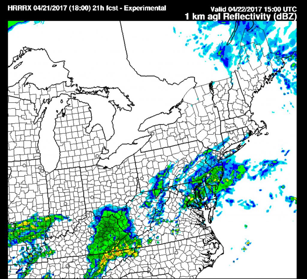
Friday evening update: It’s looking like Saturday will be wet with showers moving in during the morning, based on the latest HRRR and nested NAM models.
Significant differences in the model forecasts makes this a tough forecast for the coming weekend. The NAM and GFS models show low pressure moving eastward and to our south for Saturday; The NAM is stronger with this system and has rain moving in Saturday morning. The GFS keeps the precipitation just to the south of Philadelphia for much of Saturday
In fact, there are significant differences between the GFS and the “Parallel GFS model” (The “Parallel GFS model” is a newer version of the GFS being developed and run “in parallel” to compare accuracy).
The Parallel GFS has the early part of Saturday dry and has some showers moving in later in the day.
This afternoon’s NAM run has moved in the direction of the GFS, with the precipitation suppressed just to the south of Philadephia.
It would not take much error for the forecast to be a bust in either direction. So we’ll go with just cloudy (most likely) So we’ll go with showers for Saturday, starting in the morning and continuing into the afternoon.
but it might be wet if the rain shield moves as little as 30 miles north. High 63.

Both models suppress the rain well to our south on Sunday. Sunday will be dry, cloudy with some sunny breaks possible by afternoon. High 65.
I’ll update later this evening if things clarify for Saturday.
