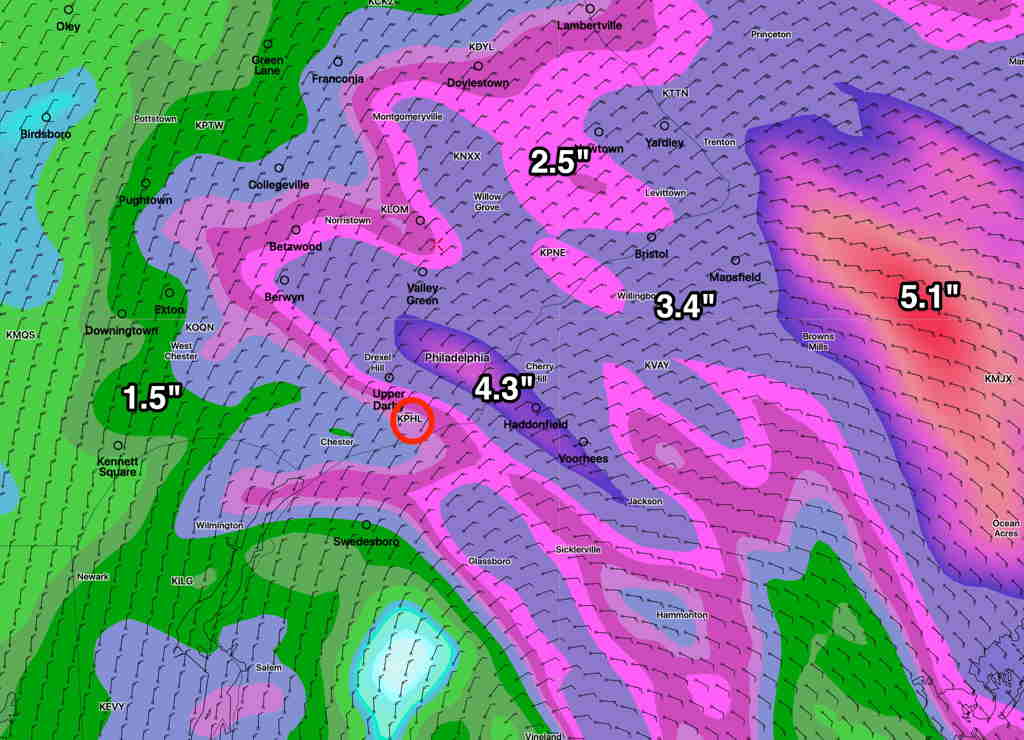
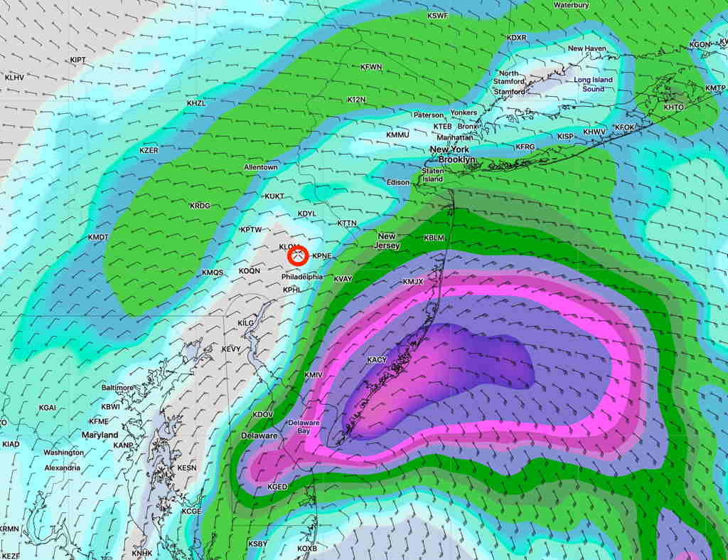
This afternoon’s NAM-NEST model as well at the Canadian High Resolution and German ICON model have moved the heaviest rain bullseye eastward into NJ. The afternoon GFS is not yet available. Still a lot of rain!

The NAM model is further eastward with the heavy rain and somewhat captures the ICON and CMC models—

This is almost as challenging as trying to predict a snowstorm!
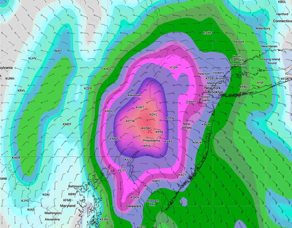
And the afternoon run of the GFS has just become available and maintains the the precip maximum over Philadelphia —

from earlier today…
The models continue to bring the center of the semi-tropical low directly over our area. As with most tropical systems, the amount of available moisture for rain will be high. (Measured as the model parameter PWAT, or “precipitable water”.)
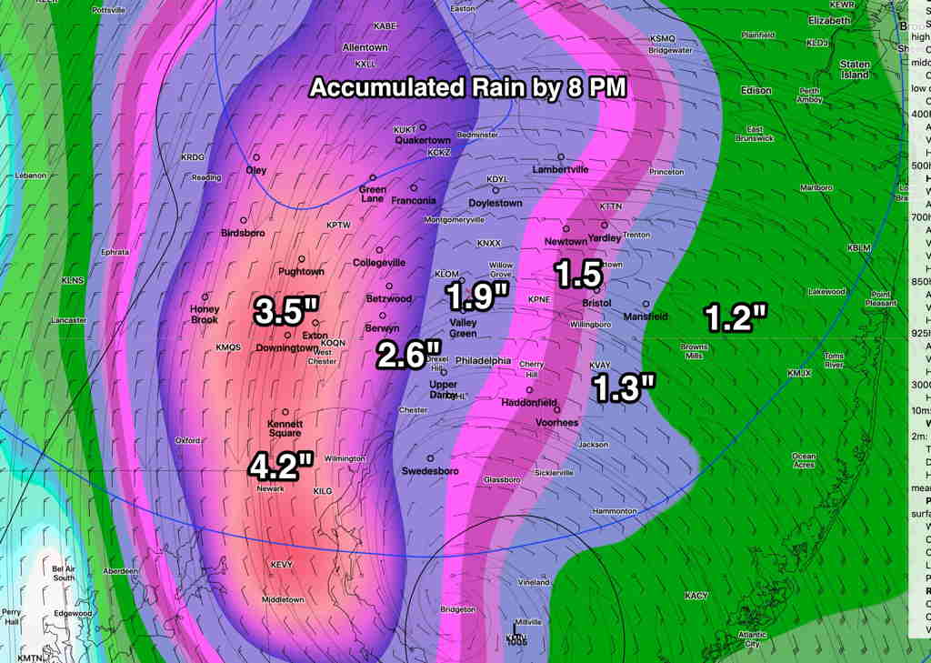
Here’s the current forecast amount of rain expected by 8 PM Friday—

Please keep in mind that model rain predictions can’t be taken literally, especially in regard to the exact placement of the heaviest rain. But it does give a good idea of the general amount of rain expected and the most likely area for the heaviest rain.
(The NAM-NEST model has a similar forecast to the GFS for the heaviest rain in the western suburbs. The NAM has the heaviest rain bullseye in NJ. )
