Category Archives: Philadelphia Weather Outlook

WEEKEND WEATHER OUTLOOK

[su_box title=” Weekend Outlook Update Thursday 7 PM” box_color=”#defcdc” title_color=”#000000″]Weekend Update – Like last weekend, it appears that the rain will arrive sometime mid to late Saturday afternoon. High near 49. Heavy rain Saturday night.

Rain ends during the [late] morning on Sunday. High temperatures about 63 Sunday, but some statistical models are suggesting 67! Updates Friday evening. [/su_box]

The overall weather pattern for Philadelphia over the next two weeks is for below average temperatures (average high about 49) with at least one 3 day warmup occurring over the coming weekend.

Low pressure will bring a southwesterly flow of mild air for Saturday and especially Sunday.  The statistical EKDMOS has a high of 60 for Sunday while the NBM shows a high of 58!

Unfortunately, there’s a high probability of rain for Saturday, but Sunday afternoon may be dry. Too soon to be sure. Stay tuned.

SNOW FOR THURSDAY MORNING?

Let me answer the title question up front – I don’t think so.

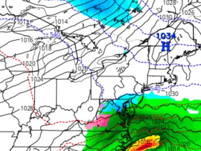
All models keep the critical thickness levels too warm for snow formation here on Thursday morning.  What we may have is a brief period of sleet or freezing rain before changing to rain early and even that is in doubt.

Basically, there may be some ‘cold air damming’ which results in a cold lower layer, allowing sleet and icy conditions before a change over to rain.

We really won’t have a good handle on the thermal profiles for Thursday until Wednesday night.   But I felt I had to chime in, after hearing a hyped up forecast from the local TV weather people.

As mentioned, the models have been highly inconsistent over the past week.  If there’s any chance of more interesting weather, it might be with the departure of this system late Thursday or Friday morning.  Stay tuned.

WEATHER OUTLOOK

[su_note note_color=”#d9f2da”]Monday AM Update: The models are showing yet another coastal storm sometime during the Thursday-Friday time frame. Timing issues still exist.

Cold air rushing in after the low departs may again give us the first chance of some mixed non-accumulating precipitation this season. Too many unknowns at this time.  Stay tuned.[/su_note]

The computer model forecasts over the past several days have been very changeable:  While the coastal storm for Monday night into Tuesday is still mostly on-track, the speed of the system has increased while the amount of cold air on the back side of the system has decreased.

We’ll have rain Monday evening into Tuesday morning, heavy at times. No flurries or snow showers expected on Tues night, although things chill down for Wednesday but it won’t be as cold as previously forecast.

Another interesting storm is possible on Thursday morning with the possibility of some frozen precipitation early, before changing to rain.

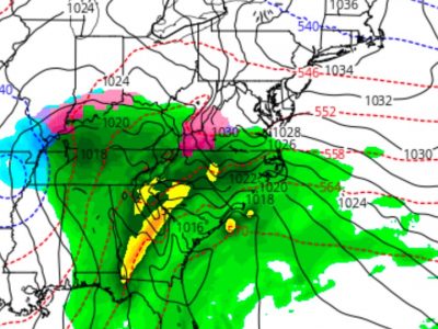
There’s a lot of uncertainty with this system- there are even large differences even between the GFS and the FV3-GFS!

  • GFS Operational Thursday morning forecast

Next weekend looks to be very cold as a dip in the jet is forecast to be in place.   But things could change.