Category Archives: Philadelphia Weather Outlook

WEEKEND WEATHER OUTLOOK – THURS

The slow-moving front that moved through Wednesday with thunderstorms will become a stalled, diffuse frontal boundary to our south; it will serve as a track for weak disturbances (areas of vorticity)  to move near our area from west to east over the weekend.

The summer daytime heating combined with these areas of vorticity and moderately high moisture (precipitable water values  about 1.5 inches) will result in instability and mostly afternoon and evening thundershowers, some which may be slow moving causing considerable downpours.  Many areas will also see a fair amount of sun, especially east of the Philadelphia into NJ.  Highs both days near 90.

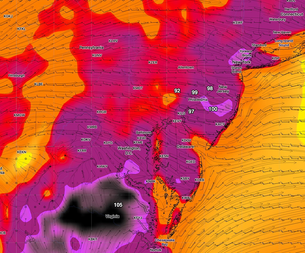
Currently,  the models show areas to the west of Philadelphia to be the most impacted by this setup on Saturday.

The current GFS shows showers to our west Saturday afternoon, but significant sunshine in other areas. (see graphic)

GFS Forecast Precipitation Rate and Cloud cover for 1 PM Saturday (green lavender =rain)

Sunday shows more clouds but fewer areas of showers—

GFS Precipitation Rate and Cloud forecast Sunday 4PM

This sort of scenario is impossible to nail down to specifics, despite the pretty graphics; it’s presented to provide an approximation of what to expect.

What will be interesting to see is whether some showers break out around 3-4 PM today (Thursday) in Philadelphia.  My view of weather models- if the short range forecast shows to be inaccurate, the longer range forecast should be taken with a grain of salt.

WEEKEND WEATHER OUTLOOK

With things being so quiet weather-wise, this “outlook” could easily be the final forecast for this weekend.

High pressure will be in control for the entire weekend.  Sunny skies and increasingly warm temperatures for Saturday and Sunday.  Based on the EKDMOS, high temps for Philadelphia 89-91, running about two degrees less in the suburbs to the north and west.

Some localized instability may cause very widely isolated thundershowers  Sunday late afternoon.  Most areas will be dry.  The NAM and GFS are also showing some very localized areas  of clouds for periods Sunday afternoon.  Most areas will be sunny.

WEEKEND WEATHER OUTLOOK

We’re entering the climatologically hottest summer period for Philadelphia this week and weekend;  the current GFS forecast appears on track to support that climate statistic.

The remnants of Tropical Storm Barry are expected to bring heavy rains Wednesday night, although the exact placement is always difficult to determine.  The current GFS bullseye is right over Philadelphia.

After that time, oppressive heat and humidity is expected for much of the end of the coming week.  Temperatures and heat indices get possibly extreme on Saturday, where temperatures in some areas may approach 100, according the latest GFS.  (That’s temperature, not the Heat Index. Heat indices will be higher. )

Here’s the current GFS forecast for Saturday afternoon, about 2:45 PM:

Current GFS forecast for Saturday afternoon 2:45 PM

The forecast specifics may change, but the weather will likely be very hot and humid for Thursday, Friday and especially Saturday.

A front may move through Sunday, reducing temps and humidity.