Category Archives: Philadelphia Area Weather Forecasts

Winter Weather Update

There are the usual differences between the GFS and NAM models – the NAM is colder and wetter- the GFS has much less precipitation and is a bit warmer in the upper atmosphere.

In recent years, the NAM has often over-predicted the amounts of snow with model runs more than a day in advance.  So while the NAM is predicting several inches of snow in PHL, I think we can ignore it and go with the GFS.

The GFS model has temperatures falling in the upper atmosphere  to support snow just as much of the precipitation winds down.  It maintains surface temperatures that are above freezing until the precipitation shuts down.  So conditions for snow and snow accumulation are very marginal with the GFS model.  While a changeover to snow looks to occur about 2-3 PM, conditions for accumulation will not be optimal because the precip will be winding down.  With warm and wet surface conditions, expect snow accumulations to be about 1 inch or so in the immediate Philadelphia area.

Traveling conditions will not be good late afternoon, but the precipitation ends about 7 PM.

Again, much of this will be RAIN, changing to snow 2-3 PM and not looking to accumulate very much before ending by 7PM.

Winter Storm Hysteria Hits Local TV Stations

Winter storm hysteria has hit again in Philadelphia for the 2014-2015 winter season.   From Hurricane Schwartz’s “shhhtorm alert”  to Cecily Tinan’s  “tracking the storm track”, you can hear the hysteria and sensationalism building for this “weather event”.

It’s going to be a coastal low.  Much of the storm will be RAIN in and around Philadephia for much of the day.  As always, the far northwest areas, near Allentown and Reading may have an earlier changeover to snow, although the amount of precipitation will be less there.

But this blog focuses on Philadelphia and its immediate suburbs.   In this area, it will start as rain, likely heavy, until at about 2 PM, according to current models.  It wil start mixing with and changing to snow after 2-3 PM, but temperatures at the surface will not be sinking below freezing until a bit later.  This changeover will be occuring just as the precipitation will be tapering down.

With temps just approaching freezing at the surface, the very wet surfaces from the earier rain, and the intensity of precipitation winding down, expect a wet mix mix of about 1 inch  by rush hour.

The real issue will be possible icy conditions after 7 PM.

In terms of accumulating snow totals, this is not going to be a big deal in Philadelphia.  It’s very bad timing for the many people on the roads for the Thanksgiving holiday.  In terms of bad travel conditions, this will be significant.  In terms of accumulating snow for Philadelphia,  this storm is being hyped right now.


Philly Weekend Weather Forecast

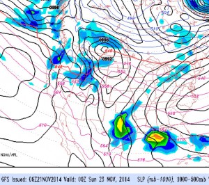
The latest GFS model shows a slight moderating trend over the weekend with temperatures into the low 40s on Saturday and into the low 50s on Sunday. This is still below seasonal averages.

As the amplified jet pattern relaxes over us and the cold high pressure moves east, a return flow of warmer air moves in with a warm frontal patter later Sunday into Monday.

Saturday will be mostly sunny with a few clouds in the afternoon. High 44.

Sunday will start with some sun but will have thickening clouds. Milder with highs in the low 50s. Some rain begins during the evening as the warm front moves through.

Outlook for next week: Rain Monday morning….then mild and windy. Windy and mild for Tuesday and Wednesday. Another big chill-down is expected for Thanksgiving weekend.

GFS model forecast for late Saturday