Category Archives: Philadelphia Area Weather Forecasts

Philly Weekend Weather Forecast

A moist southerly flow ahead a slowly advancing cold front will bring hazy skies and periods of cloudiness over this weekend.  While previous model runs had suggested significant rain, especially for Sunday, the latest GFS model backs off from much of this precipitation and keeps most of Saturday and Sunday dry.

For Saturday, a weak warm front moves through Saturday morning with a slight chance of a shower. Some sun breaks out by afternoon.  Very warm and humid. High 87

For Sunday, a repeat of Saturday with clouds and a chance of a shower in the morning. Some sun breaks out by afternoon , but increasingly cloudy late afternoon with showers and thunderstorms possible by evening into Monday.

So much of the precipitation is currently forecast to stay to our far north and west this weekend.  Stay tuned.


Philly Weekend Weather Forecast

Sprawling high pressure will maintain dry weather for our extended Memorial Day Weekend.

Very cool temperatures are expected for Saturday with sunny skies.  High 69.

Sunday will be sunny and  warmer with highs in the upper 70s.  A return flow around the high will bring moisture and some clouds late Sunday afternoon.

Monday’s weather forecast is a bit lower confidence regarding the amount of cloud cover; a mix of clouds and sun is likely.  Highs 84.


Philly Weekend Weather

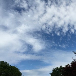
Early cirrus clouds with approaching warm front
Cirrus clouds with approaching warm front


A southerly flow of warm humid air will affect our area over the weekend.  A series of frontal boundaries will move through. Exact timing of precipitation will be difficult to nail down, but most likely late Saturday afternoon into evening and similarly late Sunday into Sunday evening.

The NAM has more breaks of sun than the GFS on Saturday.

First, a warm front moves through Friday night and some light showers are possible before daybreak, then ending early morning Saturday.

On Saturday, the warm front barely clears our area.  The GFS has some sunshine breaking through in the mid morning, but has mostly cloudy by 2 PM with an increasing chance of showers in the late afternoon and evening.  High 82.  More humid.

There’s a chance of thunderstorms also Saturday evening as a weak cold front moves through.

The weak cold front is expected to remain near our area on Sunday as weak disturbances move along it, likely triggering some showers.  Sunday looks to be mostly cloudy with an increasing likelihood of showers towards evening.