True summertime weather for this weekend. A weak “cold” front passes through Friday evening. The only change will be a wind shift to the north and somewhat drier air will filter in bringing dew points down to the mid 60s.
With somewhat less humidity on Saturday, sunshine will allow high temperatures to reach 98 . Little chance of any showers or thunderstorms.
Saturday Noon Update: This morning’s (Saturday) NAM model has a higher than expected chance of thunderstorms for early this evening.
Sunday will be similar with dew points in the mid 60s and high temperatures expected to be around 96. Humidity returns Sunday night.
A front will slowly approach Saturday and will pass through Saturday night. Most of Saturday will be sunny and moderately humid with high temperatures in the low 90s and dew points in the mid 60s.
Cloudiness will move in late afternoon Saturday, and there’s a chance of scattered showers and thunderstorms early Saturday night, although most of the activity will be in Delaware and Maryland.
Some uncertainty about Sunday, as the front will stall off of the NJ coast as weak low pressure develops. Sunday is expected to be mostly sunny, except near the coast. High around 90. A low confidence forecast for Sunday.
An interesting weather setup for July- Large low pressure in the St Lawrence valley is trying to redevelop off the mid-Atlantic coast.
Current mesoscale analysis 8 AM
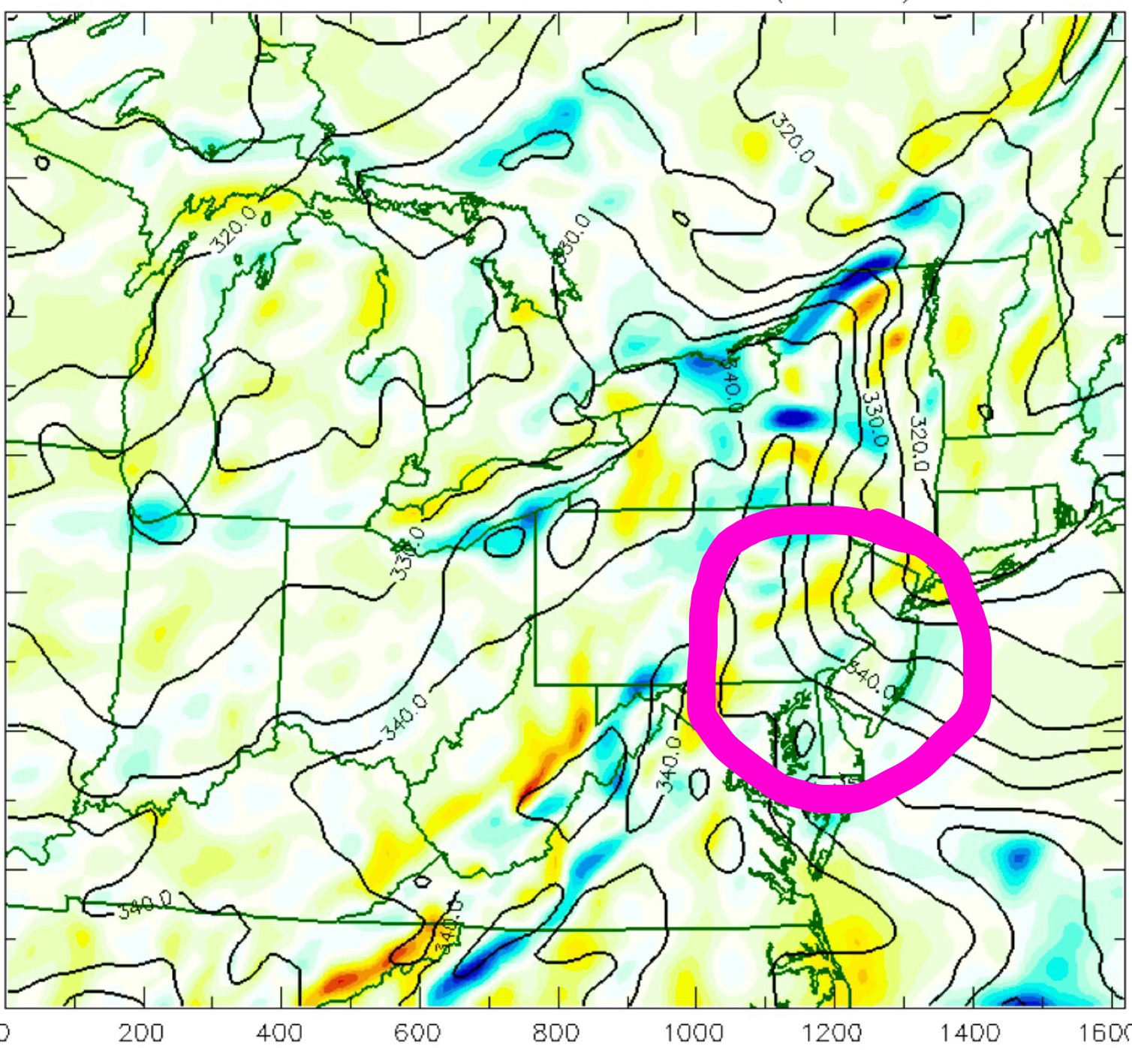
The map below shows packed theta-E contours over our area. Moisture being transported perpendicular to these contours is sparking showers just to our west.
Theta-E contours and moisture convergence
It will be interesting to see if we get any sunshine today or just showers. It looks like it will only get to 80 today, much cooler than previously predicted.