Brief update— Clouds are breaking for sun, about 2 hours later than had been forecast. Sun today with highs temps 50-52º.
This morning’s models are coming available and it looks like the easterly wind flow for Sunday may result (as mentioned) in more low-level cloudiness on Sunday than previously thought. So periods of cloudiness and some sun for Sunday. High temps 48-50º.
Monday is looking to be a very rain day. Total QPF 1.5- 2.0 inches of rain.
A brief update: This morning’s models just coming in ( it’s Daylight Saving Time, so they’re in an hour later) are not consistent with the shower/thunderstorm threat today.
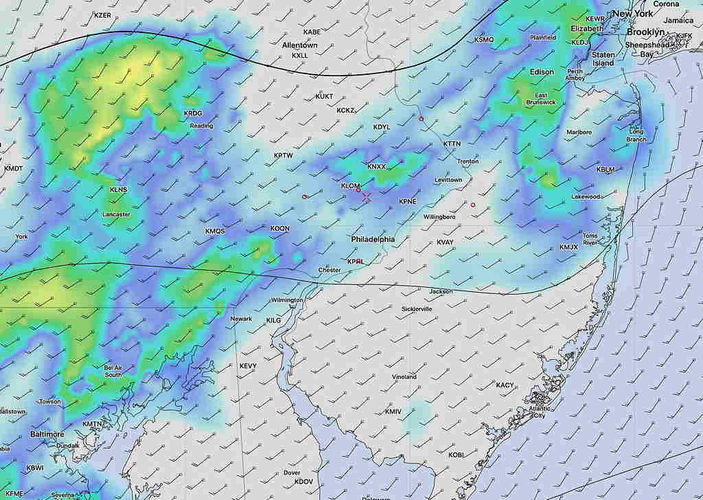
Most of the short range models have light showers developing between now and 2 PM with the greatest threat north and west of Philadelphia.
The latest HRRR (High Resolution Rapid Refresh) model is similar, keeping the showers mostly to the west of Philadelphia, although it has some showers moving into Philadelphia before noon and 2 PM.
Tonight’s models have the warm front moving through tonight, about 4-5AM. Some widely scattered showers and even a thunderstorm prior to the frontal passage late tonight.
We’ll be in a southwesterly flow on Friday. There’s a chance of showers and scattered thunderstorms anytime with increasingly windy conditions.
With a mix of clouds and sunshine, temps will approach 80°. Chances of thunderstorms are highest between 1 and 5 pm. Some may be heavy to severe.