Clouds, Some Sun Saturday, possible very light snow/rain showers Sunday afternoon
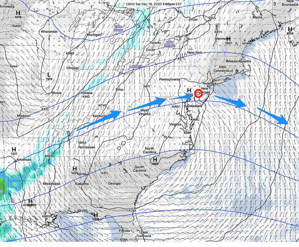
High pressure will build in for Saturday, however an upper flow will also bring in some moisture at the mid-levels of the atmosphere resulting in some cloudiness late morning into early afternoon Saturday.

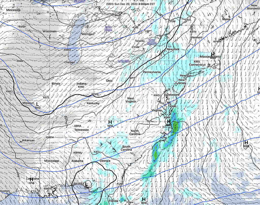
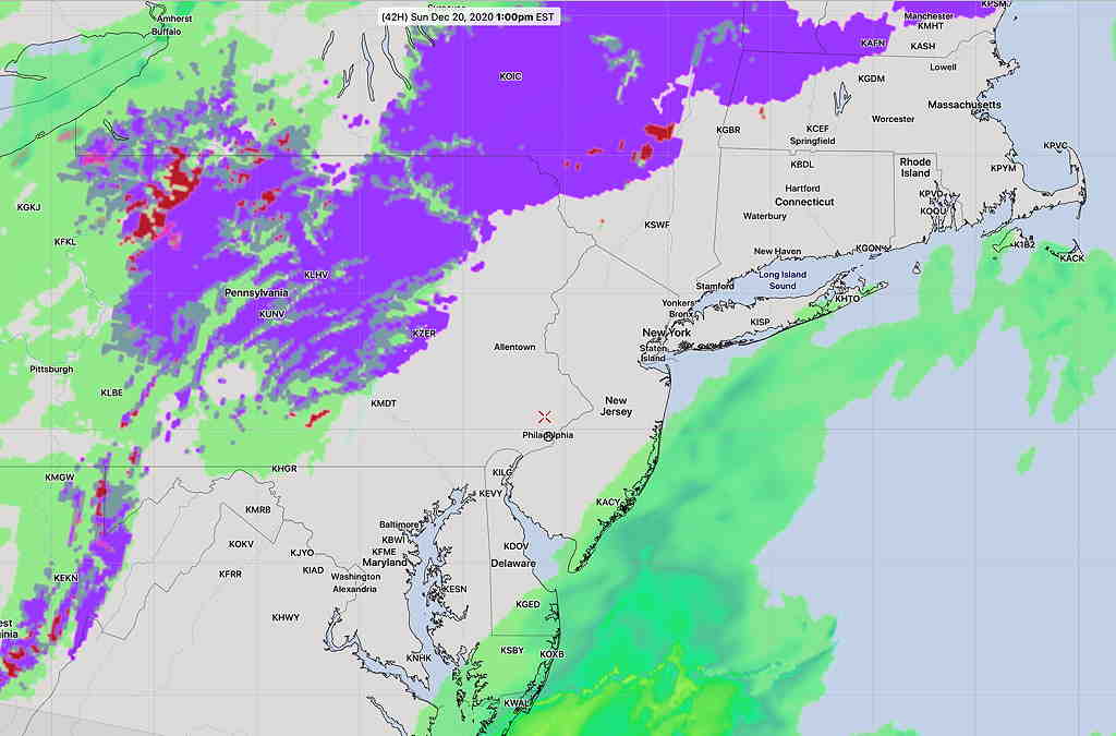
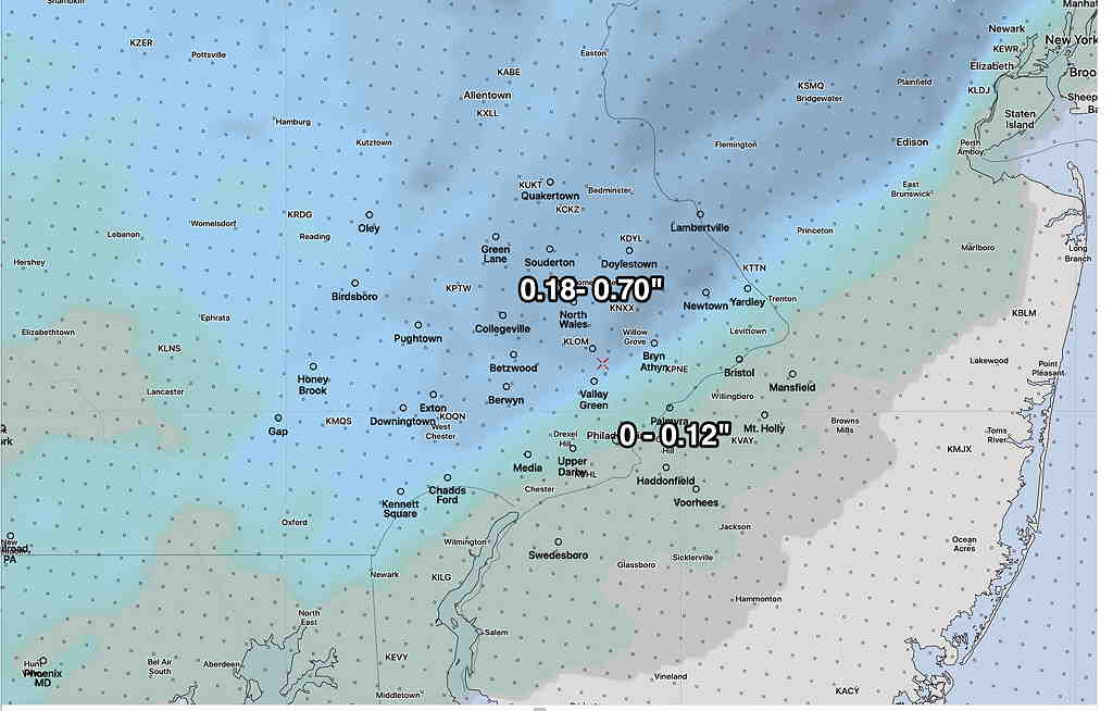
Further to the west, (also visible on the map above) is a disturbance building near Louisiana. This system, with its clouds and precip, will approach on Sunday, but is expected to pass to the south and east of us. The precipitation shield will graze us, according to the latest models. The HRRR has us sandwiched between areas of light snow and rain. Others have us dry with breaks of sun. Others have light snow or light snow with rain. There’s high uncertainty with Sunday’s forecast.


Saturday—
- Mostly cloudy with occasional breaks of sun possible.
- Morning low temp 13.5º sd 5.8º (NBM model Blue Bell) — extremely high spread indicating high uncertainty
- High temp 32.1º sd 3.0º (NBM model Blue Bell) (high spread!)
- Very light to calm winds
Sunday—
- Forecast Confidence Level- below average.
- Cloudy, perhaps some breaks of sun during the day.
- Uncertainty about light snow in the afternoon. Some models have a light snow falling during the afternoon. Others have nothing. Others have a mix of snow showers mixed with rain. Little or no accumulation.
- Morning low temp 22.5º sd 3.1º (NBM model) Blue Bell area.
- High temp 37.5º sd 2.1º(NBM model) Blue Bell area.
- Winds SSE , light 5 mph but some higher gusts to 15.
I’ll update when things clarify for Sunday.
