
#Philadelphia #weather #PAwx #PhillyWx
Saturday Forecast Update
Posted Saturday 07/26/25 @ 8:26 AM — Last night’s models have trended towards an increased likelihood of showers and thunderstorms, as early as 3-4 PM in western sections but most likely after 6-7 PM closer to the city.
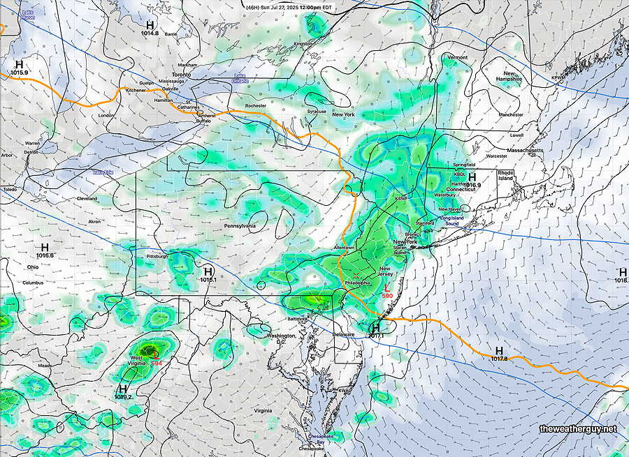
Originally Posted Fri 10:11 PM —A weak cold front moved through late Friday afternoon with showers and thunderstorms. The front will stall just to our south on Saturday, allowing somewhat drier air to filter in. The front returns as a warm front Saturday night into Sunday with widespread showers and thunderstorms. Heavy rain possible as a trough develops behind the warm front. Much of Sunday looks wet.
Saturday Forecast
Somewhat less hot and drier air on tap for Saturday with dew points in the upper 60s. There will be a mix of sun and periods of clouds with an increase in clouds during the afternoon. A scattered thunderstorm is possible late afternoon and evening.
NBM high temperatures: Blue Bell, PA 88º Philadelphia, PA 89º
Low Uncertainty (based on standard deviation): ± 1.3º
Sunday Forecast
Showers and thunderstorms develop Saturday night after midnight with the warm front advancing towards us. The front passes over us about 5 AM Sunday morning and showers and storms will linger through much of Sunday as a disturbance moves along the front. We may see some brightening skies late afternoon, but additional showers are possible in the evening.
NBM high temperatures: Blue Bell, PA 84º Philadelphia, PA 86º
Very High Uncertainty (based on standard deviation): ± 3.6º
Models guiding this forecast: ECMWF, GFS, NBM, RRFS, RGEM