
#Philadelphia #weather #PAwx
A simple forecast for this weekend. High pressure generally in control with moderating temperatures. A few disturbances in the upper atmosphere will pass through both Saturday and Sunday afternoons with some increased cloudiness.
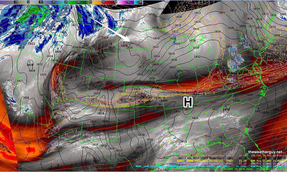
Here’s the water vapor image from this afternoon—
Saturday Forecast
Sunny in the morning with sunshine through high level clouds in the afternoon. Still somewhat windy/breezy.
NBM high temperatures: Blue Bell, PA 40º Philadelphia, PA 41º
Low uncertainty (based on standard deviation): ± 1.1º
Sunday Forecast
Similar forecast to Saturday. Sunny in the morning, sunshine through high cloudiness in the afternoon.
NBM high temperatures: Blue Bell, PA 44º Philadelphia, PA 46º
Low uncertainty (based on standard deviation): ± 1.0º