
#Philadelphia #weather #PAwx
Posted Sun, 01/21/24 @ 3:38 PM— I’ve updated this past Friday’s snow forecast review with some new information and insights.
Previously Posted Fri 6:01 PM —
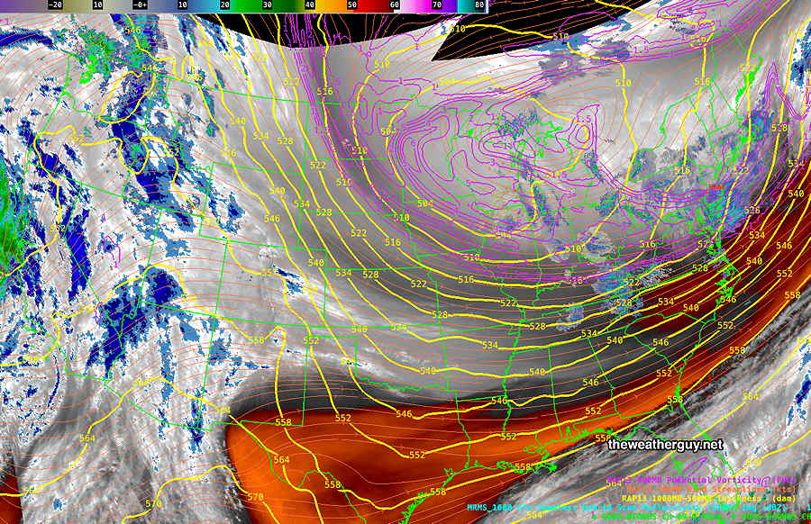
The low pressure system that brought us the snow Friday will be followed by a very cold high pressure system, and the upper air cyclonic flow and pressure gradient will result in cloudiness on Saturday and windy conditions both Saturday and Sunday.
Saturday
Some sun in the morning, followed by mostly cloudy skies late morning into the mid afternoon. Clouds should diminish late afternoon. WINDY and extremely cold.
High temperature 23º ( NBM model— location Blue Bell, PA)
High temperature 24º ( NBM model— location Philadelphia, PA)
above average confidence.
Sunday
Sunny and continued windy in the morning, less windy in the afternoon. Still very cold, but not as cold as Saturday.
High temperature 29º ( NBM model— location Blue Bell, PA)
High temperature 30º ( NBM model— location Philadelphia, PA)
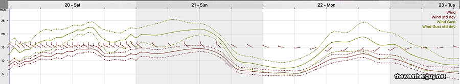
Winds
Extended Outlook
I don’t see any more snow through the end of January. Moderating temperatures later this coming week. There may be a big warm up later in the month into February.