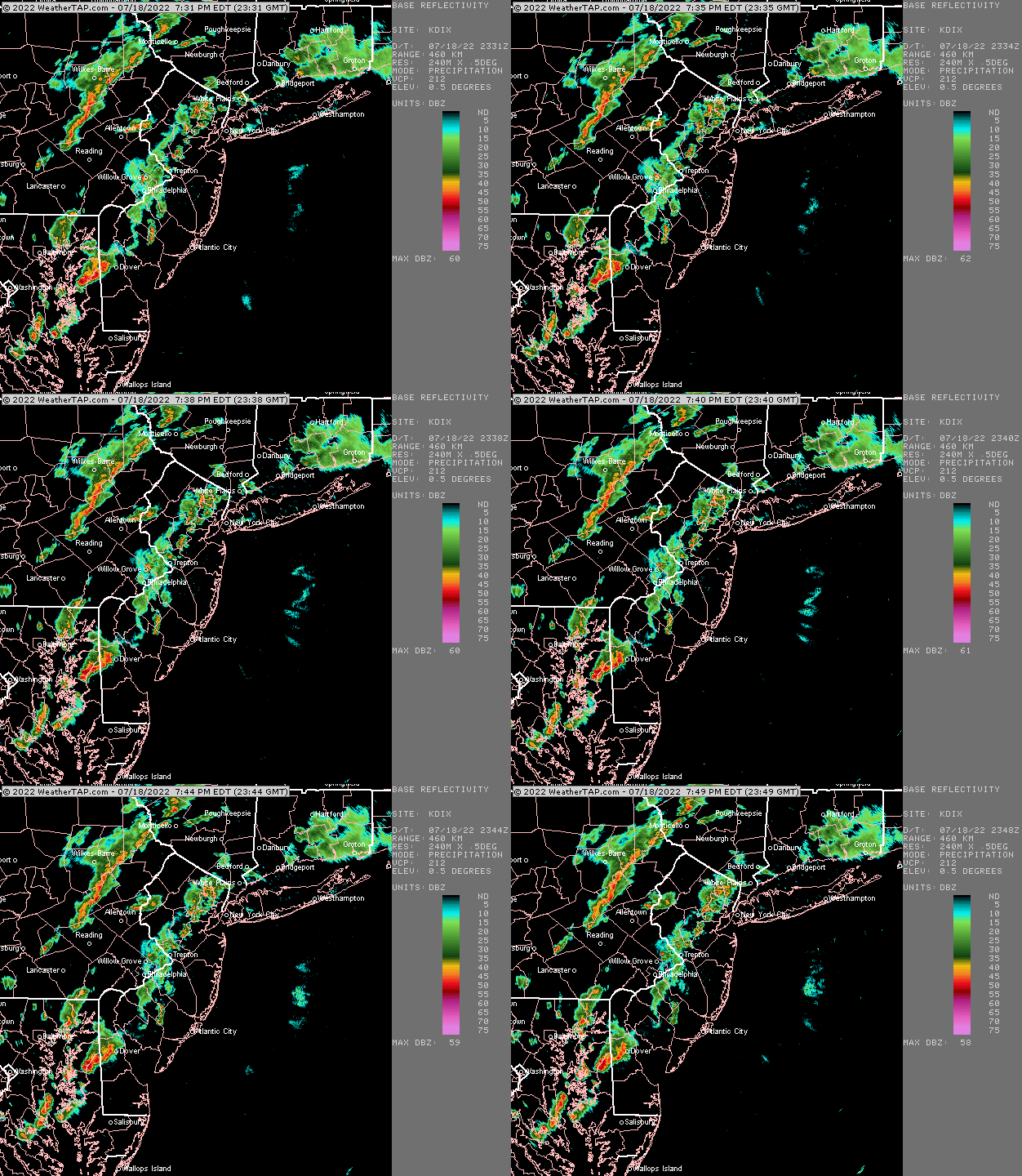
Update Mon @ 7:51 PM — Weak thunderstorms that began in Chester county mid afternoon have moved up and diminished significantly in strength—

Updated Mon 1:30 PM — A quick mobile update. There are 3 versions of the HIRESW model. The HIRESW-FV3 only shows one line of storms about 5-6 PM, closer to the NAM-NEST forecast. The earlier update based on the HIRESW-ARW is clearly not correct.
Updated Mon 11:14 AM — A quick mobile update. The HIREW model just available shows two lines of storms one moving through early afternoon and another about 7 PM
Update Mon @ 9:25 AM — This morning’s models aren’t available at the time of this update. There’s still a range of forecasts from the models. Some show storms developing in a more random fashion. Some show a distinct line moving through this evening.
The best forecast, based on current radar, water vapor and the NBM model suggests storms develop in mid afternoon western areas of Chester and Montgomery counties and gradually move eastward, arriving in the immediate PHL area between 6 and 9 PM.
With vertical wind shear values relatively low, I don’t see severe storms in our immediate area, despite very high CAPE values.
There is evidence that the storms may diminish in intensity just as they arrive in Philadelphia. Areas from Philadelphia and eastward may receive much lower amounts of needed rain.
I’ll be posting more about our dry current spell and some theories about it later this evening.
Previously Posted Sun 11:13 PM —
A complicated forecast for tonight into Monday as the models have a wide range of forecasts. Some show a chance of showers tonight into early morning Monday, while others have very little in the way of precipitation tonight.
Several high resolution models show scattered storms during the day, as early as 2 PM, with additional storms late afternoon and evening. The NAM has another line of storms around 11 PM.
So, the bottom line is an unsettled day with several chances of storms with locally heavy rain any time after 2 PM.
Adding to the uncertainty is some model suggestion that storms may fall apart as they move east into NJ.
