
#Philadelphia #weather #PAwx
Early Edition
Posted Friday 04/25/25 @ 8:51 AM —The forecast for today, Friday as well as Saturday, has a bit more uncertainty from yesterday’s posting regarding the timing of the rain and thunderstorms, as well as the amount of rainfall in our immediate area.
An associated warm front and cold front of a low pressure system will pass through our area later tonight and through Saturday.
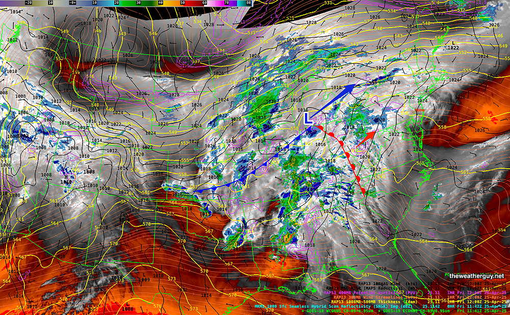
It appears that more cloudiness this afternoon is likely, compared to yesterday’s forecast. Light rain is possible this evening, according to the latest ECMWF-AI model and the experimental REFS. So the system is approaching faster than previous forecasts.
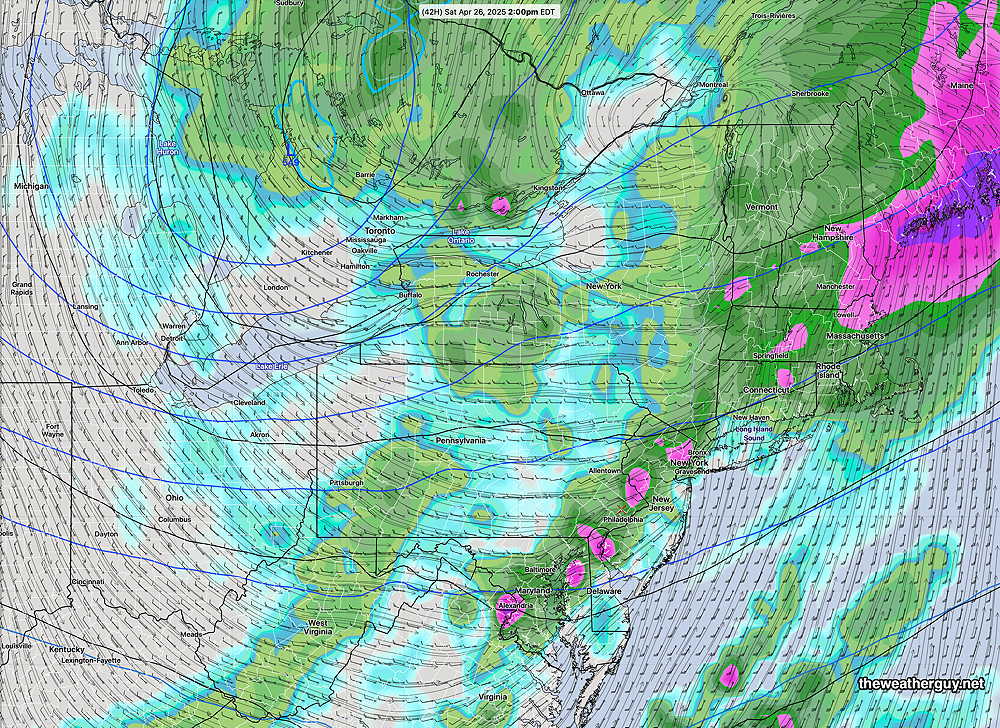
Showers persist Saturday morning, but it’s likely we’ll see some bright spots or even some sun before the cold front moves through with more showers and thunderstorms.
Yesterday’s forecast had the cold front moving through about 2-3 PM Saturday with rapid clearing by evening.
Today’s forecast has Saturday‘s rain/thunderstorms somewhat later, between 3 PM and 7 PM, (although the ECMWF shows showers with the cold front as early as 1-2 PM) and lingering into the evening hours as the cold front sharpens and intensifies as it moves through. So we may still have some showers as late as 8-9 PM. Saturday will also be quite windy! So the timing of the heavier rain/thunder on Saturday is “up in the air”.
Sunday looks partly to mostly sunny and fairly windy. (The experimental RRFS-A shows periods of instability cloudiness with less sunshine. Sunday’s highs low to mid 60s