#Philadelphia #weather #PAwx
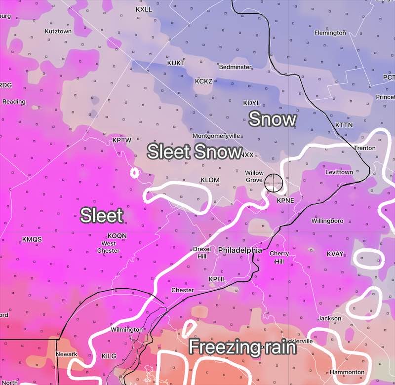
Posted Friday 2/07/25 @9:39 AM — A quick update. While the GFS is forecasting 3-5 inches of snow beginning Saturday afternoon, ending before daybreak Sunday, my preferred model for mixed precipitation events, the NBM, is forecasting very low accumulations but a heavy sleet and rain event.
Coming Active Weather Pattern
Posted Thursday 2/06/25 @9:49 AM — As mentioned in last Sunday’s post, a stalled frontal boundary through the middle of the country will become a focal point for storm development. Today’s frozen mix was the first of several disturbances that will affect our weather over the next week.
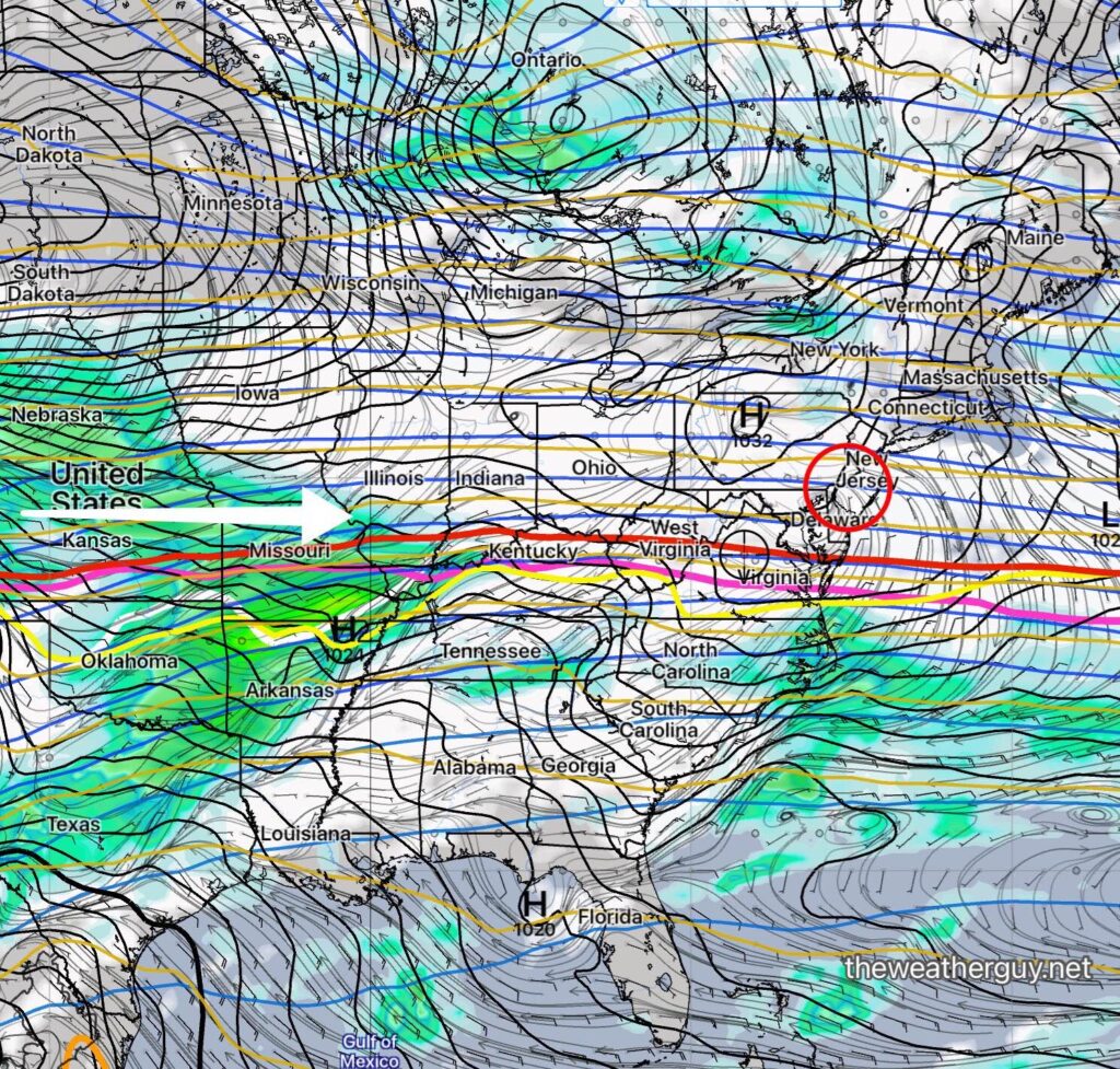
The next disturbance moves through late Saturday into Sunday morning. A thermal profile similar to today is expected, with snow, sleet, and rain changing to all rain by Sunday morning. This weekend storm has the potential for somewhat greater amounts of snow accumulation in our area.
Additionally, there’s a strong signal for at least one or two additional disturbances next Tuesday into Wednesday. The ECMWF is suggesting the potential for substantial snow during this time frame, although the AI model isn’t in full agreement.
A Messy Commute Early Thursday
Posted Wednesday 2/05/25 @5:37 PM —Little change from this morning’s posting. Light snow after midnight tonight changes to sleet and freezing rain around daybreak and then to all rain by late morning. The rain tapers off and ends between 2 and 3 PM.
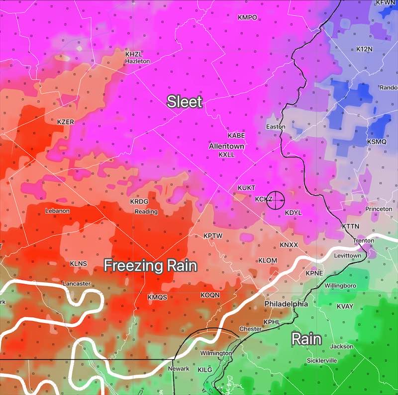
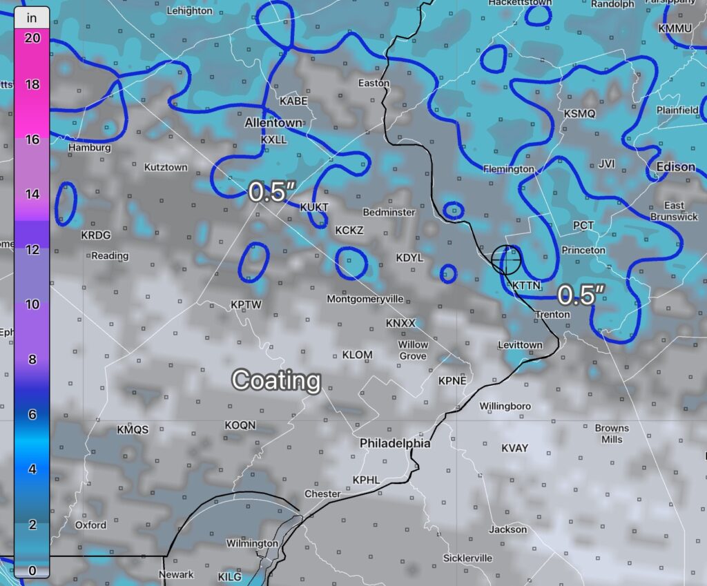
Posted Wednesday 2/05/25 @9:44 AM — Light snow and somewhat heavy sleet will transition to freezing rain and then quickly to rain between 6 AM and 9AM on Thursday, somewhat later far northern and northwestern suburbs. Accumulations of a coating of sleet and snow are still forecast to be up to an inch in some places, according to the NAM.
I’m still leaning towards the model blend (NBM) which has only about 1/2” in a few locations—
Snow Sleet and Rain Thursday
Posted Tuesday 02/04/25 @5:22 PM — After reviewing the latest model blend (NBM) and the ECMWF AI model, Thursday’s storm looks to be mostly sleet and rain, but starting as light snow with a coating to a half inch accumulation only. I think we need to disregard the Canadian model snow totals I posted earlier. The changeover to rain occurs during the rush hour, as posted yesterday.
Posted Tuesday 02/04/25 @3:20 PM — Some snow accumulation is looking more likely Thursday morning, despite a changeover to sleet, freezing rain and then rain by mid morning. The precipitation moves in early and departs earlier too. A total of near 0.5” water-water equivalent is expected to fall; if this were not to changeover, this might be 5”-6” of snow.
The GFS has this starting about 3 AM as a location-dependent mix—
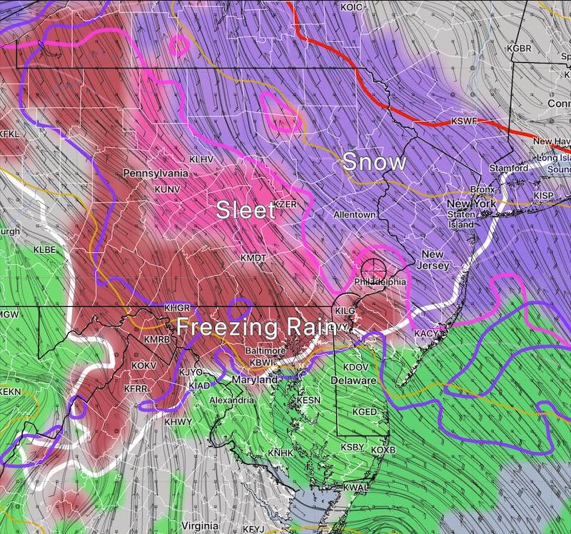
There’s an expected changeover to all rain by late morning, with the precipitation becoming spotty at that time. The thermal profile suggests a period of cold air damming, which may delay the changeover.
The actual vertical temperature profile will determine the actual snow accumulation, but in some areas, actual ice accumulation may be more important. Here’s the Canadian RGEM snow totals forecast—
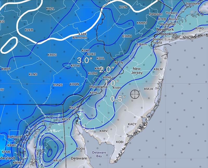
Posted Monday 02/03/25 @5:31 PM —Low pressure in the central US will move eastward and spawn a secondary coastal low near the Delaware coast before daybreak Thursday.
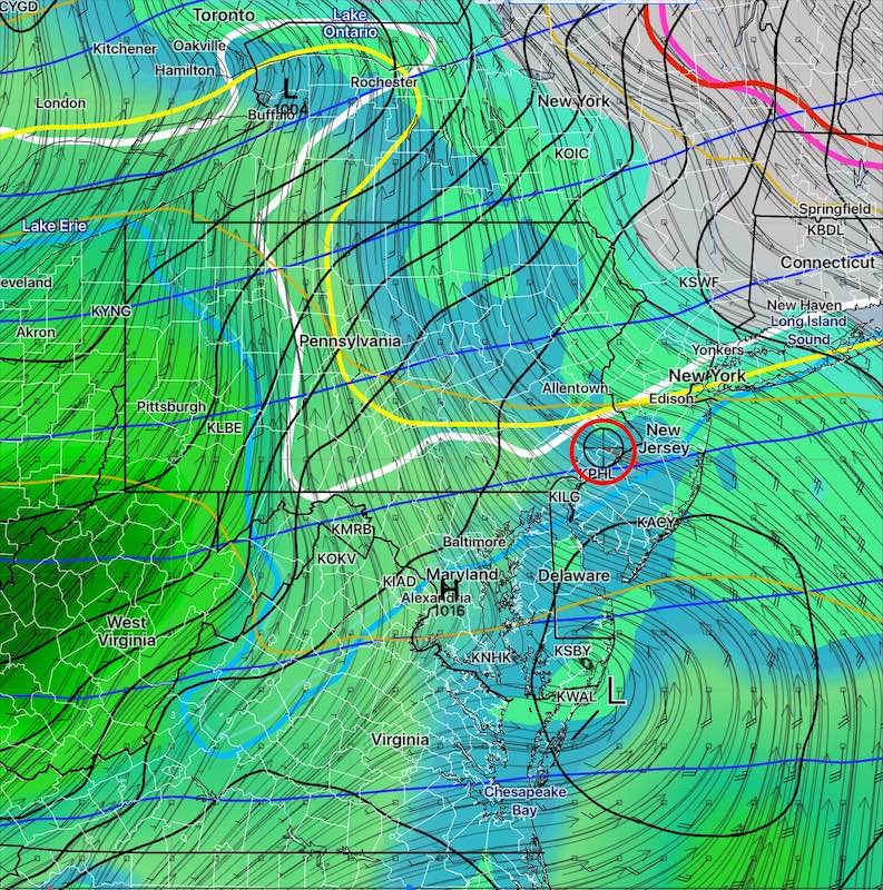
Temperatures in the mid levels of the atmosphere are forecast to be too warm for snow, but cold temperatures in the lowest levels will likely cause the precipitation to start as sleet and freezing rain, especially north and west of the city. This should change to all rain during the morning rush hour.
The rain should end by mid to late Thursday afternoon.
A somewhat similar situation will develop on Saturday. There are differences in the speed and timing of this system, but it’s looking to be primarily rain, again possibly starting as a mix.
Posted Monday 02/03/25 @ 10:52 AM —This week’s weather postings will be more sporadic than usual.
Originally Posted Mon @ 10:04 AM —
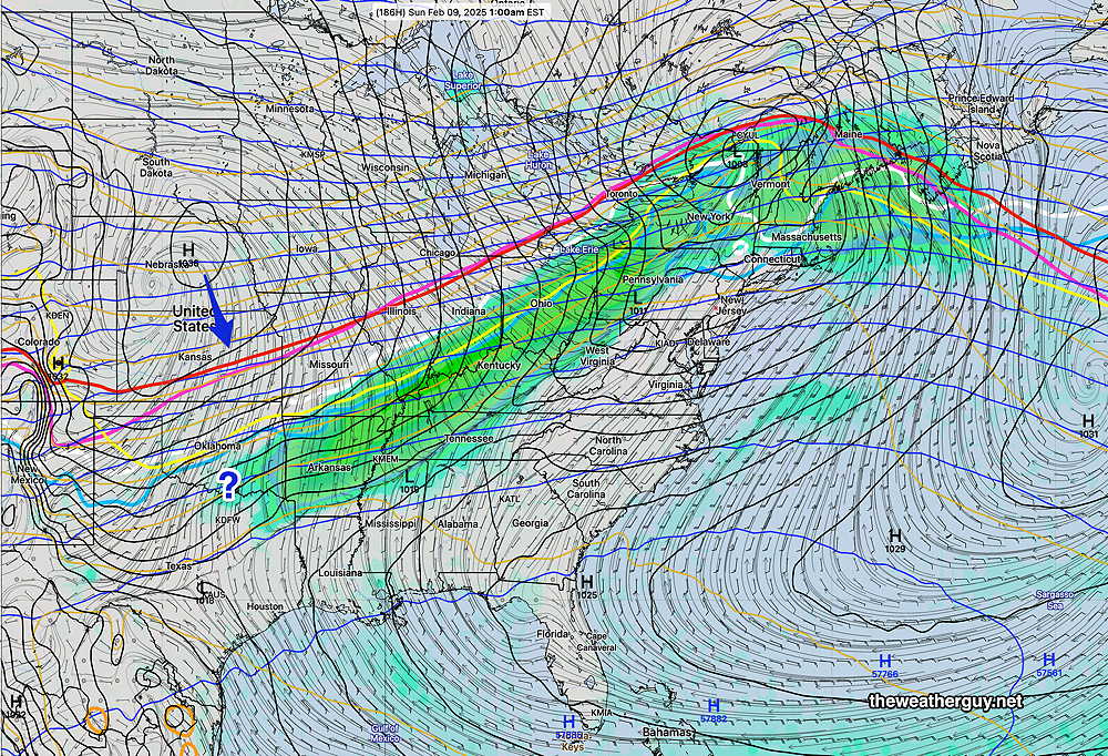
A frontal boundary to our south will become a focus for low pressure development later in the week. A storm system will move along this front from southwest to northeast late Wednesday into Thursday and again next weekend.
Slight changes in the intensity of the low pressure systems that develop along with changes in the position of the stalled frontal boundary will determine the precipitation type- snow- sleet-freezing rain-rain.
The current trend is for mostly liquid (rain) here in and around Philadelphia, but there are differences in the model forecasts, so uncertainty exists. Several models have snow changing to sleet and/or freezing rain Wednesday night. Too early to be sure.
ECMWF AI model—
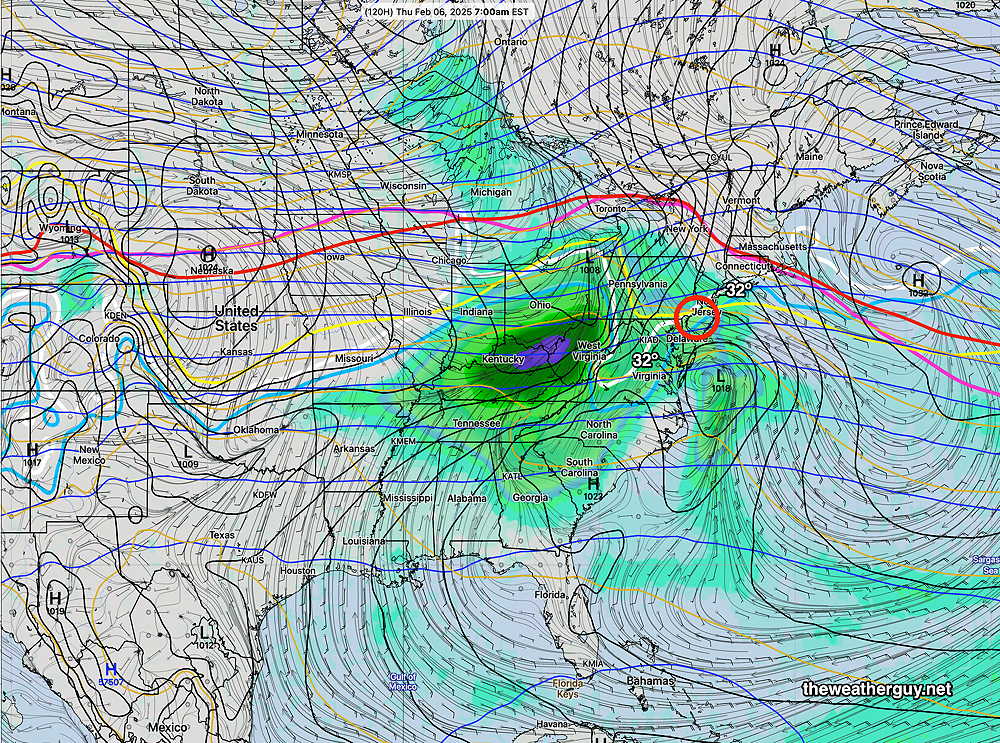
By next Saturday, we’ll be in the warm sector ahead of an approaching cold front, according the the ECMWF-AI model—
An interesting set up. Stay tuned.
