
#Phillywx #Philadelphia #weather #PAwx
Sunday Forecast Update
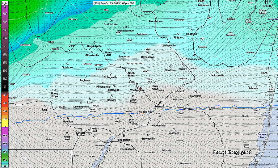
Updated Sat 10/28 @ 6:06 PM —There’s still a wide range of model forecasts for the showers on Sunday. The current trend ( with the exception of the HREF model) is for very little in the way of rain here in the immediate Philadelphia area, as forecast by the HRDPS this morning (see graphic below on previous update.) I’m still leaning towards very little rainfall Sunday.
Capturing the great uncertainty and low confidence is the NBM model which still shows an incredibly large standard deviation of 6.0º in its forecast high temperature for Sunday. (Typical sd is about 0.8º -1.5º for a 24 hour forecast.)
Sunday Forecast Update
Updated Sat 10/28 @ 9:30 AM — Following some heavier showers at daybreak Sunday, it appears that most of the rain/showers will be north and west of the city. Only very light, occasional, scattered sprinkles possible for the rest of the daytime Sunday.
Previously Posted Fri 8:14 PM —
Friday’s media forecasts of “sunny with highs near 80” didn’t jive with reality – the clouds, light sprinkles and cooler temperatures. Things continue to change and there’s a change in the forecast for Sunday. First let’s see where we are—
Currently, cold air is diving southward into the Rockies and some push eastward is occurring on a somewhat stationary cold front north of us—
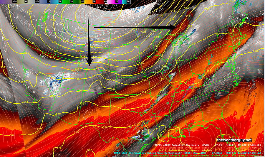
The above water vapor image corresponds to this NAEFS weather map—
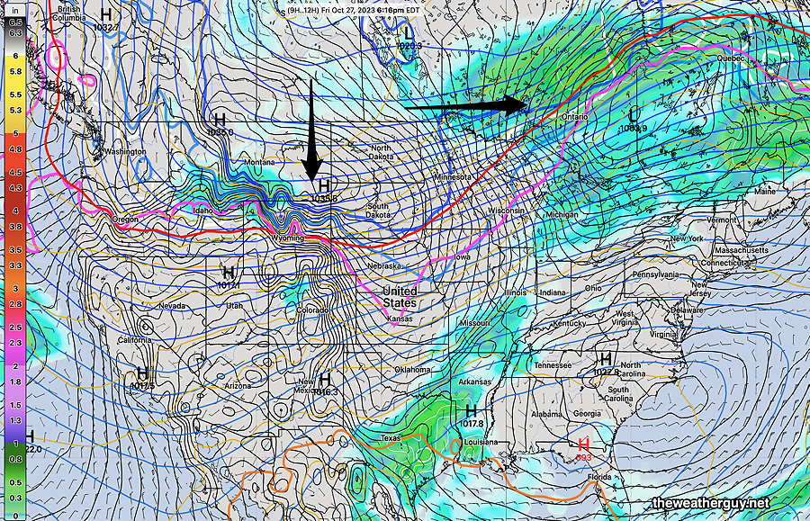
The question for the weekend forecast is how much push east and southward will the cold front to our northwest move?
Saturday
The models are still forecasting sunny skies and unseasonably warm temperatures. There seems to be a consensus on this. Some cloudiness may move in, especially north and west, late afternoon.
High temperature 81º ( NBM model— location Blue Bell, PA)
High temperature 82º ( NBM model— location Philadelphia, PA)
uncertainty – ± 1.4º
Sunday
The real question mark has been with Sunday’s forecast. Prior to today, it was felt that the showers associated with the front would stay to our north and west. That’s no longer the case.
Today’s models (with the exception of the Canadian HRDPS and RGEM) are forecasting low clouds, with showers as early as daybreak and light showers/rain throughout the day. But there’s higher than usual uncertainty. The temperature forecast standard deviation is 6.1º which is extraordinarily high; typical is 1º-2.5º and captures the low confidence in the current forecast.
Total rainfall is anywhere from 0″ to 0.5″
High temperature 62º ( NBM model— location Blue Bell, PA)
High temperature 65º ( NBM model— location Philadelphia, PA)
uncertainty – ± 6.1º
Sometimes, the best forecast is indicating that for Sunday, we just don’t know for sure.
I’ll update Saturday morning.