#Phillywx #Philadelphia #weather
Sunday Update
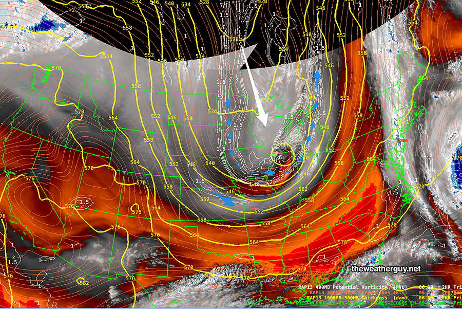
Updated Sun 10/08 @ 11:34 AM — My forecast already included clouds and isolated sprinkles today. It appears that a significant wave has developed to our southwest and we may have considerably more cloudiness than forecast at times. Breaks of sun possible and still a chance of isolated sprinkles as well.
Sunday
Update Sat 10/07 9:47 PM —
Sunny in the early morning. Periods of clouds and sun in the afternoon. There’s a chance of isolated instability sprinkles in the mid to late afternoon, especially north and west of the city. Windy.
High temperature 60º ( NBM model— location Blue Bell, PA)
High temperature 62º ( NBM model— location Philadelphia, PA)
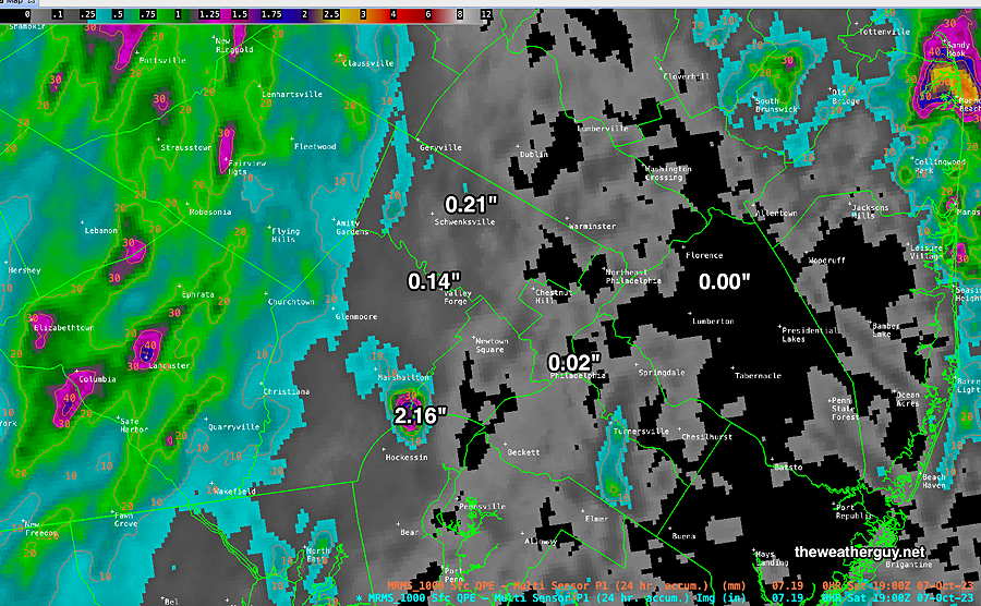
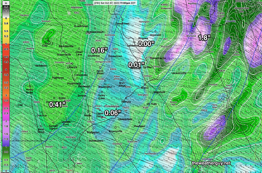
Here’s the current estimated actual measured rainfall that occurred over the past 24 hours based on radar and rain gauges (MRMS estimate) —
The model forecast guidance usually impresses me. Not over the past three days. As I’ve mentioned over the years, the presence of a tropical system nearby seems to affect the accuracy of the models. Not sure why that is, and it’s just an observation based on my many years doing this stuff.
I had mentioned earlier this morning that the HRDPS did well.
Well, not perfect by any means, but the rainfall totals were more in line with what we received and it even placed the 0.00″ area fairly close to where no rain was received. Yet areas in NJ received no rain, despite some significant rain being forecast.
Saturday Update II
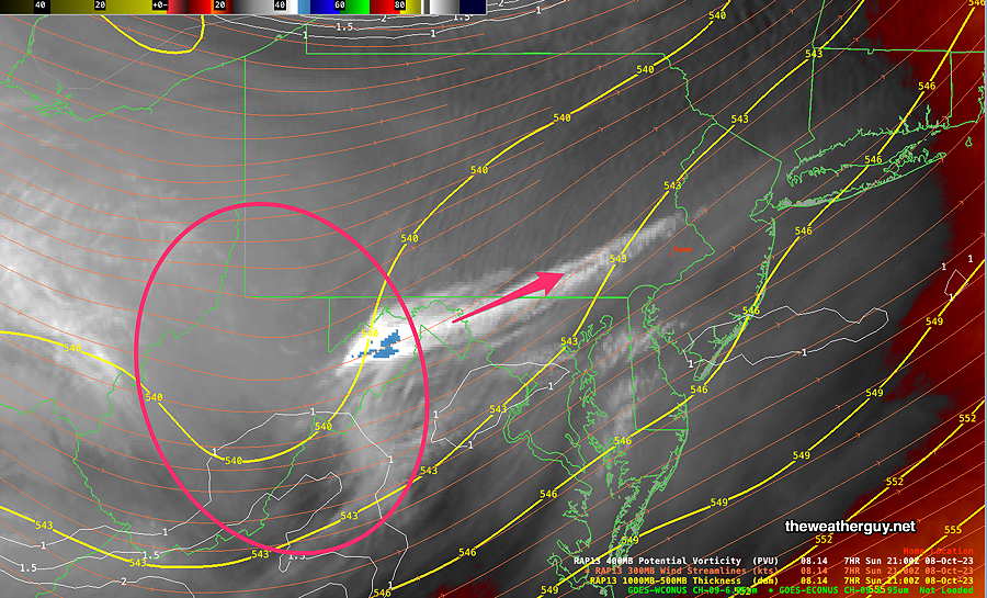
Updated Sat 10/07 @ 10:00 AM — So, which model has done the best with this system? It appears the Canadian HRDPS has done very well. It even shows the break of sunshine we had over the past 3 hours.—
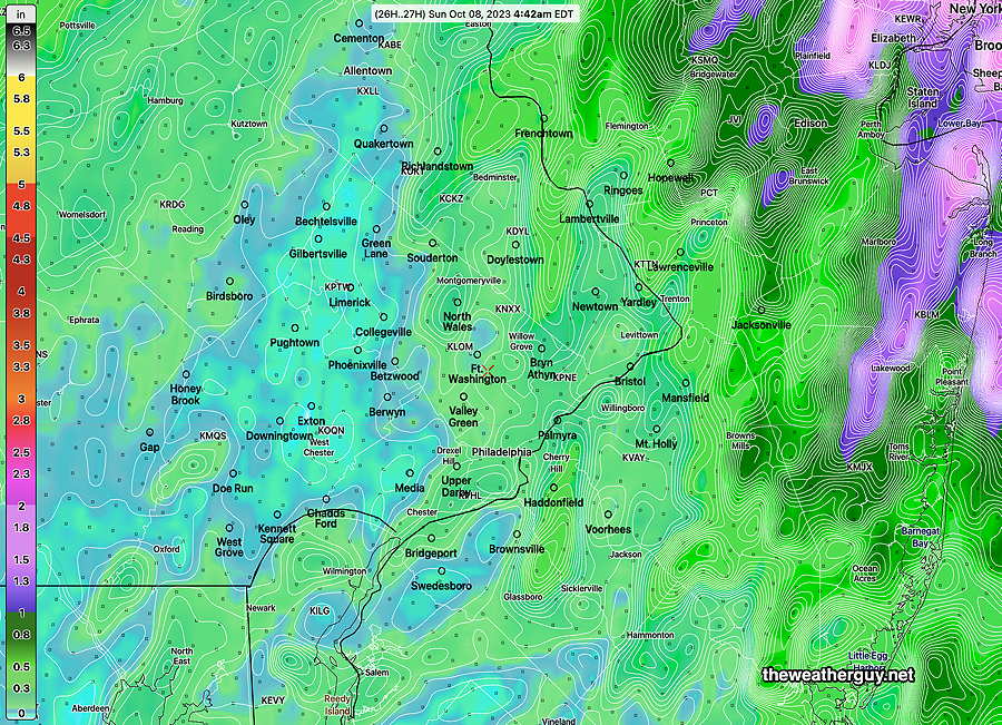
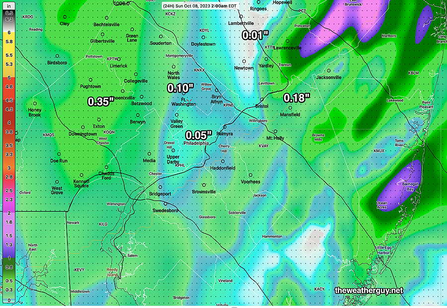
While we’re on an HRDPS roll, the model has very light total rainfall for much of our area—
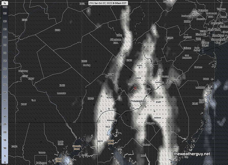
Updated Sat 10/07 @ 9:33 AM — Here’s the latest WV/Radar image—

Saturday Update
Updated Sat 10/07 @ 9:16 AM — The model forecasts over the past two days haven’t been that stellar and today’s forecast continues that trend. The front has just moved through the immediate Philadelphia area, based on wind shifts in the RTMA—
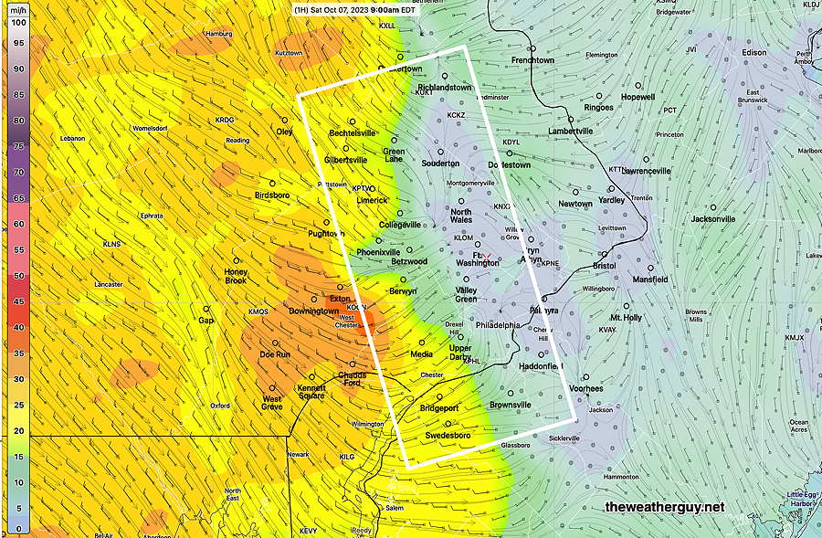
Additional showers expected, but much of the heavier rain is moving off to the northwest.
Previously Posted Fri 5:52 PM —
An upper level trough will drive a cold front through Friday night into Saturday morning—
Saturday
The front comes through the Philadelphia area around daybreak Saturday with showers and wind gusts. Areas of vorticity behind the front will set off additional showers into the afternoon. There may be a quick break of sun, but mostly cloudy conditions with rain showers expected. It appears that one of those disturbances moves through early afternoon, with some rain showers. Unsettled is the term often used to describe this scenario. It will be windy. The rain may last until 4-5 PM, according to this afternoon’s models and skies will clear west to east.
(In a departure from recent forecasts, this afternoon’s HRRR shows some areas of heavy rain here Saturday. Right now, I’m seeing it as an aberration. I’m inclined to lean towards the HRDPS model, which has an area of heavy rain in northern Montgomery and Bucks counties Most other areas have lighter precip, less than 0.5 inches. )
High temperature 68º ( NBM model— location Blue Bell, PA)
High temperature 69º ( NBM model— location Philadelphia, PA) uncertainty ± 1.6º
Sunday
Continued windy. Sunny early in the morning. A considerable amount of instability cloudiness develops late morning into afternoon.
High temperature 60º ( NBM model— location Blue Bell, PA)
High temperature 61º ( NBM model— location Philadelphia, PA) uncertainty ± 1.7º
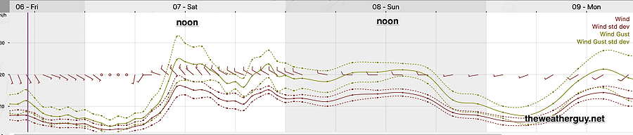
Winds