
Updated Sun 09/17 @ 6:03 PM — It appears that some rain will linger here in the Delaware Valley until about 10-11 AM Monday. Cloudiness will linger longer…until about 2-3 PM.
More info in This Week’s Weather to be posted this evening.
Update Sat 9/16 10:51 PM — It looks like rain will only affect eastern NJ and the shore on Monday. but clouds linger here with some clearing in the afternoon.
Update Sat 9/16 9:39 PM — This evening’s models are showing showers moving in as early as 3-4 PM Sunday.
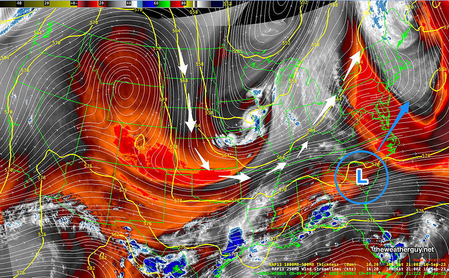
A large dip in the jet stream will spawn a coastal low pressure system late Sunday and it may affect our weather with rain Sunday evening through early Tuesday.
Sunday
Sunny in the morning. Increasingly cloudy beginning 12 to 2 PM. Showers move in from the west between 5 PM and 7 PM.
Model temperatures have a higher than usual uncertainty (spread) due differences in forecast cloud cover. sd =2.5º
High temperature 76.7º ( NBM model— location Blue Bell, PA)
High temperature 79.3º ( NBM model— location Philadelphia, PA)