We’re entering the climatologically hottest summer period for Philadelphia this week and weekend; the current GFS forecast appears on track to support that climate statistic.
The remnants of Tropical Storm Barry are expected to bring heavy rains Wednesday night, although the exact placement is always difficult to determine. The current GFS bullseye is right over Philadelphia.
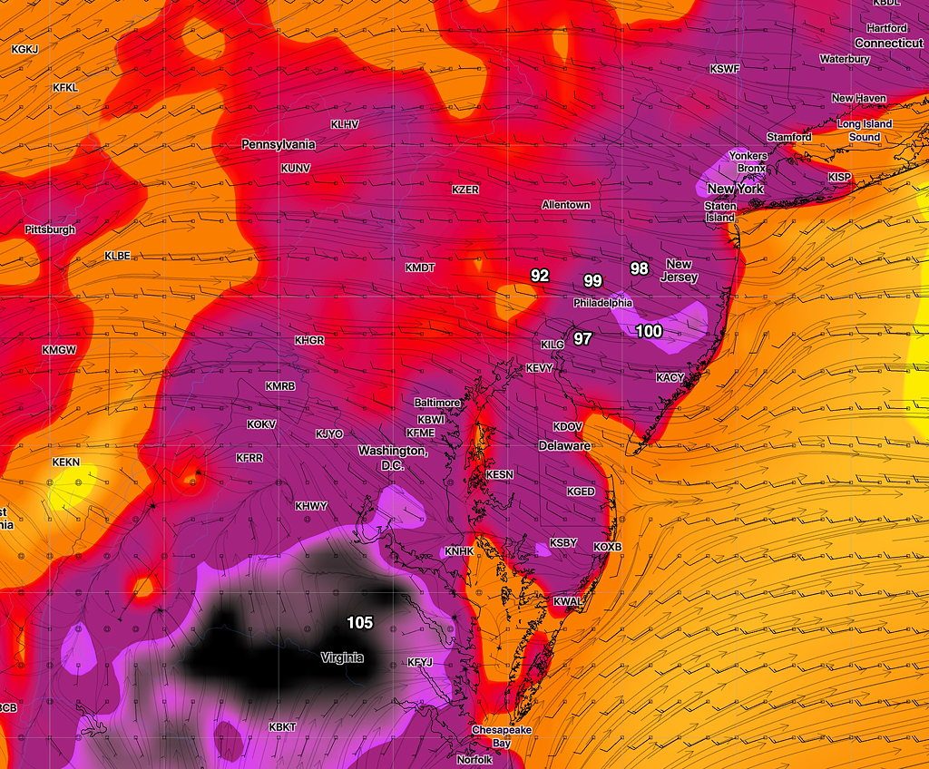
After that time, oppressive heat and humidity is expected for much of the end of the coming week. Temperatures and heat indices get possibly extreme on Saturday, where temperatures in some areas may approach 100, according the latest GFS. (That’s temperature, not the Heat Index. Heat indices will be higher. )
Here’s the current GFS forecast for Saturday afternoon, about 2:45 PM:

The forecast specifics may change, but the weather will likely be very hot and humid for Thursday, Friday and especially Saturday.
A front may move through Sunday, reducing temps and humidity.
