#Philadelphia #weather #PAwx #Drought
Forecast Update
Posted Sunday 11/17/24 @ 10:03 AM — A cold front moves through around daybreak Monday morning. We’ll see some high cirrus clouds associated with this front today and especially this afternoon. Sunshine through high clouds is expected, with occasional mixing of mid level clouds.
The ECMWF shows some light sprinkles moving through between 5 AM and 8 AM Monday, although most of the other models keep us dry. The HREF suggests some radar echoes without the sprinkles reaching the ground.
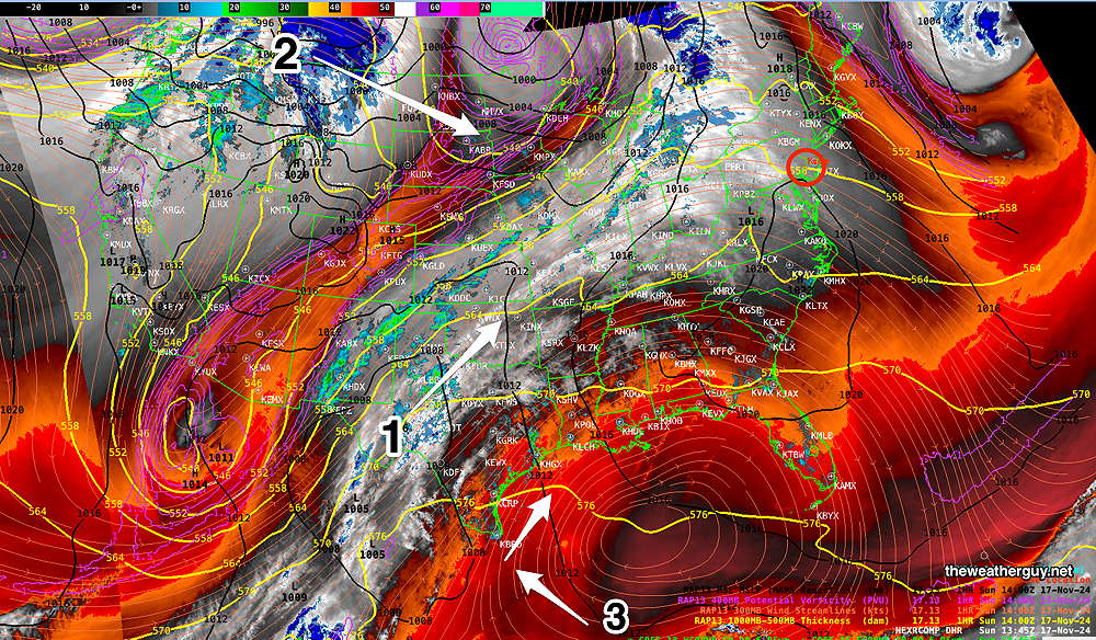
The atmosphere is setting up for an active week by Wednesday. Here’s the current water vapor/radar image/RAP model —

Additionally, showers from this developing system may move in earlier, as early as Wednesday morning. Stormy and windy by Thursday.
The models are still cranking out about 0.8″ of rain, although the current trend has been towards lower amounts.
Forecast for Rain late Wednesday Continues
Posted Saturday 11/16/24 @ 4:44 PM — Following a beautiful but windy day today, we’ll have another delightful day for Sunday with a layer of high clouds filtering some of the sunshine.
As beautiful as the weather has been, we really need some rain. I’ve been keeping my eye on a seasonally induced pattern change with a dip in the jet inducing low pressure development in a location favorable for rainfall here.
The latest operational, ensemble and AI models continue with a forecast of rain, beginning Wednesday evening and continuing through part of Thursday. Most models are currently forecasting anywhere from 0.8″ to 1.2″ of rain in the immediate Philadelphia area and areas west and northward. Similar amounts to our east in NJ.
Unsettled, windy and much cooler weather is likely for later Thursday into Friday.
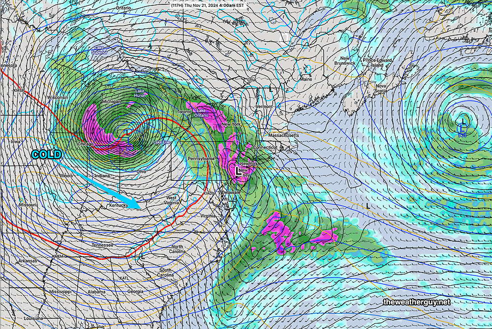
Here’s the latest ECMWF forecast—

We’ve been disappointed several times over recent months regarding rainfall, but I think, “this time is different”. (Famous last words.)
The consistency and continuity of various model forecasts for rain this time is encouraging. It’s also possible that some moisture from the tropical system in the Gulf may be brought into play.
Stay tuned for updates.
Originally Posted Fri @ 6:06 PM — —High pressure builds in for this weekend. An approaching cold front will bring sunshine through high clouds Sunday afternoon. As has been the case over recent months, no rain is expected here with this frontal passage on Monday.
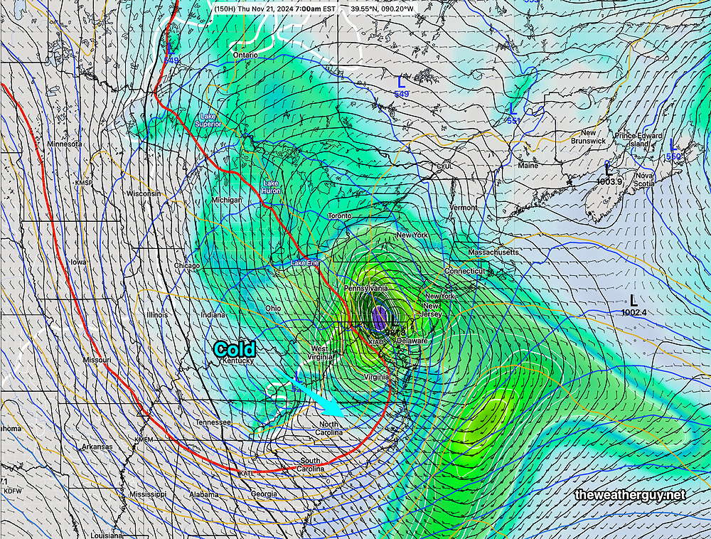
A seasonally driven pattern change is forecast by numerous models next Wednesday into Thursday, with the jet flow dipping south to our west and spawning surface low pressure in a favorable position to give us rain! I’ve seen these potential rain-makers fall apart in recent weeks, but this one is currently looking likely—
Latest ECMWF for next Thursday early morning—

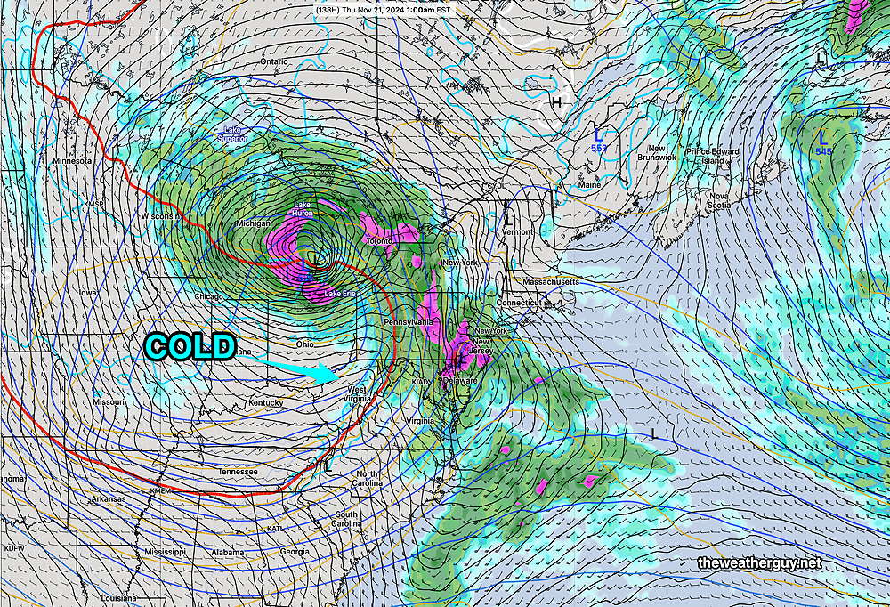
Here’s the latest available GFS – AI model forecast for early Thursday, also supported by the latest GFS—

I’ll keep an eye on this over the coming days.
Saturday Forecast
Sunny and windy/gusty, especially in the afternoon.
NBM high temperatures: Blue Bell, PA 60º Philadelphia, PA 62º
Uncertainty (based on standard deviation): low uncertainty ± 0.8º
Sunday Forecast
Sunny in the morning, then mostly sunny through high clouds in the afternoon. There may be some mid level clouds at times.
NBM high temperatures: Blue Bell, PA 60º Philadelphia, PA 63º
Uncertainty (based on standard deviation): low uncertainty ± 1.2º
