#Philadelphia #weather #PAwx #Drought
Sunday Evening Rain Update
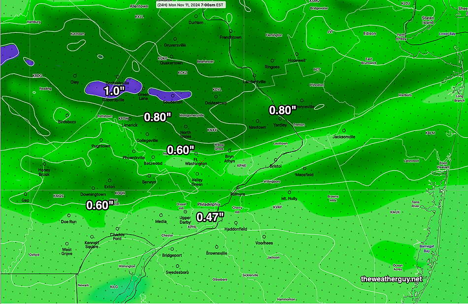
Posted Sunday 11/10/24 @ 10:10 AM — Things still look good for an end to the dry period we’ve been in here (although, tonight will not be a drought-buster). The models have trended upwards in the rainfall amounts and many areas may see 0.5″ –0.6″ or more this evening and tonight. Rain expected to move in between 6 PM and 8 PM.
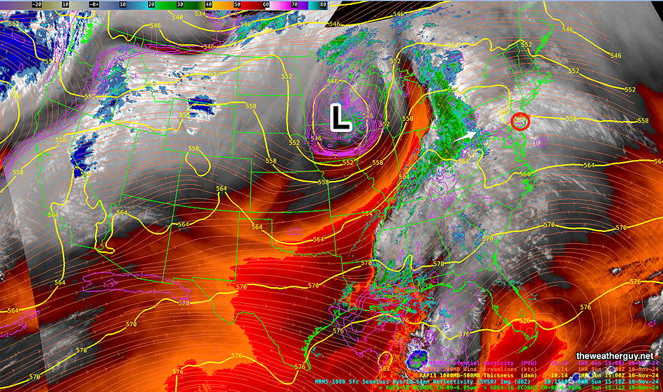
Here’s the latest Water Vapor/Radar image—

The latest HRRR is below—

Not posted is the latest RRFS which had many areas receiving in excess of one inch of rain here. (Probably not correct, but we’ll see if they corrected the excessive rainfall bias for this still experimental model.)
Additional rainfall expected here Thursday!
Sunday Evening Rain Update
Posted Saturday 11/09/24 @ 3:25 PM — It’s been an awfully long time since I posted a rainfall forecast, but it looks very likely that we’ll get some rain in the Philadelphia area Sunday evening and night.
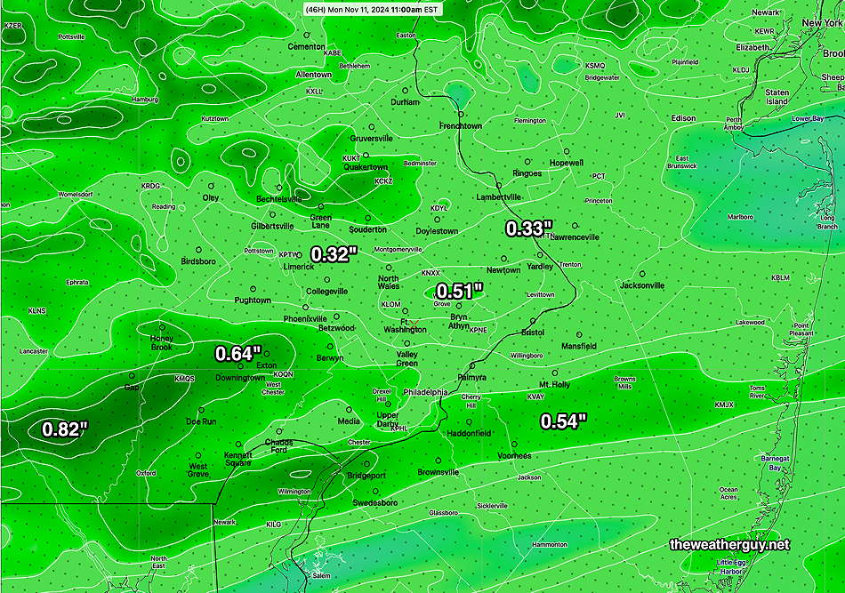
As always, the models show a range of rainfall totals and distributions, but most models are between 0.25″ and 0.60″ with 0.30″– 0.40″ being solid bet. Today’s models are showing light rain to start in western areas around 6 PM and it moves into Philadelphia and then NJ about 8 PM or so.
Before then, a mostly cloudy to cloudy day. (Can’t remember the last time we had a cloudy day!)
Here’s the latest HRRR rainfall forecast which is running a bit higher than the NBM and RRFS totals—

We have another chance of rain Thursday.
Originally Posted Fri 10:23 AM —High pressure will continue to provide beautiful weather through Saturday, although it appears that it might become quite windy at times, especially Friday night.
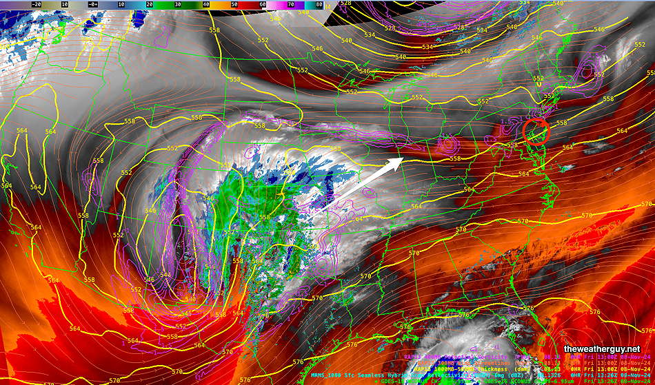
An approaching low pressure system will pass to our north and a warm front followed by a cold front will move through Sunday night.

Following a sunny day Saturday, Sunday will be mostly cloudy. Rain should hold off until 4-7 PM
It had appeared that moisture from Rafael might enhance the rainfall here, but that is appearing less likely as the hurricane is forecast to to remain in the Gulf and gradually dissipate.
Total rainfall looks to be in the 0.3″ to 0.5″ range by Monday morning with the larger amounts west of the city. Hardly a drought-buster but better than nothing. There’s another chance of rain next Thursday.
Saturday Forecast
Sunny and somewhat breezy.
NBM high temperatures: Blue Bell, PA 56º Philadelphia, PA 58º
Uncertainty (based on standard deviation): ± 1.3º average to low uncertainty. Average seasonal high temp is 56º
Sunday Forecast
Cloudy and increasingly windy. There may be some breaks of sun through high clouds mid-day. Light rain develops west to east from about 5 PM through 7 PM and continues into early Monday morning. Windy and gusty at night.
NBM high temperatures: Blue Bell, PA 61º Philadelphia, PA 62º
Uncertainty (based on standard deviation): Low to average uncertainty ±1.2º
