#weather #paweather #wx #pawx #philadelphia #phillywx
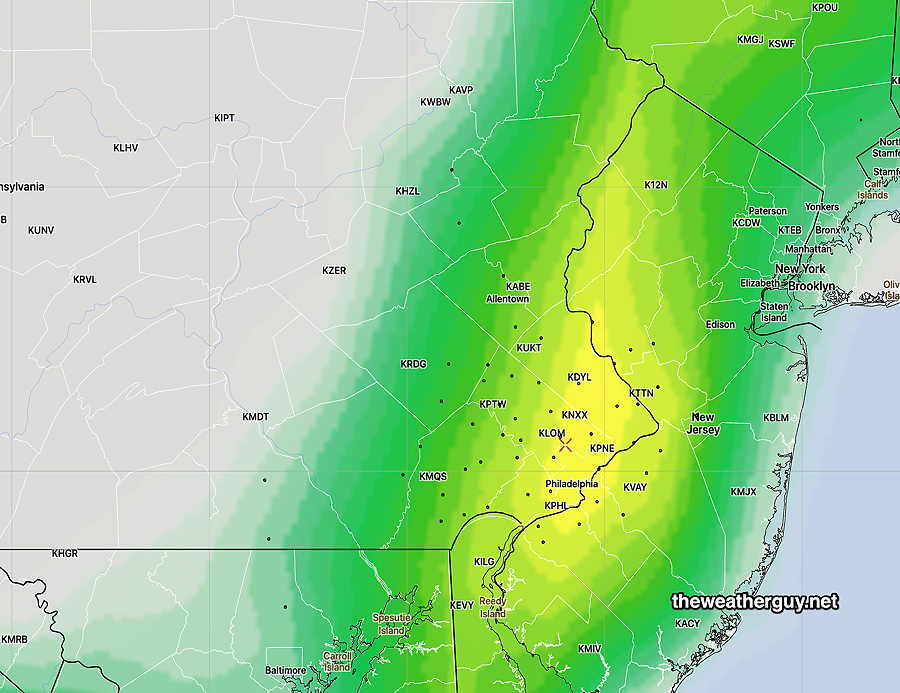
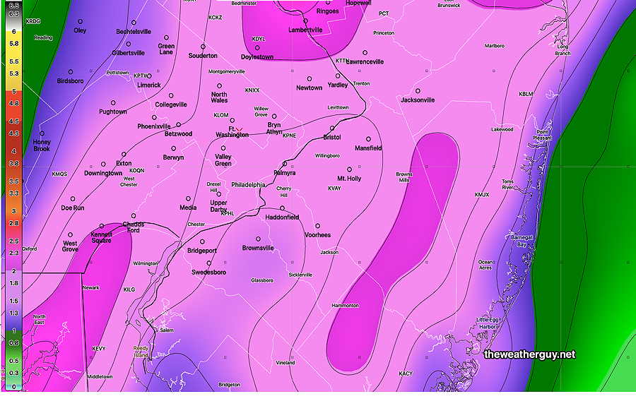
Sunday Rainfall Totals
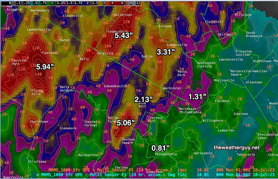
Weather Update
Updated Sun 07/09 @ 4:04 PM— Far western suburbs have been having heavy rain most of this afternoon. The rain with embedded thunderstorms is slowly moving in our direction and should be in the immediate Philadelphia around 5 to 6 PM with additional activity moving in from the south.
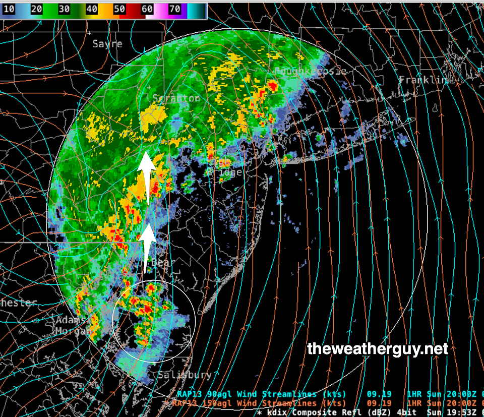
As had been forecast by several, but not all, models, the heaviest rainfall will likely be to our north and west.
The area of storms will depart our area by 10 PM, according to the latest HRRR.
Weather Update
Updated Sun 07/09 @ 12:29 PM — Latest GFS model total rainfall is similar to last night’s general model forecast —
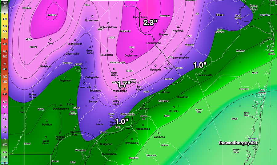
This morning’s GFS and HREF still have the period 3 PM through 8 PM as producing the highest rainfall rates in the Philadelphia area and immediate suburbs.
Weather Update
Updated Sun 07/09 @ 11:10 AM — Thunderstorm activity has broken out way ahead of model forecasts, including . The complexity of this weather setup suggests last night’s models are not handling it accurately.
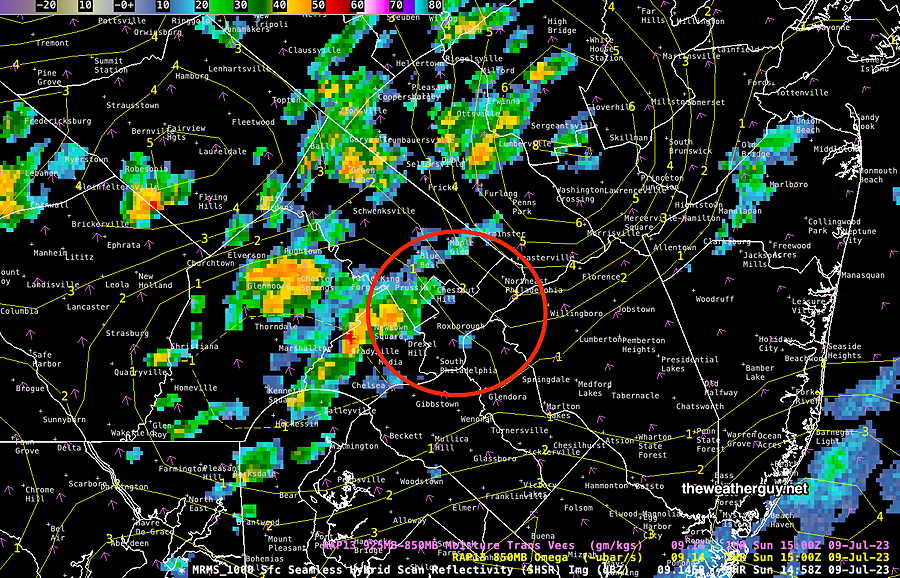
Some of this morning’s models are much faster with the precipitation entering and leaving our area.
Sunday Heavy Rain Potential
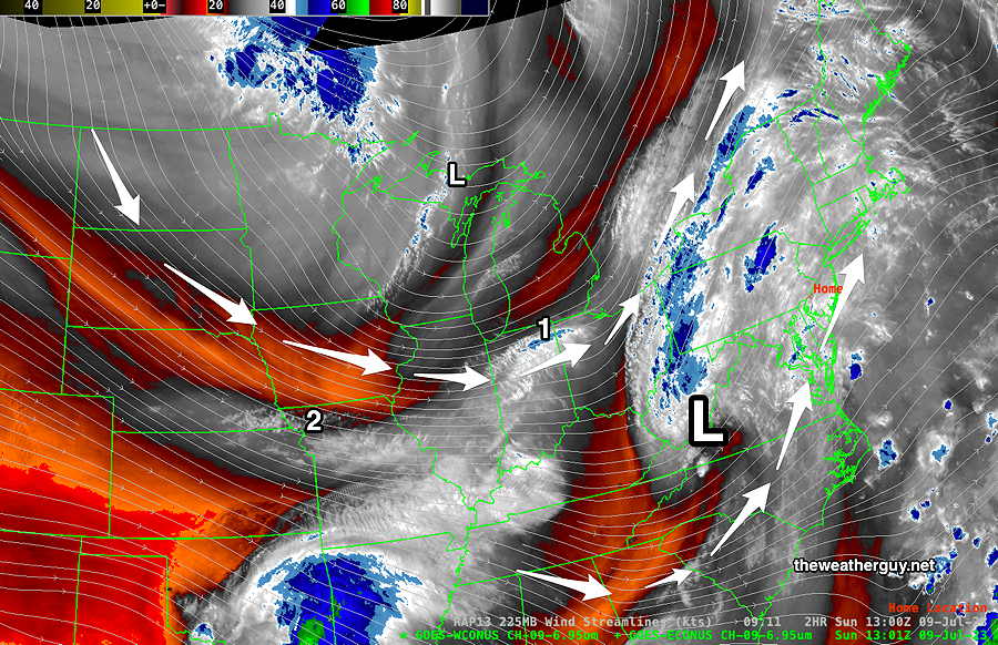
Updated Sun 07/09 @ 9:15 AM — A complex system is approaching our area with strong jet stream energy and several impulses expected to affect us Sunday into Monday.
The complex system is shown via this morning’s water vapor image —
The models continue to place the immediate Philadelphia area in a “doughnut hole” where heaviest precip seems to be missing, but I’m going to chalk that up to some modeling error at this time.
Showers and thunderstorms can break out any time early this afternoon, but peak time for rain and thunderstorms is about 3 PM to 10 PM. There isn’t much signal for any tornadic activity and excessive, heavy rainfall appears to be the main threat. Areas far south and far north of Philadelphia will have the most activity.
Sunday Forecast
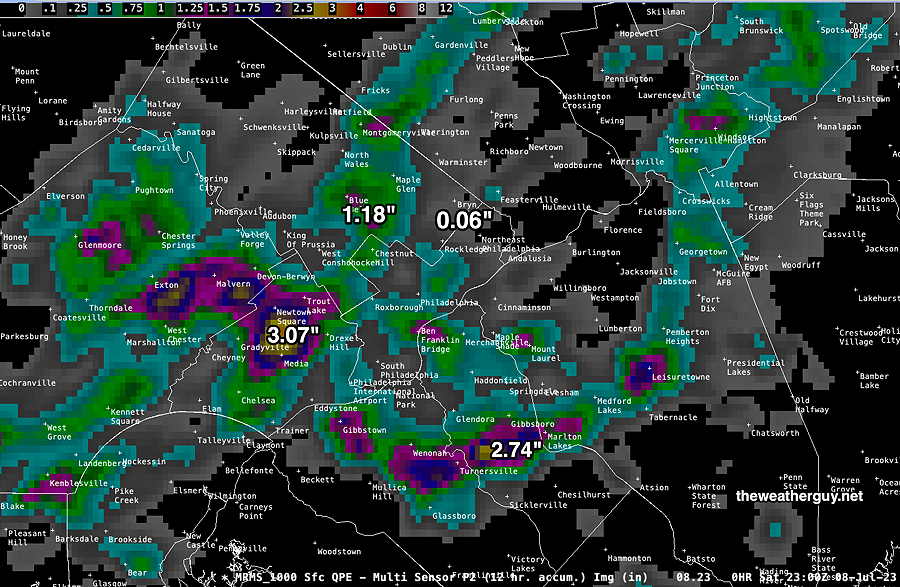
Update Sat 7/08 10:55 PM — Some areas today received heavy rainfall with the thundershowers that popped up reasonably close to the model forecasts.
For Sunday, a few scattered showers possible in the morning, but most models have the main area of showers and thunderstorms moving in between 3 PM and 5 PM.
Of interest, tonight’s models have the heaviest rain missing the immediate Philadelphia area and surrounding suburbs.
Updates Sunday morning.
Saturday Forecast Update
Updated Sat 07/08 @ 9:18 AM — This morning’s 06z models continue with a forecast of fairly widespread pop-up showers today in the immediate Philadelphia area and Delaware Valley.
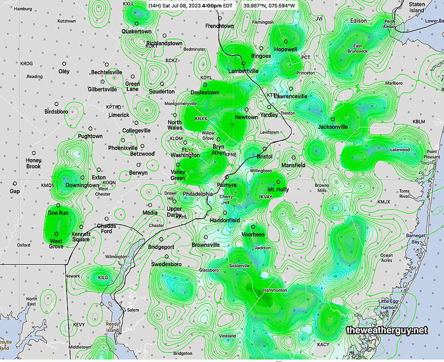
These pop up showers/thundershowers will start as early as 1- 2 PM in and around the city and will persist until at least 8 PM. Rainfall in some may be heavy. PWATs will be in the 1.7″ to 1.9″ ranged. Here’s the latest HREF model with the forecast locations at 4 PM—
The latest trend with the rain on Sunday is for the heavy rain to move in mid afternoon (3 PM) from the west into the the early evening hours. This is about 3 hours later than previously forecast.
Previously Posted Fri 7:59 PM —
Western areas had some fairly heavy rain Friday afternoon, but as had been suggested, the showers barely made it into Philadelphia.
Saturday will be similar to Friday with clouds giving way to a mix of sun and clouds. Thunderstorms again in the afternoon and evening hours. Details below.
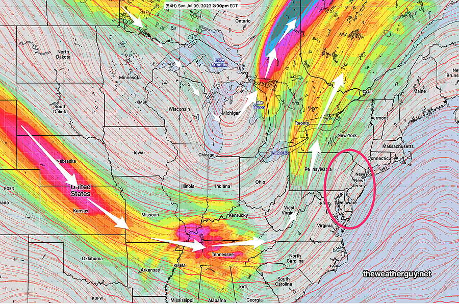
A significant jet stream induced wave will bring stormy conditions for Sunday. An developing upper level large scale trough and a potent jet stream impulse will cause low pressure to develop. Significant lift will result in heavy rain.
Saturday
Clouds and some fog in the morning, then partial sunshine in the afternoon. Like today, showers and thunderstorms will develop from 2 PM to 8 PM. The storms are currently favored to develop just east of the Delaware Rive during the afternon, but may spread westward into Philadelphia during the evening. Potentially heavy rain possible wherever the storms develop.
High temperature 8.6º sd 1.5º ( NBM model— location Blue Bell, PA)
Sunday
Cloudy. Light rain develops in the morning and becomes heavier and more widespread by early afternoon. Rainfall may be very heavy, especially north towards Allentown. 1.5″ to 3 plus inches possible. Becoming windy. Thunderstorms especially during the afternoon and evening. Rain may continue into the night as a cold front moves through. Windy conditions.
Severe weather possible. Stay tuned.
High temperature 82.9º sd 2.6º ( NBM model— location Blue Bell, PA)
