
Winter Weather Update
Update Sat 2/08 7:42 AM — Last night’s models showed the following trends—
- The precipitation moves in later, between 5 PM and 7 PM.
- Much of the heaviest precipitation moves north of Allentown.
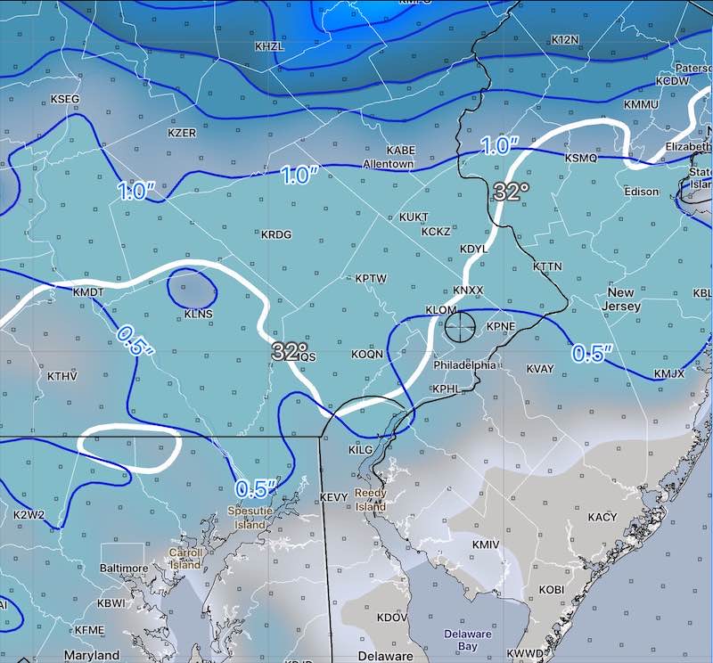
- A major percentage of the precipitation will fall as sleet instead of snow.
- While last night’s NBM slightly increased snow accumulation, I’m leaning towards the 06z NAM which forecasts mostly sleet—
Update Fri 2/07 9:57 PM —Tonight’s models are leaning towards more snow than previously forecast with a slower transition to sleet and freezing rain. All tapers off before daybreak Sunday.
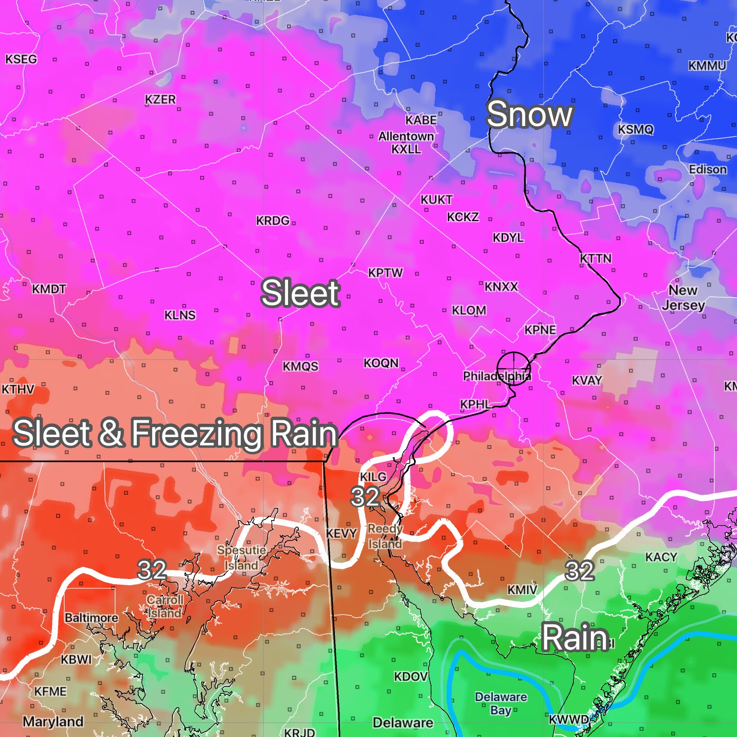
Considerable Icing Possible
A disturbance moving west to east will spawn a coastal low pressure system late Saturday. Temperatures in the mid levels of the atmosphere will be too warm to support snow to fall, but temperatures near the surface will be at or below freezing, causing any precipitation to freeze, or any melting snow on the way down to fall as sleet.
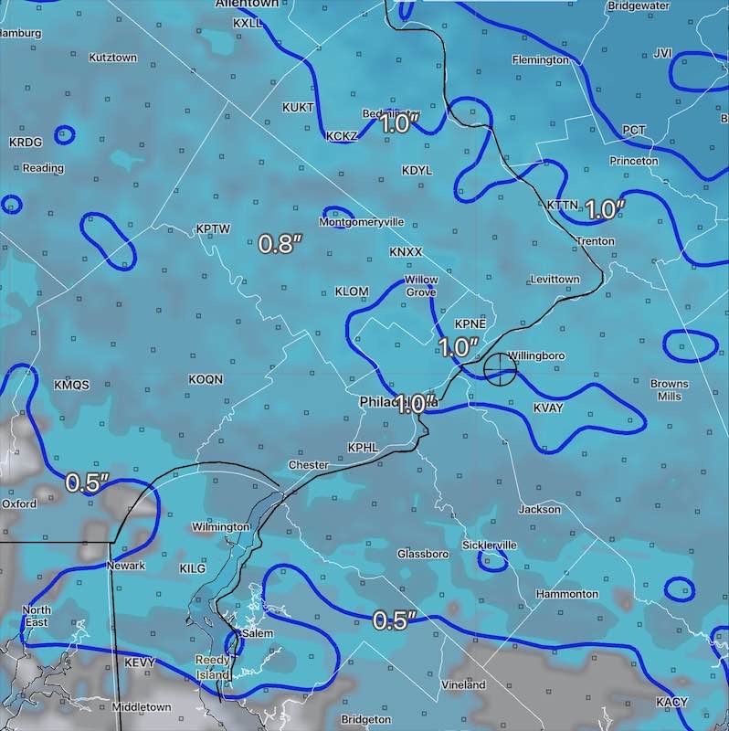
Precipitation amounts will be on the order of 0.5” water equivalent, resulting in the potential for significant icing and potential ice buildup in some areas.
The precipitation begins possibly as light snow between 2PM and 4PM Saturday. The heaviest precipitation will fall as sleet and freezing rain by around 10 PM and will transition to rain or some freezing rain and end before daybreak Sunday, as temperatures rise above freezing from south to north.
Considerable cloudiness and some sun expected on Super Bowl Sunday as temperatures initially warm to 39-41°. It will become windy mid day.