Category Archives: Philadelphia Weather Outlook

WEEK & WEEKEND WEATHER OUTLOOK

Updates Tues 7:15 PM & Wed 8:30AM are highlighted

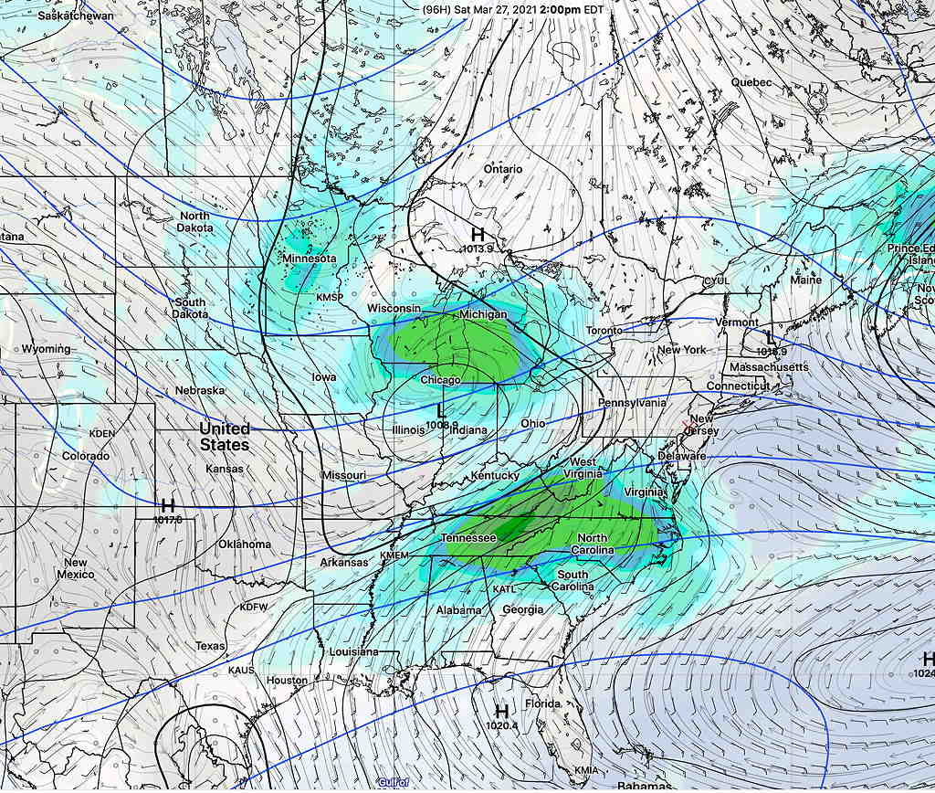
The forecast for the weekend continues to evolve regarding timing of the rain. Based on the latest GFS, we may luck out and have most of the rain fall Friday evening and Saturday evening, leaving much of the daytime hours cloudy, but rain-free.

A blocked weather pattern has been in place for the past several days with low pressure stuck in the middle of the country as well as low pressure system stuck in the Atlantic. This blocking pattern will evolve into a classic “omega block” (the jet stream flow resembles the Greek letter omega “ Ω “) by Friday.

GEFS Jet forecast for Friday.  (Click on image for a larger view.)

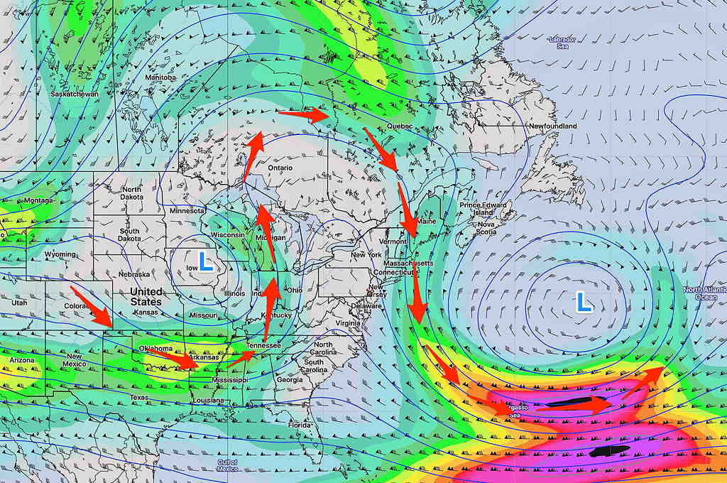
The latest GEFS model shows this Atlantic low pressure system remaining even more entrenched as the low pressure in the central US tries to move east.  High pressure caught in the middle will bring a moist, easterly wind flow and cloudiness to our area from Friday through Sunday. 

Periods of showers and rain are most likely Friday and again Sunday.  

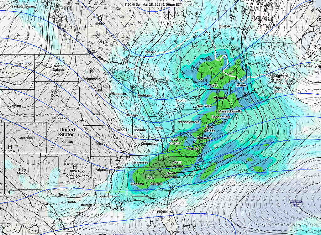
Additionally, the Central US  low pressure may induce secondary low pressure formation off the Delaware coast.  This coastal secondary low may make the rain on Sunday moderately heavy (the ICON model cranks out almost 1.5 inches of rain Sunday.)  

GFS Forecast Sunday 8 AM  (Click on image for a larger view.)

The models have backed away from heavy rain. The rain is looking less continuous over the weekend. Indeed there may be periods of cloudy, but dry weather. The exact timing of the rain over the weekend has shifted. Sunday’s rain may occur mostly before daybreak.

Blocked weather patterns result in long stretches of persistent weather.  We never really know when the block will break down until we see some kicker system appear.  So the block will be in place…until it isn’t.  The models aren’t all that good at showing that moment in advance.  As a result, long range forecasts sometimes become totally undone.  

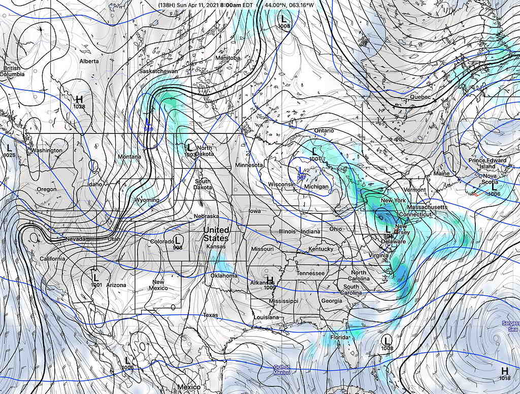
According to the GEFS  that persistent low in the Atlantic and its effects on our weather may be with us much of next week!


ANOTHER BRIEF RETURN TO WINTER

A low pressure system will move in Wednesday afternoon with moderate rain (~1 “) and a  strong cold front will move through later Wednesday night with the jet stream plunging southward from a push of cold air—

Canadian GEM Regional model forecast 10 PM Thursday.  Red line is the 1000-500mb thickness line,  a rough approximation for the jet position and often considered the ‘rain-snow line’.  (Click on image for a larger view.)


This very strong cold front may bring some ‘interesting weather’ as it moves through and I’ll be keeping an eye on it.

Much colder temperatures later Thursday through early Saturday.  We may even see some snow flurries Thursday nightCold, windy conditions Thursday through Friday!   High temperatures in the low to mid 40s Friday and temps may fall into the upper 20s Friday night.   Still chilly on Saturday, although the afternoon should warm up a bit more.

Things  moderate further on Easter Sunday and next week looks milder and more tranquil. 


WEEKEND WEATHER OUTLOOK

The model forecasts for this weekend are surprisingly consistent.

Following a weak cold front passage late Friday, weak high pressure is expected to build in for Saturday.  Saturday currently looks to be mostly sunny and mild with temps in the 60s—

GEFS surface forecast for Saturday at 2 PM  (Click on image for a larger view.)


Low pressure moving up through the Ohio valley is expected to bring clouds and rain on Sunday with cooler temps—

GEFS forecast for Sunday at 2 PM  (Click on image for a larger view.)


It’s interesting that the models show high agreement for the weekend. We’ll have rain on Wednesday, but the  time frame from Thursday through Friday is a little more uncertain regarding the timing of several frontal passages and the amount of dynamics in our area.  Questions remain about the timing of showers Thursday (if any) and the possibility of thunderstorms late night Thursday  (with a warm front passage) and again late Friday afternoon with a weak cold front.  

Friday looks to be very warm but VERY windy.  I’ll update if things get interesting.