[su_note note_color=”#defcdc”]Update Sun 12 PM: So, the current radar shows precipitation moving in sooner than any models had predicted. Rain may start as early as 1 PM.[/su_note]
Most of last night’s models continue with the idea that rain begins in the general Philadelphia area around 3-4 PM today, Sunday. A remaining exception is the high resolution Canadian (HRDPS) which waits until 7 PM for the rain to start.
Rain may be heavy overnight and into Monday morning, then more light and scattered.
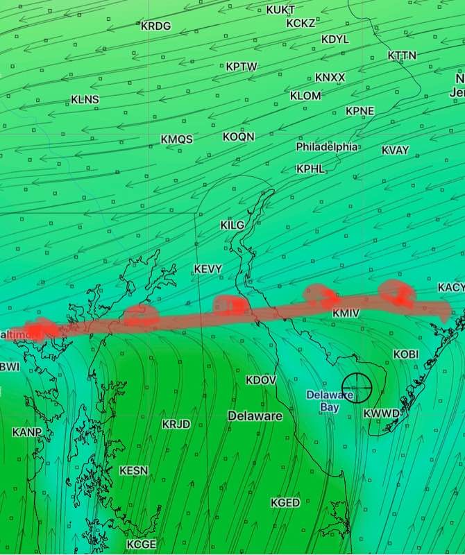
A warm front will try to make its way into Philadelphia and areas on a line to its south on Monday morning. If it does, temps will rise into the low 60s.
However, only the GFS has it making its way as far north as Willow Grove. The NAM, NAMNEST and the Canadian HRDPS, GDPS keep it further south. Areas that remain north of the warm front will remain in the low 50s. (Warm fronts are not as distinct as cold fronts.) So it may not get as warm as previously though on Monday.

Most models have a cold front moving through about 2-3 PM, dropping temperatures.
