#Philadelphia #weather #PAwx #PhillyWx
When we have such beautiful weather in August, there’s not much to write about. Sun, minimal clouds, light winds, smooth sailing.
High pressure will block the very hot weather to our west through early Monday.
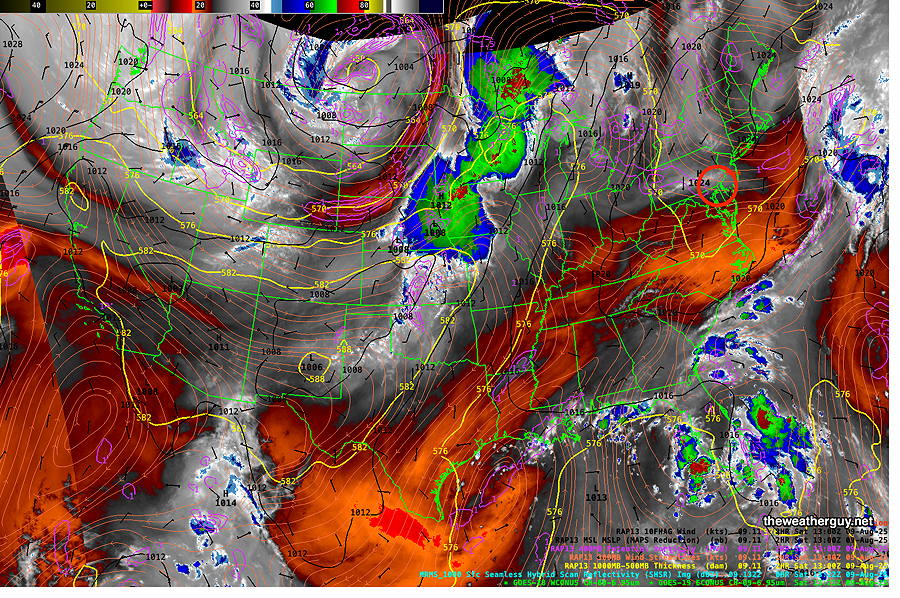
Water Vapor Temperatures indirectly reveal height, called the “effective layer”, of the water vapor in a region, therefore revealing the mid and upper level 3D contours of systems. Colder temperatures (blue- grey – white) indicate higher altitude, often revealing upward motion. Red- Orange indicates warmer temperatures and a lower height for this layer. (Click on image for a larger view.)
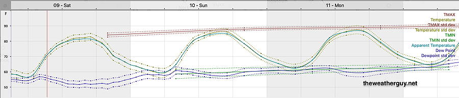
Here’s the updated model blend (NBM) forecast temperatures and humidity meteogram for Blue Bell, PA through Monday—