#Philadelphia #weather #PAwx
Week Outlook Early Edition. Snow??
Posted Sunday 12/01/24 @ 9:21 AM — First, today’s morning clouds were predicted and but the latest models have these clouds hanging tight for most of our area through 4-5PM, instead of dissipating earlier. (Far northern areas may see some sun by afternoon.)
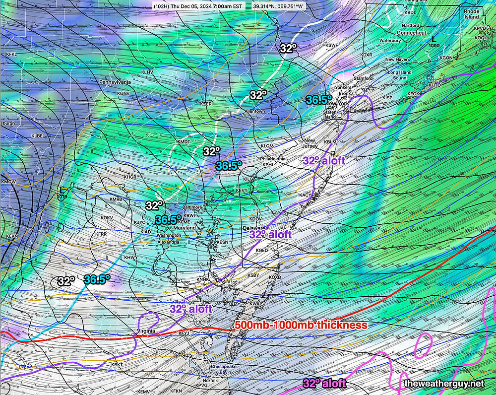
As for this week, all the radio and TV forecasters are using the word “SNOW” for late Wednesday into Thursday. My personal feeling is that after months of sunny skies and no rain, they’re starved for attention. I don’t see much in the way of any meaningful snow deserving this sort of hype.
Since last Friday, the models have been hinting at some snow late Wednesday into late Wednesday night. The truth is, the reinforcing cold front responsible for this “snow” is moisture starved and over the past several days, the models have shown very little to suggest that we’ll get anything more than snow showers. Right now, I see only snow showers that may give a coating in most areas. I don’t see the need for snow shovels. Perhaps an ice scrapper for your car Thursday morning to remove frozen melted snow from your car windows.
The latest GFS and the caption below explains the situation—

I’ve been keeping an eye on this situation, but, if your’e hoping for real snow, you’re likely going to be disappointed.
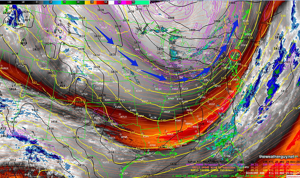
Originally Posted Fri 6:34 PM —We had the instability showers/snow showers today as forecast yesterday by the RRFS and GFS. Those will be ending with sunset, as cold air streams in from the northwest.
A broad dip in the jet flow will cause cold weather to be with us through the weekend and into much of the next week.

For Saturday, cold with instability cloudiness again about noon into early afternoon. No showers expected. Sunday continues sunny and cold.
Saturday Forecast
Sunny in the morning, instability cloudiness towards noon into the early afternoon, then skies clear. Windy during the mid-day hours. Temperatures in meteogram below. Wind chills (‘apparent temperatures’ in the meteogram) below 30º
Sunday Forecast
Some warm air aloft from a southwesterly wind will cause some cloudiness during the morning hours, then partly sunny. Still somewhat windy mid-day into early afternoon.
A weak cold front moves through Sunday evening dropping temperatures.

Looking Ahead
A cold front with a possible interaction with some southern jet stream energy will bring some very light showers or showers with some snow flakes later Wednesday. There’s uncertainty with is system.
