
#Philadelphia #weather #PAwx
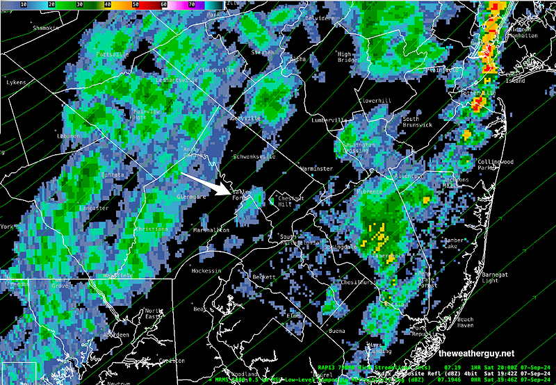
Posted Saturday 09/07/24 @ 3:51 PM — Radar shows an additional area of light rain behind this anafront that may move in between 4 PM and 7 PM. This additional area is showing in today’s models that became available late this morning.
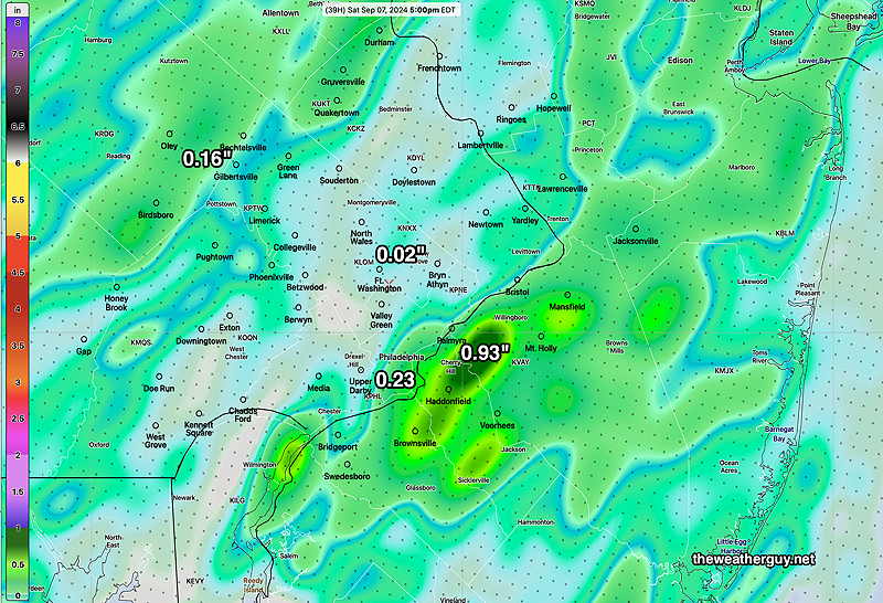
Here’s the MRMS rainfall summary—
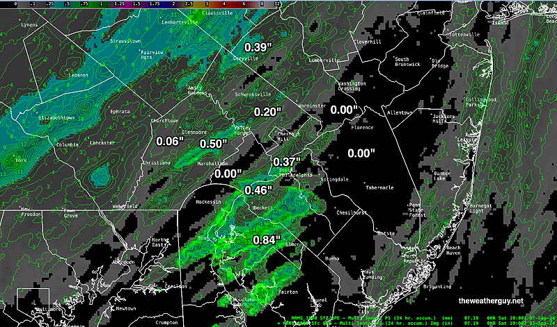
The model forecast below did pretty good at capturing the area around Philadelphia that got minimal rainfall.
Saturday Update
Posted Saturday 09/07/24 @ 9:45 AM — The approaching cold front (classified asa frontal type “anafront” due to the precipitation lagging the actual surface front) will pass through here between 1 PM (western Montco/Bucks/Chester) and 2-3 PM (Philadelphia) and 4-5 PM (NJ).
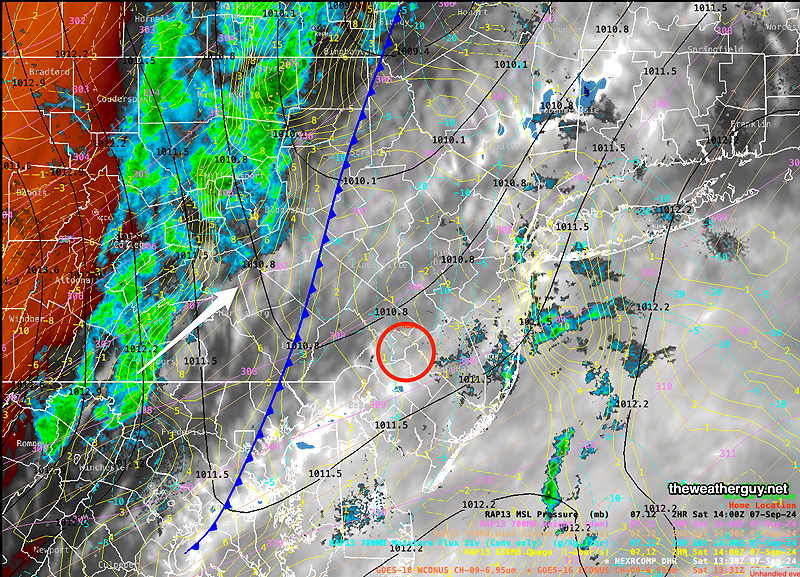
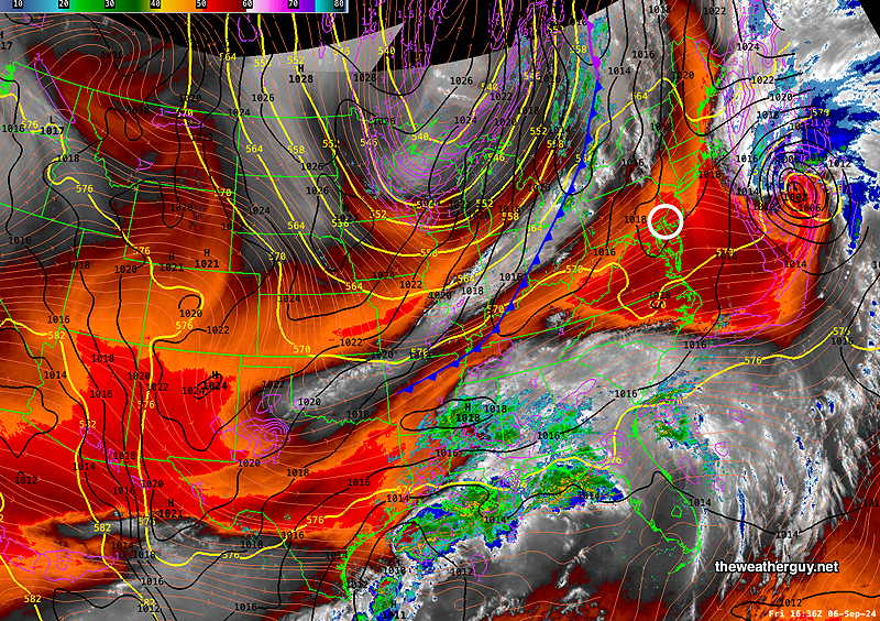
Here’s the Water vapor/radar image—
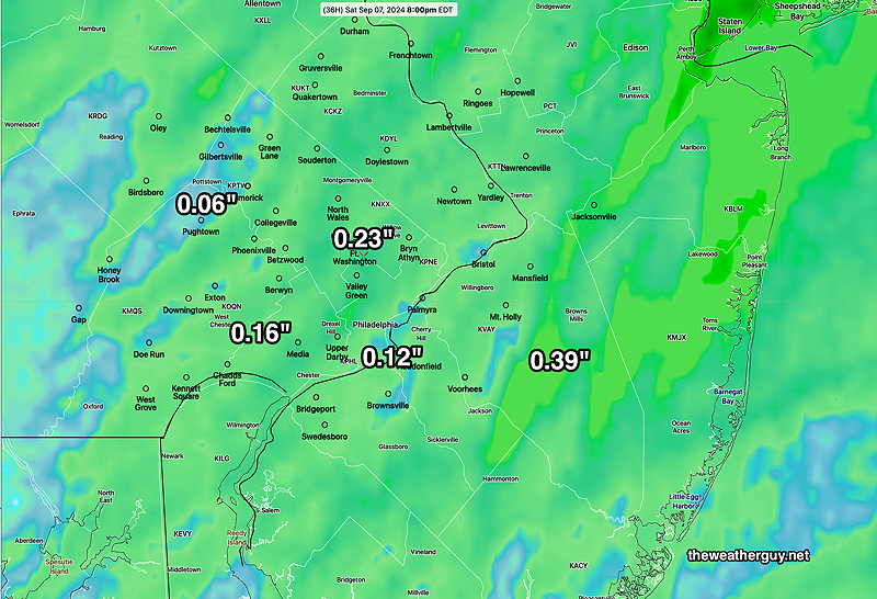
Expected total rainfall continues to lessen for our immediate area, with areas receiving 0.00″ to 0.15″—
Originally Posted Fri 5:34 PM —A cold front will move through our area between noon and 3PM Saturday. What had looked earlier this week to be a decent rain-maker has diminished to a chance of a few showers with precipitation totals of about 0.20″ or less. Our dry pattern continues and appears to be worsening.
Those of you who followed the discussion this past week about rain “skipping over” Philadelphia will recognize the rainfall pattern of the 06z experimental REFS forecast for Saturday—
The high pressure system that follows for Sunday will further suppress any possibility of rainfall far south of our area for much of the upcoming week.
Current satellite water vapor shows the current setup—
Originally Posted Fri @ 5:34 PM —
Saturday Forecast
Cloudy. Showers move in to western Montco/Bucks/Chester counties about noon and through the city by 2 PM into NJ. Strong wind gusts with the frontal passage.
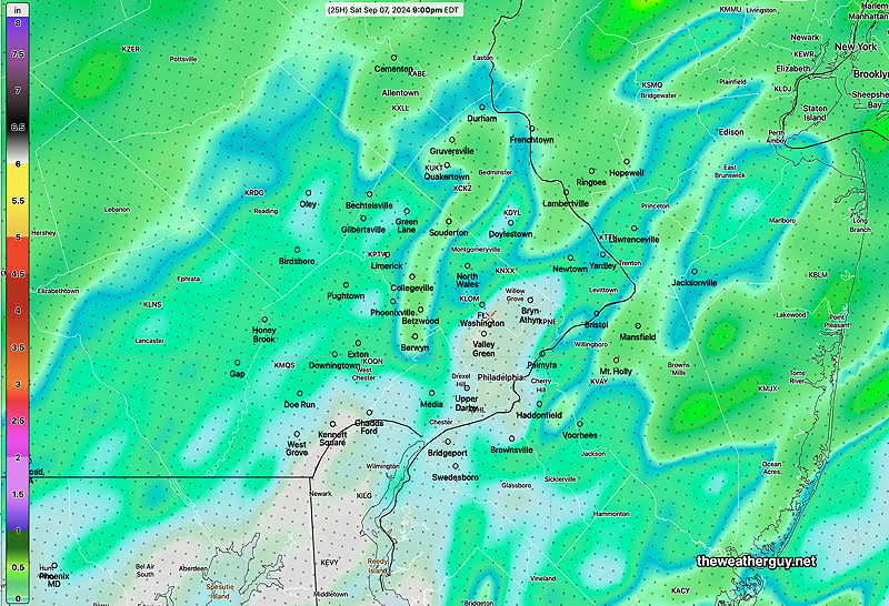
Total Rainfall (Model Blend)
NBM high temperatures: Blue Bell, PA 76º Philadelphia, PA 78º
High Uncertainty (based on standard deviation): ± 2.3º
Sunday Forecast
Sunny and breezy.
NBM high temperatures: Blue Bell, PA 71º Philadelphia, PA 73º
Low Uncertainty (based on standard deviation): ± 0.7º