
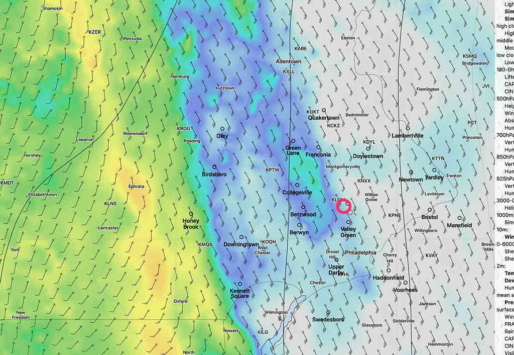
A brief update. The first of this morning’s models are coming in. Like last night, the trend is for the main area of heavy rain to move in a bit later— between 4:30 and 6 PM. Winds will be increasing.
The other trend is for less severe storm parameters. “Vertical shear” has reduced with this model run from the extreme values forecast yesterday.
The scattered showers we’re having in the morning now were predicted and won’t last.
HRRR (High Resolution Rapid Refresh) 8AM Simulated Radar Forecast for 4:30 PM—
I’ll update after noon, after reviewing more data. Stay tuned.