Rain New Year’s Eve
Update Wed 12/28 @ 8:34 PM — So, it’s increasingly likely that New Year’s Eve will be quite rainy and warm for December. What about earlier on Saturday?
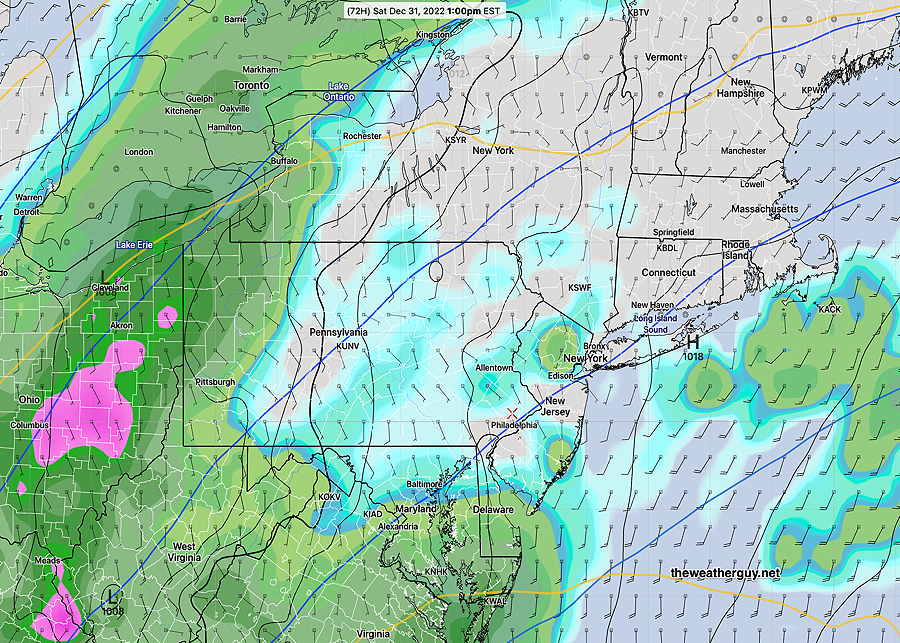
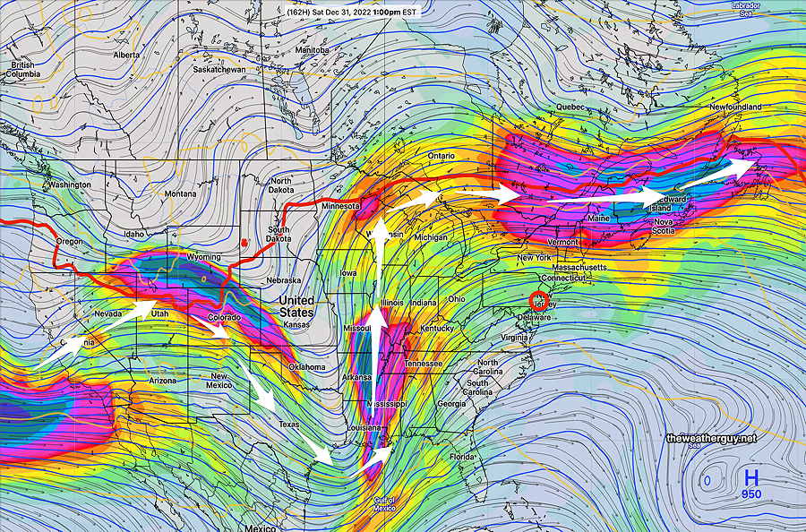
Unfortunately, the models have the rain moving in late morning or around noontime. Here’s the ECMWF forecast for Saturday at 1 PM—
The skies gradually clear out New Year’s Day (Sunday). It will be mild but VERY WINDY.
The best day for outdoor activities this week might be this Friday.
Today’s NBM model wasn’t forecasting as warm temperatures for next week as discussed immediately below, but still temps above average.
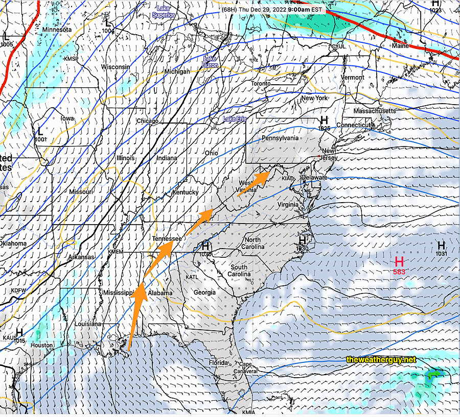
No snow in the current forecast, but there’s plenty of cold air in Canada and quite a moisture stream into the continental US from the subtropical jet stream.
Gradually Warming Temperatures
Update Tues 12/27 @ 8:54PM —The main focus for this week’s weather is the gradually increasing temperatures. Here’s the latest NBM model temperature forecast through early Saturday —
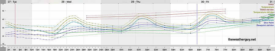
By the weekend we are moving into the 50s and near 60º. And next week will be even warmer—

Unfortunately, there’s fairly good model agreement that New Year’s Eve will be very rainy here although timing varies with the rain—

Update Mon 12/26 @ 7:57 PM — The clouds that moved in mid-afternoon will move out on Tuesday. Expect temperatures to remain cold on Tuesday.
The trend is towards warmer by Thursday and especially Friday through Sunday.
A Bermuda high builds by Thursday…is this summer??
High temperatures will be near 50º on Friday and near or above 60º on Saturday. Unfortunately with the warm temperatures, rain is expected for New Years Eve and possibly lasting into New Years Day.
The current outlook is for warm and wet next week.
Forecast Outlook through New Years Eve
Posted Sun 8:46 PM —
Overview
This week’s weather will transition from the current cold upper air trough—
….. to a much warmer upper air ridge over our area by next Saturday, New Years Eve—
In the interim, daily high temperatures will gradually increase each day.
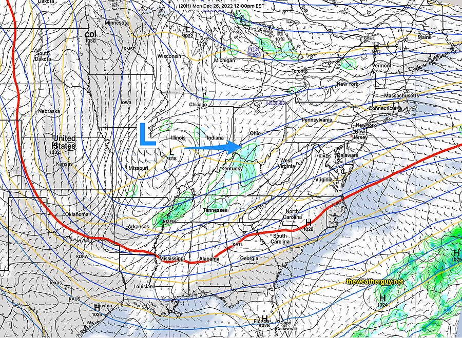
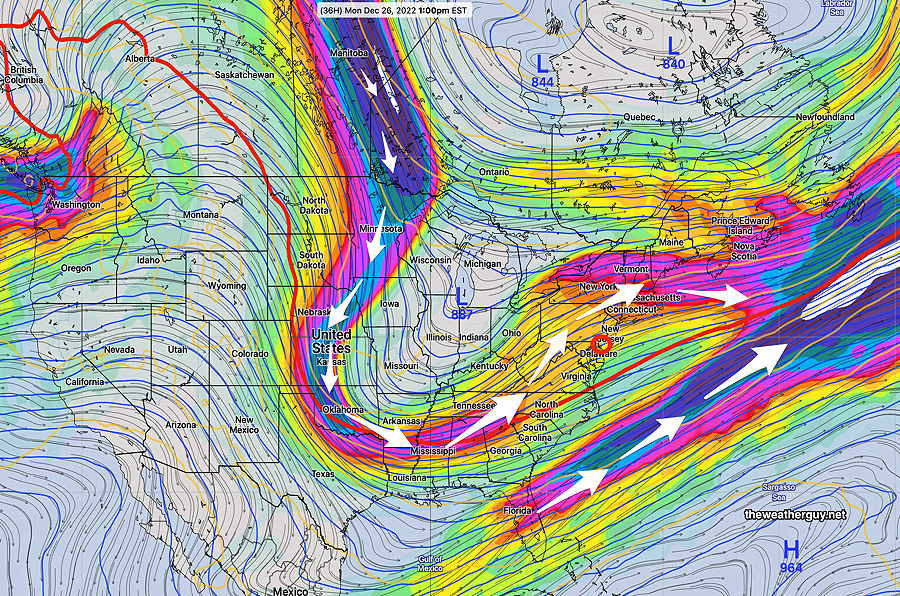
Monday
An upper air disturbance along with a surface low pressure system will approach our area during the day. Increasing cloudiness late morning and mostly cloudy by mid afternoon.