
Less Unsettled Weekend
Updated Fri 8:12 AM — An early preliminary update.
Not unexpectedly, the models are backing off on the rain for the weekend. (Dry spells are hard to break.)
For today, Friday, there’s a chance of very widely scattered popup showers/thunderstorms late afternoon, mainly from Philadelphia and eastward.
Much of Saturday looks to be just unsettled with our immediate area dry until showers move in from the west later in the day or evening. Now, much of the activity goest to our north and our south.
After some lingering showers on Sunday morning, it looks like things dry out for much of Sunday.
I’ll do a complete Weekend Weather Forecast later today.
Updated Thu 6:06 PM — We may get some much needed rain. Unfortunately, it may come this weekend. The GFS, ECMWF and the NAM all have low pressure developing in the area of the upper trough depicted in my original post graphic below, as the strong ridge in the middle of the country temporarily retreats.
The timing of the rain varies with the models. The NAM has showers moving in early Saturday. The GFS during the evening hours. The ECMWF late Saturday night and early morning Sunday. The ECMWF is notable for some very heavy rain Saturday night.
Despite these model forecasts, these dry spells are difficult to break down. Low soil moisture reduces the usual feedback loop for rain production.
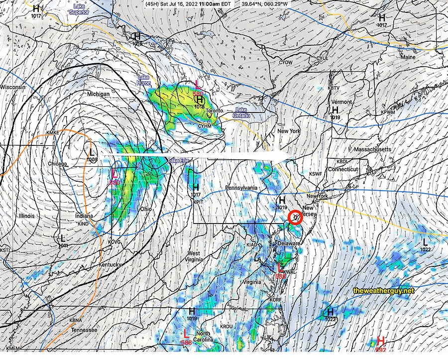
Current NAM forecast for 11 AM shows showers ready to move in.
Tomorrow’s model runs will hopefully better define the timing.
BTW, all models keep unsettled conditions for Sunday, with some scattered showers. Stay tuned.
Previously Posted Wed 10:30 AM —
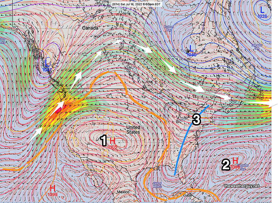
A persistent upper level high in the middle of the country that has been resulting in recording breaking high temperatures for central parts of the country shows signs of a slight retrograde to the west allowing the Bermuda high in the Atlantic to move slightly westward.
An upper trough will develop in the middle and affect our weekend. The caption for the graphic below explains the salient issues.
The slight pattern change, described in the caption above, will result in increasing moisture and and increasing chance of showers by Sunday.
Until then, typical summertime weather for us.
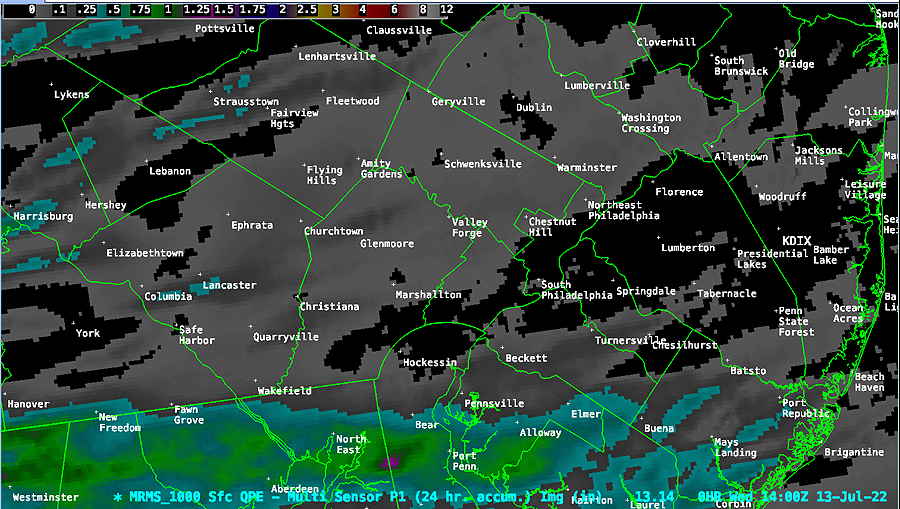
There were virtually no heavy storms in our immediate area.
What the heck are they talking about?? Here’s MRMS precipitation summary for the past 24 hours:
The NWS is forecasting a good chance of rain Monday afternoon. Any thoughts on that?
I appreciate your flagging our dry spell. I had noticed it, too, and also hope it breaks soon.
The models have all moved the -possible- rain to Monday. But I’ve watched as the models went from Saturday night to Sunday and now to Monday with this rain.
We need the rain and I hope this most recent model run gets it right. That said, “dry begets dry” in a biblical way. The 570 thickness line (from the Midwest high pressure system) is pushing back this way. Things become too stable if it move over our area. The longer this rain delay goes on, the more likely it won’t happen in the way we need.