
Update Fri 11:48 AM — This morning’s models have decreased the total accumulated rain to 0.27-0.43 inches water. Yesterday, the models were cranking out ~ 0.6 inches of water.
Update Fri 10:29 AM — The latest HIRESW-ARW MEM2 shows a critical temperature for snow remains too far north of our area; it will be too warm for snow.
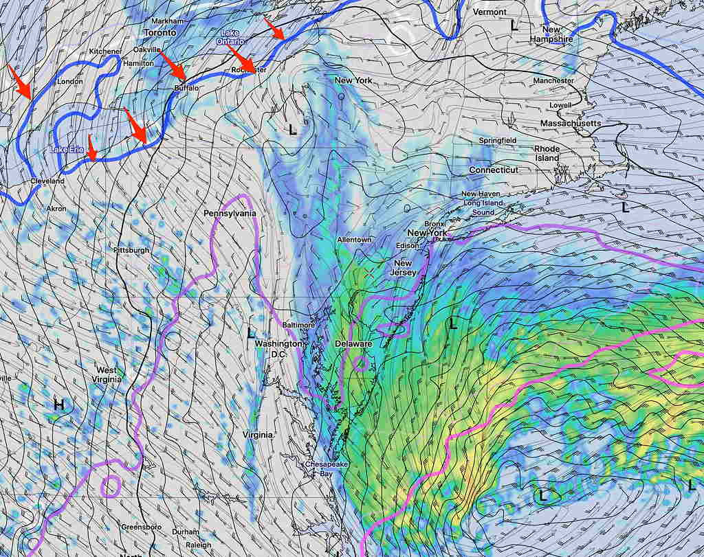
By the time this level chills off, most the precipitation will have moved away. A few wet flakes early evening, maybe.
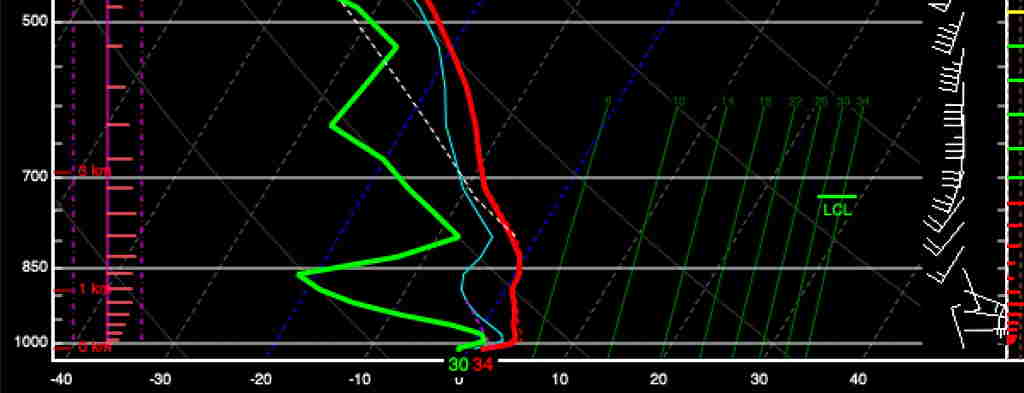
This morning’s newest upper air measurements (called “soundings”) were done at 7AM and incorporated into the latest Rapid Refresh Model (RAP) Analysis which just became available. Soundings are done worldwide via the launch of weather balloons with attached radiosondes twice a day, at 7 AM and 7 PM EST (0 and 12 UTC).
Despite the colder surface temps observed this morning. there is still a strong southwesterly flow of warm air at levels of 1500 feet which will keep temps above freezing at critical snow temperatures, as predicted by the models.
Here’s something called a SKEW-T diagram, which plots temperatures and dew points as a function of height. This one is derived from the latest RAP model.
So I guess the predominant model forecast for predominantly rain, maybe with some wet snow flakes later today, appears to be the best bet.
“Yes, I know this ‘storm’ doesn’t merit the attention I’m giving it, but I’m just honing my skills for next winter. 🙂 “
The newest HRESW-ARW MEM2 will become available about 10 AM.