
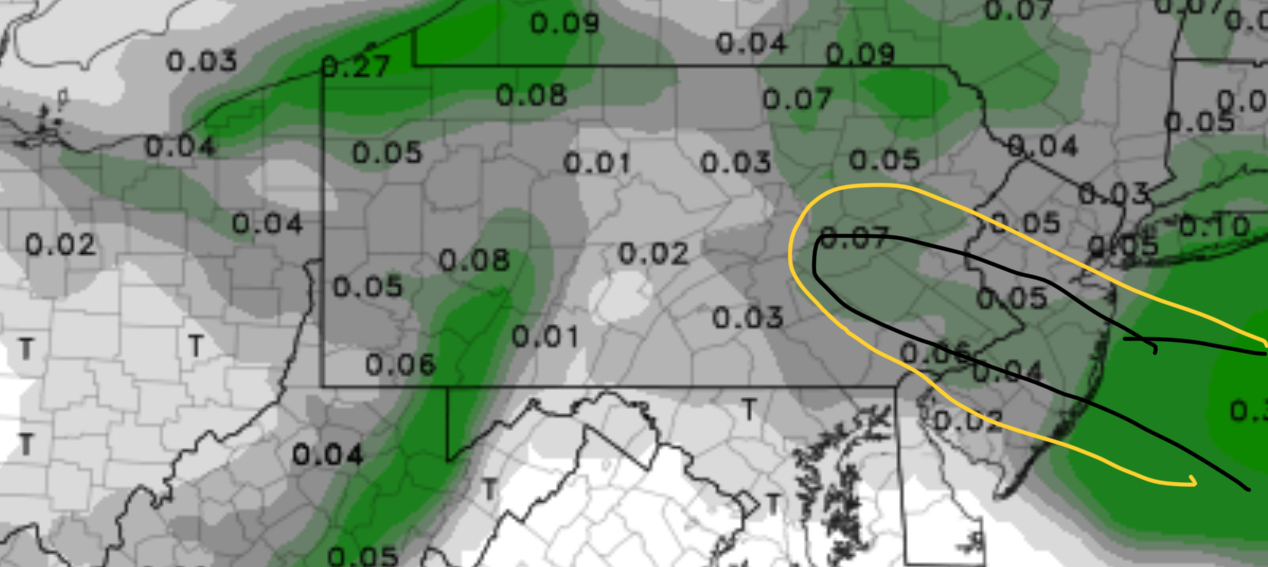
The 1 AM runs of the NAM and GFS continued with the 0.11 and 0.06 QPF values. Even with snow-water values of 20:1, it appears that the NAM may have done better than the GFS with the snow totals. (Usually an average of the two gives a pretty good read, but not this time around.)
In my neck of the woods, northwest of the city, we already have about 2 inches of snow. I’m beginning to think this is one of those clipper systems that exceeds snowfall expectations, making the forecasts all off.
One of the things talked about by the central NWS forecast office a week ago was the possibility of developing an obscure setup called a “Trowal -Norlun trough”. There’s a deep low pressure system far off the coast today; the clipper system may have “connected” with this far offshore causing this band of snow enhancement we’re experiencing this morning. That connection or upper air trough is the Trowal-Norlun trough, resulting in enhanced lift and enhanced snow production.
With the short range HRRR still showing small amounts of QPF remaining, we’ll have to see how much snow actually falls. Clearly a wrong forecast.
The very latest NAM shows 0.06 inches water for PHL this morning but suggests the heavier band of precip (see graphic above.)
Latest radar shows the banding clearly. (See graphic below) Notice that the gridpoint for PHL airport is not in the heavy band.
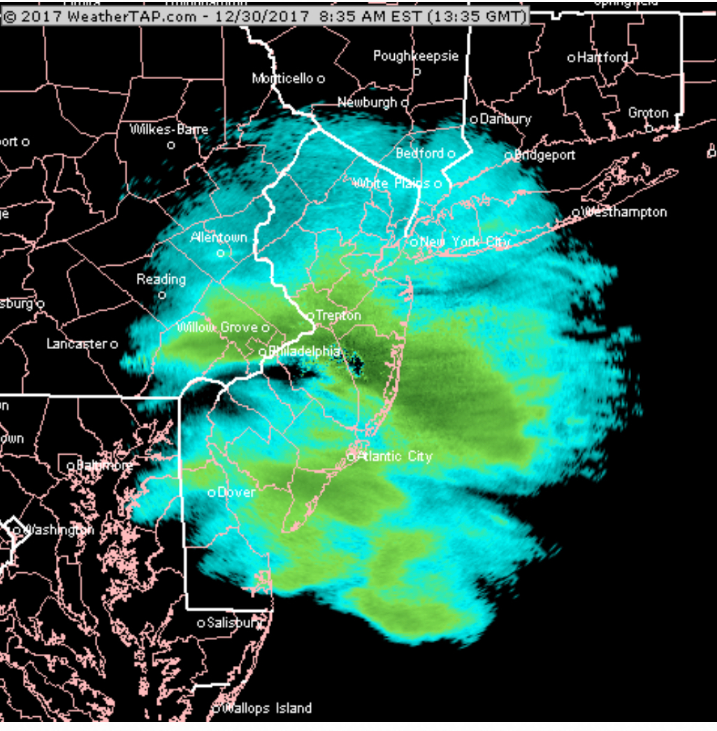
I wouldn’t be surprised if areas in the banding get 3 or more inches from this storm.