WEEKEND WEATHER FORECAST

This weekend’s weather will be the nicest we’ve had in many weeks and the forecast  will be easier as well —  a  far cry from the boundary conditions with a stalled front  we’ve had to deal with over past weekends.

Both Saturday and Sunday will be sunny.  High on Saturday 84 and high on Sunday 90!

[su_note note_color=”#d9f2da”]Sat AM Update: High temperatures have shifted a bit higher for Saturday 86 and Sunday 91.[/su_note]

We’re finally entering a summer-like weather stretch. Monday’s high is expected to be 96-98 with increasing dew points.


By the way, the NWS announced today an expected major update in the GFS model. The new GFS model, to be referred to as the FV3-GFS,  will become operational in mid January 2019, in time to improve snow forecasts.

From what I could infer from reading about the new model, its improvement is in part due to changes in the geometry of how the globe’s atmosphere  is broken down into a 3 dimensional mathematical grid.

The new geometry, a Finite Volume Cubed Sphere, (hence FV3) allows for better computation at the edges of each cubed grid, and reduces approximations where some of the physics would ordinarily result in infinite mathematical series or unsolvable equations.  This should result in better forecasts .

The pre-release version of this new model was used for this forecast’s high temperatures. We’ll see if the highs on Monday really reach 96+.

YET ANOTHER FORECAST CHANGE

[su_note note_color=”#d9f2da”]So the rain moved in earlier than expected, closer to the GFS- based LAMPS than the NAM-based HRRR. In fact, the HRRR did poorly; one of the few times I can think of where the LAMPS did better than the HRRR. Will have to try again next weekend![/su_note]

The lack of consistency and accuracy with the model forecasts this weekend is almost enough to force me into finding a new hobby.

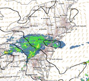
The 2am runs of the models has the GFS bringing rain by early afternoon.   The GFS-based LAMPS short range has rain by mid morning here.  The NAM still holds off most of the rain until late afternoon and this evening.   The NAM-based HRRR shows rain moving into PHL about 3 PM.

The further north you are from PHL, the earlier the rain starts.

So there you have it.  The HRRR did well yesterday so about 3 PM looks like a good bet here in PHL.   Areas to our north, in Bucks county, upper Montgomery counties and Trenton, already have rain or will have it starting in the morning.   Areas as close as Blue Bell might have rain starting later this morning, according to the LAMPS.

HRRR
HRRR Sunday 1 PM forecast

YET ANOTHER FORECAST CHANGE

Tonight’s NAM model data has yet another change in the forecast for Sunday.  Mostly cloudy conditions forecast, but the latest NAM holds off most of the rain until late afternoon.  The earlier NAM and GFS had heavy rain by mid afternoon Sunday.  (Due to Daylight Saving Time, the new GFS won’t be available until after my bedtime.)

But the latest data we have suggests a Sunday that is drier than previously expected.  Still moderate rain expected for Sunday night.

Weather… and Other Things 'Up in the Air'