Tue 05:40 PM Update — The most recent run of the HRRR model has the storms falling apart before reaching us. So tonight’s storms are not a sure thing. It’s becoming clear why there was such a wide range of model forecasts.
An upper air disturbance moves through this evening, between 10 PM and 2AM.
Yesterday’s models picked up on this, but had the storms affecting the far western suburbs and falling apart as they entered the immediate PHL area. This morning’s NAM-NEST continued to have the storms falling apart, while the HIRESW model had them affecting PHL.
This afternoons’s models have been on-board with more of the PHL getting some scattered heavy thunderstorms.Not all areas will see these storms, but this afternoon’s models just becoming available show some isolated areas of heavy rain and even some hail possible. The storms will be fast moving.
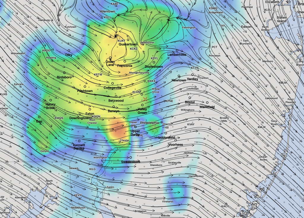
Here’s the HRRR model simulated Radar forecast at 11 PM with storm motion streamlines—
(The location of the storms in simulated radar forecasts can’t be taken literally. It’s just a model.)
HRRR (17z) Simulated Radar and storm motion at 11 PM (Click on image for a larger view.)
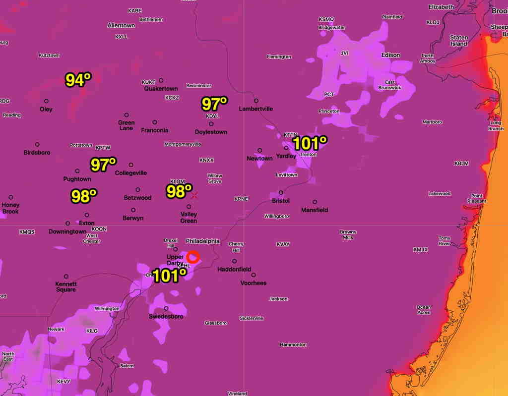
Sun 08:22 AM Update — The heat index forecast for Monday remains little changed in contrast to last night’s suggestion it might be a tad better.
Model Blend Max Apparent Temperature (Heat Index) forecast for Monday. (Click on image for a larger view.)
Sat 11:16 PM Update — Several of tonight’s models have backed off a bit from the extreme heat previously forecast for Monday. Too early to be sure of this trend.
A hot Sunday and very hot Monday is on tap for the Philadelphia area.
First, reviewing today’s forecast, dew points did stay near 60º, allowing our high temperature of 93-94º to be fairly tolerable. The model blend (NBM) did very well in predicting today’s temperature and “apparent temperature” or “heat index” staying in the mid 90s.
So, going with the model blend for Sunday, Sunday will have a high of 97.5º sd 1.3º. Heat indices (“apparent temperature”) will be in the high 90s for most of the area—
NBM v 4.0 apparent temperature forecast for Sunday. (Click on image for larger view)
Things get ‘interesting’ for Monday, as temperatures get into the upper mid to upper 90s, but dew points rise to near 70º, giving us very high apparent temperatures (heat indices)—
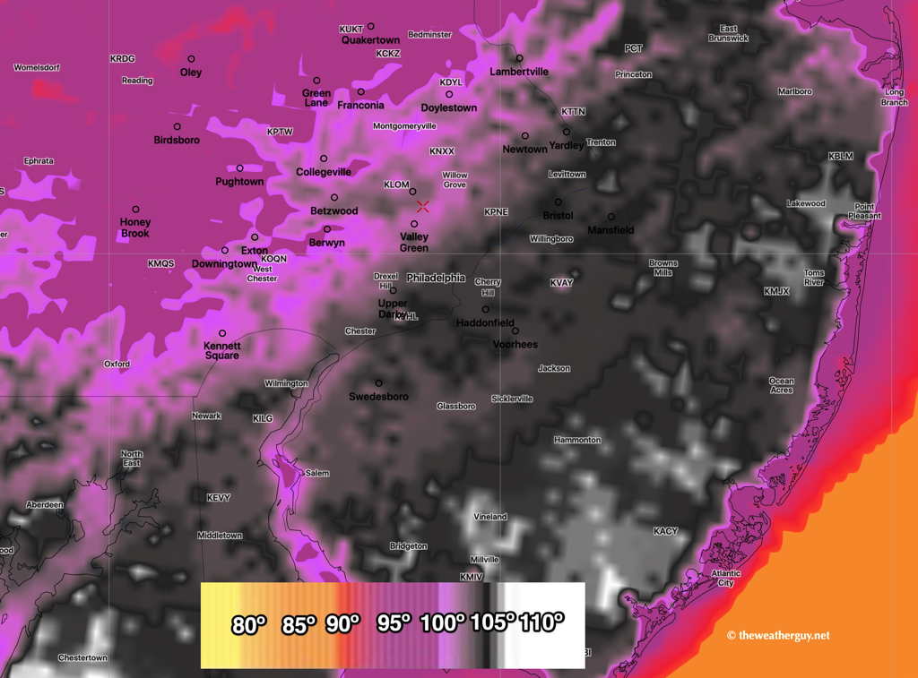
NBM v 4.0 forecast Apparent Temperatures (Heat Index) for Monday afternoon. (Click on image for larger view.)