Thu 02:53 PM Update — Thunderstorms look much less likely this afternoon and tonight. It also appears that we won’t hit the highly advertised 94º high temp today.
My previous post postulated that it’s tougher to accurately forecast the weather with a tropical system in the picture. That’s not going to stop me from trying.
Tonight’s models are just becoming available. A warm front moves through overnight and dew points rise almost 10° by 8 AM.
Tonight’s models show some scattered/isolated thunderstorms developing between 5 AM and 7AM Thursday morning with the warm frontal passage. The ‘severe weather parameters’ are fairly elevated at that time, so while these storms will be isolated, they may pack a punch.
Some models are showing more thunderstorm activity late Thursday afternoon and evening.
Unfortunately, I’m unable to access the HIRESW model this evening.
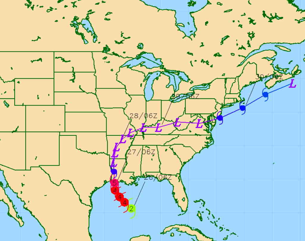
The latest information about Hurricane Laura shows it to be a major and dangerous hurricane. The latest US Navy COAMPS tropical model has it as a category 5 storm at landfall. The National Hurricane Center is always your best bet for information.
Navy COAMPS model forecast- track and intensity – Laura (Click on image for a larger view.)
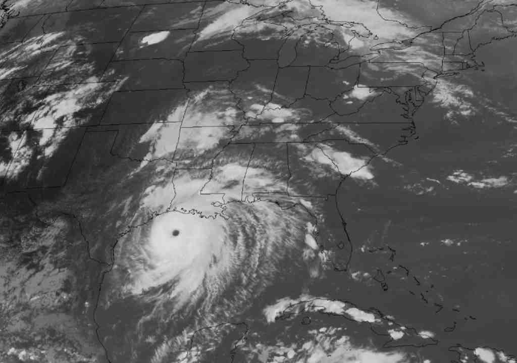
Latest satellite imagery is impressive—
Visible Satellite Image 5:56 PM EDT (Click on image for a larger view.)
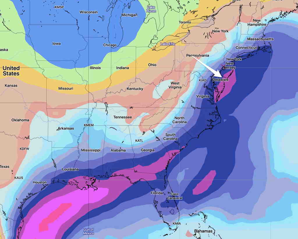
Where does all this moisture and energy end up? The COAMPS continues to suggest it moves just south of our area on Saturday.
The latest GEFS (Global Ensemble Forecast) shows the remnants as a increase in “precipitable water”, referred to as PWAT. Here’s the PWAT forecast for Saturday at 1 PM—
GEFS (pre-release version) PWAT forecast for Saturday 1 PM
There’s much uncertainty with the position of this moisture when it gets to the mid-Atlantic area on Saturday. The above is the soon-to-be released GEFS model, showing the PWAT maxima.
The current operational GEFS model, the GFS model and new pre-release version of the GFS model all have different timing and positions for the remnants of Laura.
This is not surprising… hurricane tracks and intensity are difficult to forecast; once a hurricane transitions to an extra-tropical system, it seems to get even more complicated to forecast.
I expect the forecasts for the next few days to become very changeable. I call it the “tropical storm effect”. Even yesterday’s model forecast bust, I believe, was due to the “tropical storm effect”.
The “tropical storm effect” is a total creation of my own and it is NOT at all science-based. Over the many years of weather forecasting as a hobby, it’s been my strong impression that local model forecasts are more unreliable when there’s a strong tropical storm or hurricane in the picture. Does it cause a discontinuity in the mathematical models? Only the numerical weather scientists can answer that.