Memorial Day Weekend Weather Update

Forecast Updated Thu 9:16 AM in highlighted text below—

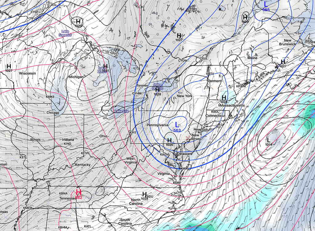
As indicated in this morning’s update, the position of the closed low has changed from yesterday’s models and yesterday’s outlook. There continues to be quite a bit of “spread” in the statistical models regarding the position of the closed low.

So there’s a lower confidence in the forecast than usual. (I expect this forecast to be revised again; upper closed lows are very difficult to forecast accurately.)

I wanted to post this update to indicate the major shift in the optimistic forecast I posted yesterday. Additionally, it does not look like a good NJ shore forecast in particular with windy/cloudy and chilly conditions.

The general trend is for more clouds and chances of showers over the weekend, and a reduction in the amount of rain Friday.

Friday

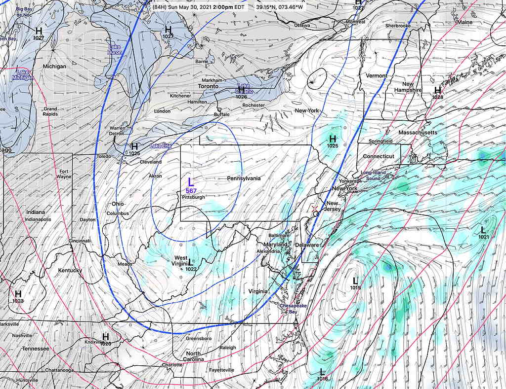
As the upper air flow transitions from a ridge to a trough, a surface low, originally to track over us will now track to our south. Unfortunately, this is translating into lower rain amounts for Friday. Instead of 1 inch, it looks more like 0.5 inches of rain. The latest ICON model has well over 1 inch of rain for Friday into Saturday. The NBM has 0.6 inches

Memorial Day Weekend

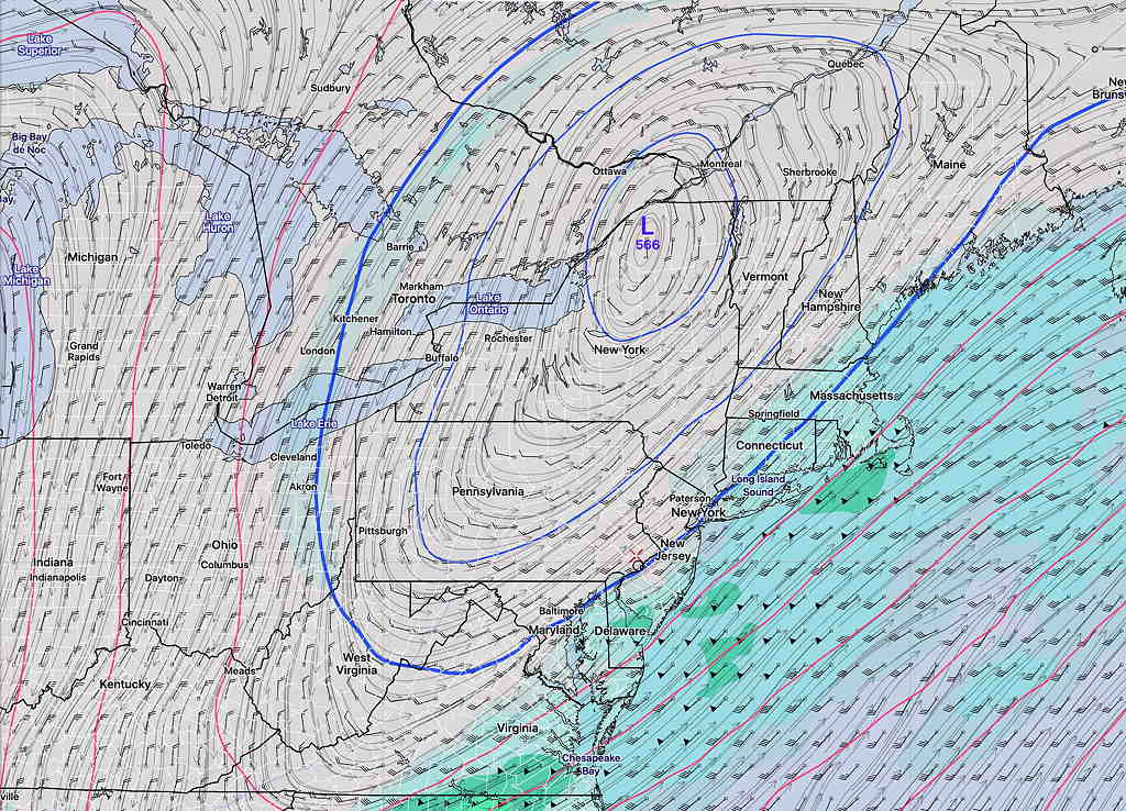
An upper air trough develops over our area on Saturday and lifts out by Monday. The upper trough will pinch off into a “closed low”.

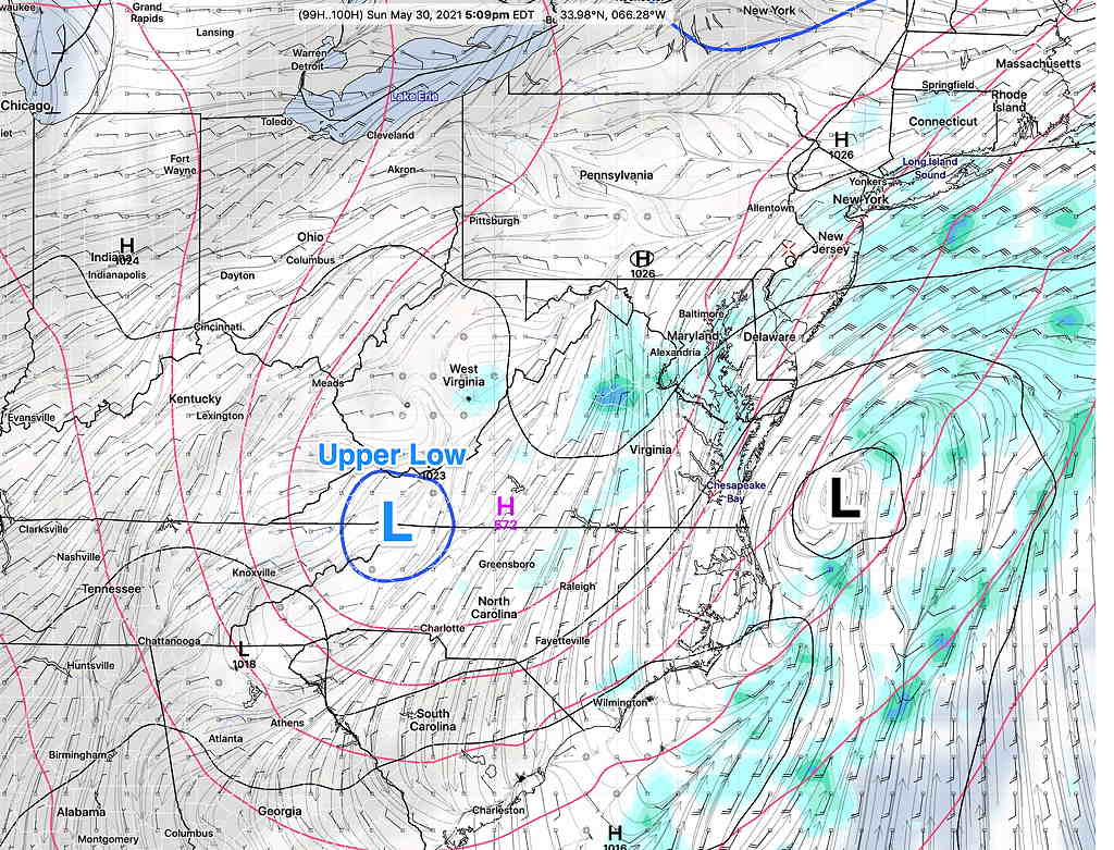
The entire scenario has changed in a day. The position of the closed low is now south of us and the GFS is forecasting a coastal storm to form!

GFS model forecast for Sunday 5 PM with upper closed low (blue) and surface low (black) (Click on image for a larger view.)

(Average seasonal high temp is 77º-78º)

Saturday

Saturday will be cloudy with scattered showers. High 61º sd 3.5º Chilly. (very high spread – high uncertainty!) The latest NBM has high temps 59º with an extremely high spread of 6º! The ICON has us in the mid 50s!

Sunday

Cloudy. Dry according to the model blend (NBM). The GFS has some showers, especially in NJ. High 62.5º sd 5.2º High 60.0º sd 5.7º Chilly and windy.

Updated GFS forecast Sunday afternoon showing closed low (blue), surface low and showers. The forecast position of the 500 mb low keeps shifting. (Click on image for a larger view.)
Monday

Cloudy (GFS) or partly cloudy (NBM) High 70.0º sd 3.5º Partly to mostly sunny (GFS) and (NBM). High 71.0º sd 3.5º

Thu 09:20 AM Forecast Commentary —The aim of this blog is to demonstrate both how good the numerical weather models can be, but also to show how fluid and changeable  forecasts are, with model forecasts shifts  and changes clearly marked. 

In contrast, many of the TV forecasters seem to live in the moment and seem to hope that you don’t remember what they said the previous day (or previous program).   

WEDNESDAY & Memorial Day WEEKEND OUTLOOK

Updated Wed 8:18 AM highlighted below (There are significant changes in the forecast based on last night’s GFS model.)

The ridge of high pressure that’s been providing the very dry weather will gradually break down over the next several days and will be replaced by an upper air trough over the weekend.

Tuesday into Wednesday

First, for tonight (Tuesday), a warm front will move through between 3 AM and 6 AM Wednesday morning. The models are showing several instability parameters consistent with showers and possibly an isolated thunderstorm tonight, although many models are downplaying this scenario. If you are awoken by a rumble of thunder tonight, it shouldn’t be a surprise.

Wed AM Update: latest models have the showers and thunderstorms moving through during Wednesday evening. Much of the heavier dynamics will move by to our west. Still only a small amount of rain (0.3 inches) at most

A cold front will move through on Wednesday. Most models have some showers and thunderstorms between 5-7 PM Wednesday and again between 11PM and 1 AM Thursday. While I’m providing likely timing, this may change. Some of these storms could be strong, but total rainfall in the region from this frontal passage won’t make that much of a dent in our recent rainfall deficit.

Friday

As the upper air flow transitions from a ridge to a trough, a surface low will track over us on Friday, with rain. (Hopefully!) Many models have between 0.7 and 1 inches of rain on Friday, starting early morning. If it plays out, this would be our first significant rainfall in awhile.

Memorial Day Weekend

An upper air trough develops over our area on Saturday and lifts out by Monday. The upper trough may pinch off into a “closed low”.

GFS Forecast for Sunday 2PM , showing upper air closed low over PA, and some clouds.

Depending upon the exact location of the closed upper low, the forecast below can change. Right now, most models have the closed low directly over us, which can be a good thing weather-wise. So this is the most optimistic forecast, based on current models.

Wed AM Update: The location of the closed upper low seems to have changed, now north of us. This may mean prolonged clouds and showers into Saturday.

Updated Wed:  GFS Upper air forecast for Sunday 10AM
Saturday

As a result of the upper closed low, Saturday may have a few showers lingering around daybreak, most of the day will be dry, and cloudy conditions will linger into at least the mid to late afternoon. A widely scattered sprinkle can’t be ruled out. It will be chilly with an easterly wind. High 63º sd 5.2º (very high spread – high uncertainty!)

(Average seasonal high is 77º-78º)

Sunday

Partly sunny skies some clouds at times. Still cool for the end of May. High 70º sd 2.4º Cloudy with a chance of sprinkles.

Monday

Mostly sunny and milder. High 75.5º sd 2.4º

Weather… and Other Things 'Up in the Air'