THUNDERSTORMS: MONDAY

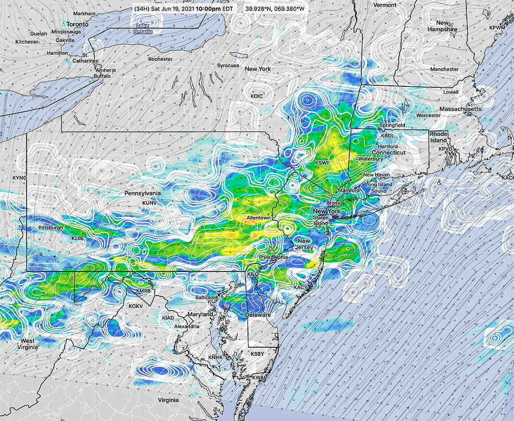
Forecast Updated 7:06 PM– Looking further at the latest GFS, some thunderstorms may fire up again at 11 PM to midnight.

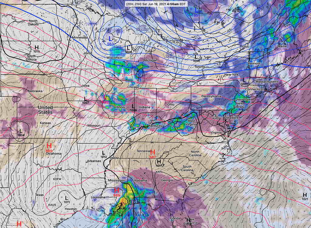
Forecast Updated 6:15 PM– The latest GFS, just available, shows considerable convective inhibition (see update below) as the storms approach Philadelphia. As mentioned earlier, this may cause the storms to weaken as they approach. The exact point of weakening may be to our west, or just to our east, as the GFS is a relatively low resolution model. Much of the energy is being held back, as the main front will pass through on Tuesday with additional rain. We will see.

Forecast Updated 12:10 PM in highlighted text below:

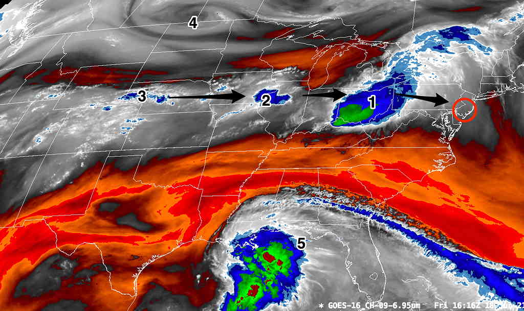
A strong cold front will approach this evening. Ahead of the actual front, a prefrontal trough will trigger thunderstorms in the Philadelphia area this evening, likely starting between 5:30 6 PM and and 8 PM. Additional thunderstorms may move through up to around midnight.

Conditions are favorable for moderate to strong severe thunderstorms with CAPE values (convective available potential energy) in the 1500 J/Kg range and instability values (Lifted Index) around -5..5ºK. (More negative is stronger here.)

The latest HIRESW-ARW and HREF show higher CAPE values, in the 2000 + J/Kg range, especially western suburbs. Expect moderate to severe thunderstorms as early as 5:30 PM in far western suburbs, with heavy rain, moving into Philadelphia. They may weaken as they move further east.

All models show high CIN parameter inhibiting thunderstorm strength, just east of Philadelphia into NJ developing by 9 PM. So any thunderstorms making it into NJ may weaken.

Precipitable water values are high, in the 1.7-2” water range.

Last night’s models show considerable diminishment of the activity as it enters into NJ after 8 PM, as shear and storm motion vectors become opposed. CIN (“Convective Inhibition”) values become elevated in NJ after 8 PM. (Think of CIN as the anti-energy of CAPE.) Of course, this could change.

Last Monday, the GFS did the best with timing in a somewhat similar setup and I’ll be leaning on this for today.

I’ll likely update sometime during the afternoon.

WEEKEND WEATHER FORECAST

Sunday forecast updated Sun 8:46 AM, highlighted below

Saturday forecast updated Sat 7:15 AM, highlighted below

Update Friday 10:25 PM in highlight below

Update Friday 7:45 PM — The forecast below was based on Friday’s morning and early afternoon models. The models that have become available late in the afternoon suggest the possibility of a more cloudy, unsettled Saturday with some showers as early as 2 PM. I’ll update with tonight’s models that will become available between 9:30 and 10:30 PM.

The cool, dry air mass that has given us four days of stellar weather will be moving off to the northeast, unfortunately just in time for this weekend.

This weekend will be affected by several disturbances shown on Friday’s water vapor satellite image with a boundary becoming stationary just south of our area—

Current Weather Setup – Water Vapor Image at noon on Friday.  A series of disturbances (1, 2, 3) moving along a boundary between cooler air and warm air to the south will affect us over the next few days.   (4) shows a low pressure system that will bring a strong cold front next Tuesday. (5) is the tropical system that is expected to move to the Carolinas, south of us, but may introduce moisture our way.  (Click on image for a larger view.)


The first disturbance will move into our area about 3-5 AM Saturday morning with showers and (maybe thundershowers).  The GFS cloud/radar forecast is below—

GFS forecast 5 AM Saturday   (Click on image for a larger view.)

The showers move out around daybreak Saturday, and clouds break for hazy sunshine during the morning. It will be humid (dew points around 68º) and very warm. High 88.1º sd 2.2º (NBM Blue Bell, PA)

Areas of cloudiness re-develop during the afternoon.

Additional showers and thunderstorms develop later afternoon on Saturday and especially Saturday evening. (Some models have thunderstorms developing as early as 2–5 PM mostly from the city on southward. Most hold off any showers until late afternoon or early evening. Some keep the activity both north and south of the immediate PHL area, so there’s some uncertainty how much rain the immediate PHL area and suburbs will receive. There remains higher than usual uncertainty regarding timing and areal coverage of the showers on Saturday. (Even the HIRESW-ARW2 and the HIRES-FV3 aren’t in agreement about the thunderstorms for Saturday afternoon.)

Saturday 7:15 AM update —There should be some hazy sunshine this morning. Several models from early this morning show showers/thunderstorms developing between 3 and 5 PM Saturday afternoon in the immediate PHL area.

The NBM paints a broad stroke with this rain Saturday evening— (Sat AM Update continues with this broad area of showers this evening.)—

NBM model 1 hour rain Saturday 10 PM (Click on image for a larger view.)

Mostly sunny, very warm and humid. High 89.5º sd 1.8º (NBM Blue Bell, PA) A chance of showers and thunderstorms in the evening, with highest probability south far north and west of the city. Any showers will be widely scattered and will occur between 5 and 11 PM, most likely around 7-9 PM.

Winds
NBM Wind Meteogram Blue Bell PA

Weather… and Other Things 'Up in the Air'