
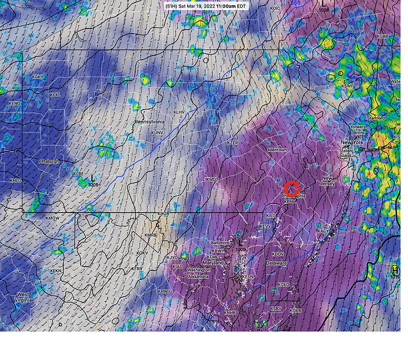
Update Thu @ 8:06 PM — Following some early morning rain and even a morning thunderstorm Saturday, the NAM-NEST maintains an extended rain-free period on Saturday for much of the late morning into much of the afternoon. We may even see some sun.
The models are showing considerable atmospheric instability on Saturday, something not seen since this past September/October.
Showers and even some thunderstorms (some strong, especially northwest of the city) will move through with a cold front early Saturday evening.
Update Thu @ 12:51 PM — My previous forecast for a 4 to 6 hour rain-free period on Saturday may be overly optimistic, based on the latest GFS and HIRESW-FV3. Following rain early morning, both maintain a chance of scattered showers throughout the day.
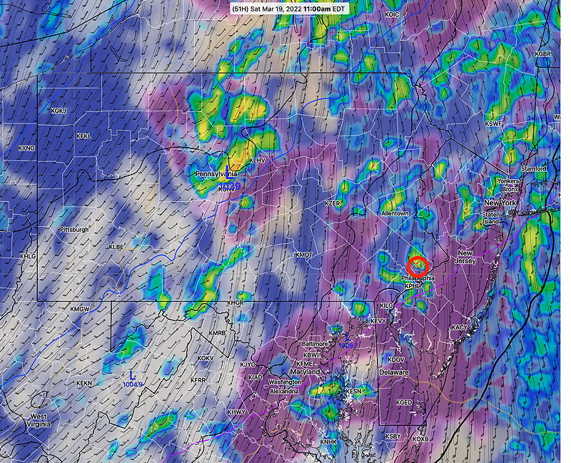
The NAM-NEST still forecasts a cloudy, but mostly rain-free period for most of the area after 11 AM.
Looking at other models (ECMWF, CMC-GEM), the more pessimistic forecast of scattered showers seems to be in the majority.
The ICON model, like the NAM-NEST has a rain-free period. So there’s hope.
Update Wed @ 8:45 PM — No change in the forecast.
Rain/showers on Thursday.
Beautiful and warm on Friday.
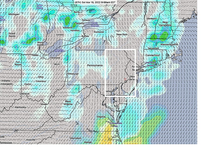
A warm front moves through Saturday morning with showers. Many models have at least a four to six hour period late morning into early afternoon where there’s a break in the showers and possibly some sunshine. More showers Saturday late afternoon and evening as a weak cold front moves through.
Sunday looks good.
Update Tue @ 8:27 PM — The forecast has changed for more rain on Thursday and possibly a salvaged Saturday.
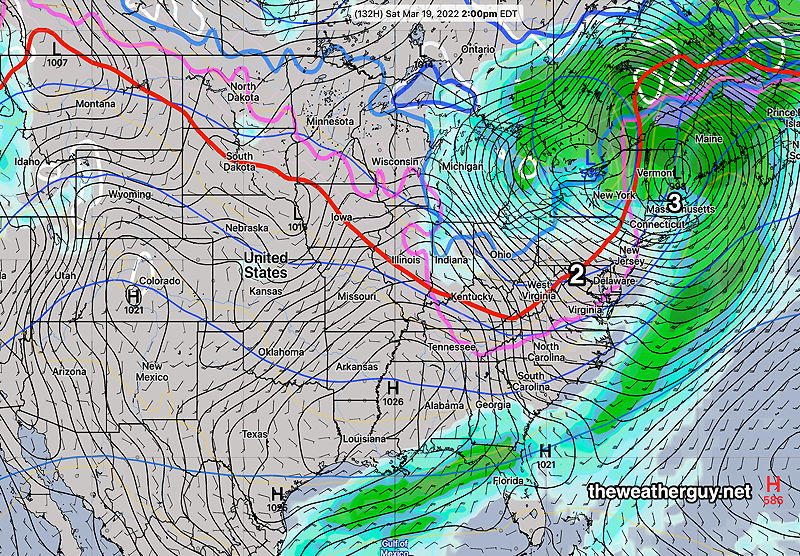
The low pressure system depicted in the graphics below for Thursday looks like it will move bit closer to us than previously forecast. That means Thursday will likely be a rainy day.
Things may have improved for Saturday. A warm front will move through early morning. Rain may end in the early morning with a warm up and some breaks of sunshine before a cold front moves through later in the day with additional showers.
I’ve read about the possible legislation to keep Daylight Saving Time throughout the year. Probably good, although neurophysiologists say it screws up the natural diurnal rhythm. I do know, if it passes, I’ll have to get used to having the major evening weather models come out past my bedtime, as discussed in my previous post.
Previously Posted Mon 10:08 AM —
This week will be comparatively quiet weather-wise compared to last week’s every-other-day storms.
Two weather maps, one for Thursday and one for Saturday should summarize the weather system flow for the week—
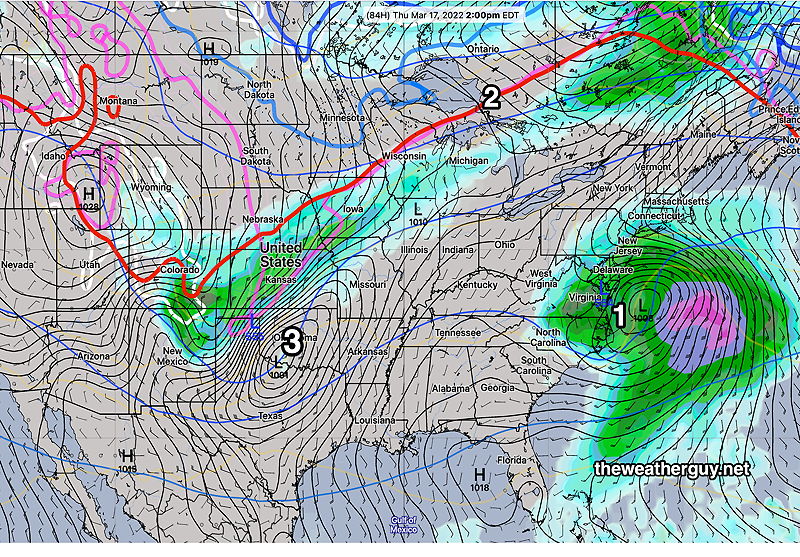
While the above scenario is a good bet, changes in timing, track and intensity of various systems will affect the actual forecast details. Stay tuned.