
This morning’s latest NAM and GFS models got this forecast wrong. Even as the snow is falling, both predicted a QPF of less than 0.10 inches water! Hardly accounts for the snowfall.
Regarding the short range models, the NAM based HRRR (hourly forecast) also blew this one. The GFS LAMPS forecasts (also hourly) shows snow likely until 2- 3 PM, although I find the GFS LAMPS is often wrong about such things.
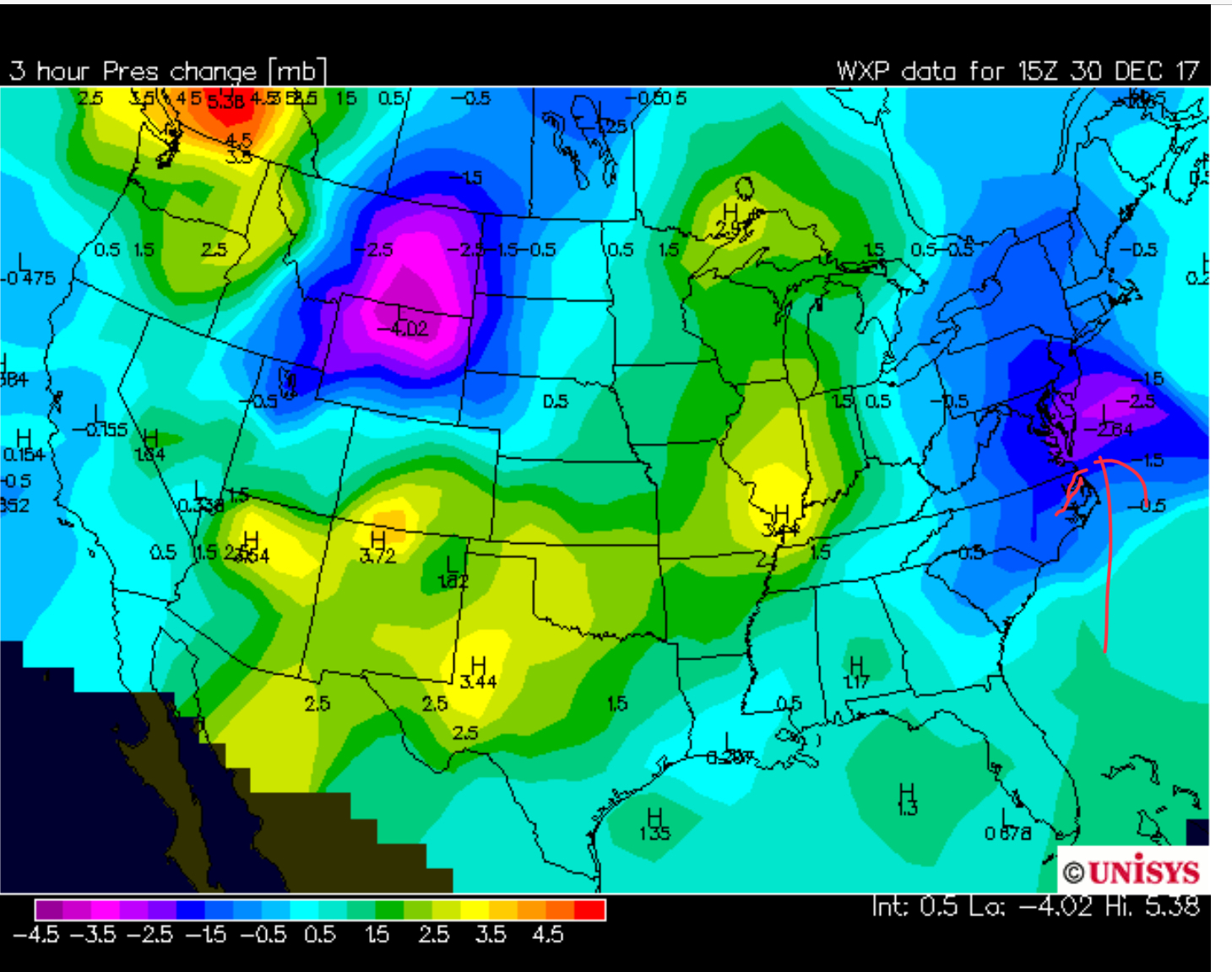
Forgetting about the models, using old forecasting techniques, pressures are dropping along the coastline, showing the development of a coastal low. (See graphic below.) Not sure if my trough explanation earlier was correct.
So a much larger storm than forecast. 3-4 inches in some areas seems likely, although my guess is as good as yours. Without some reliable numbers, it’s all guess work.
It does look like it’s ending in the western suburbs, based on current radar.
I’m wondering what the media forecast people are going to say about this one? Usually, they just do their thing, as though the coating to 2 inches everyone forecast was nearly correct.