Category Archives: Winter Weather

LIGHT SNOW WEDNESDAY MORNING

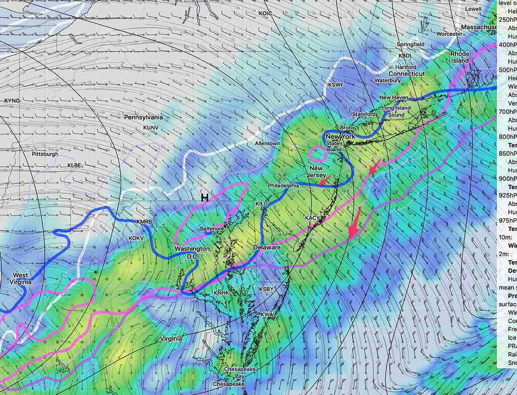
[su_note note_color=”#defcdc”]Today’s models continue with the idea of weak low pressure developing along the front as it moves through early Wednesday.

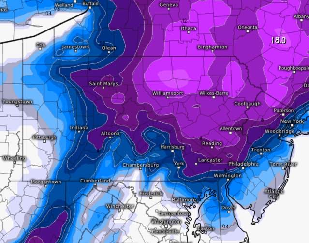
There are differences in timing and snow amounts, but the statistical models, the GFS and the European have increased snow totals to 3 inches. We’ve seen these forecasts change drastically, but I’m letting you know that some amount of snow is expected during the morning rush hour on Wednesday.   Stay tuned [/su_note]

On my previous forecast, I mentioned that I would keep an eye on the strong cold front  moving through Tuesday night into Wednesday morning.  I mentioned that snow showers were possible Wednesday morning.

The most recent model runs suggest a trend that the rain mixes with and changes to snow sometime after midnight Tuesday as the upper atmosphere chills down, supporting snow.

While strong cold fronts often scour out any residual moisture, the models are showing that some weak low pressure development occurs along this front as it moves through, with moisture lingering after the cold air moves in aloft.

Latest GFS model forecast for Tuesday 11 PM showing snow-critical temperatures (arrows) have moved southeast of us.  Cold enough for snow. Shading is simulated radar.

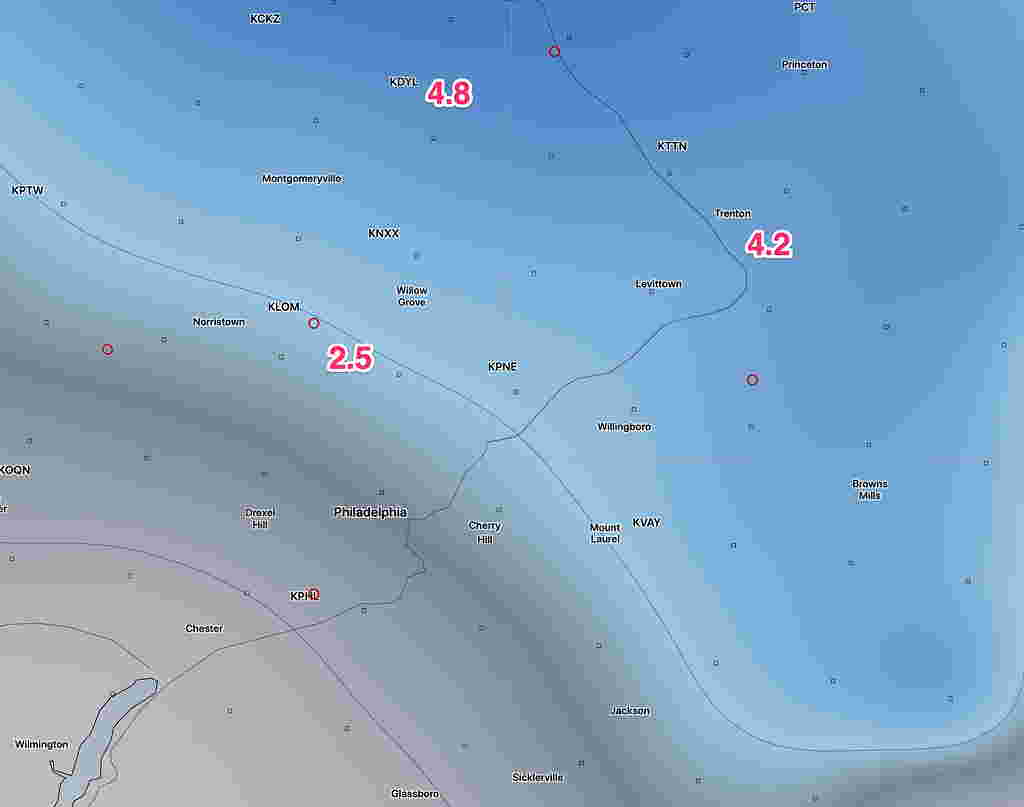
The GFS has about 1 inch of wet snow for the Philadelphia area ending about 9-11 AM Wednesday morning  The NAM about 0.8 inches.   We know that things change.   Stay tuned.

WINTER WEATHER UPDATE

[su_note note_color=”#defcdc”]Sun 8 PM Update: Here is this afternoon’s NAM model snow forecast.  (2.5 inches for Glenside 4.8 for Doylestown.) The built in model algorithms are not always very accurate.   I’ll have a better handle about 11 this evening. The GFS has almost nothing for us.

NAM model snow depth forecast for Monday evening

[/su_note]

“The latest NAM model supports the scenario discussed as a possibility over recent days— a secondary coastal surface low is held back or regenerated along the coast due to the upper atmosphere low pressure system to the west playing catch-up with the surface system.

Once they come together and become “vertically stacked”, the coastal system will further intensify.  This setup allows the collision of cold air and wrap-around moisture to create the chance of snow Monday afternoon and evening over our area”

The above is from my Friday Update post.  Over this weekend, it wasn’t clear if this was going to happen.

The latest Canadian and ECMWF models have become available and support the changeover to snow on Monday. More importantly, they show the secondary low developing closer to the coast which may allow as much as 4 inches just outside Philadelphia.

Here’s the latest ECMWF snow totals forecast by late Monday night:

So, there’s been uncertainty about accumulation and recent trends support the possibility of more than the coating to an inch near Philadelphia.

This afternoon’s NAM supports these higher snow totals for late Monday, indeed the NAM FOUS data suggests the possibility of greater than 4 inches!  Stay tuned.